
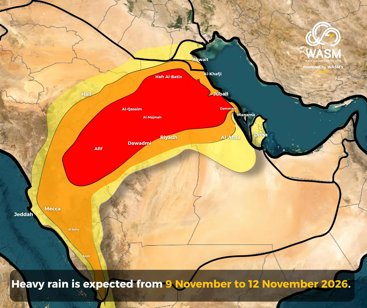
WASM – Large parts of Saudi Arabia and the Gulf region are expected to be affected by a significant rainfall event beginning today and continuing intermittently through the end of the week, with the heaviest impacts expected across Riyadh, Al-Qassim, and parts of the Eastern Province.
Thunderstorms are expected to develop today, Monday, across Hail, Al-Qassim, and western parts of the Riyadh Region. Rainfall intensity is forecast to increase rapidly Monday night into Tuesday, affecting extensive areas of Al-Qassim, Riyadh, and southeastern Hail, accompanied by an elevated risk of flash flooding.
On Tuesday, the rainfall event is expected to expand across wide areas, including eastern parts of Al Madinah Region, the Makkah Region and its coastal areas, Jeddah, and much of the Riyadh Region, including the capital later in the evening. The primary focus of the heaviest rainfall is expected to remain over Al-Qassim.
The rain-bearing system is then expected to extend toward Hafar Al-Batin, Al Khafji, Jubail, Dammam, Al Ahsa, as well as Qatar and Bahrain, between Tuesday evening and Wednesday, bringing an increased risk of flash flooding.
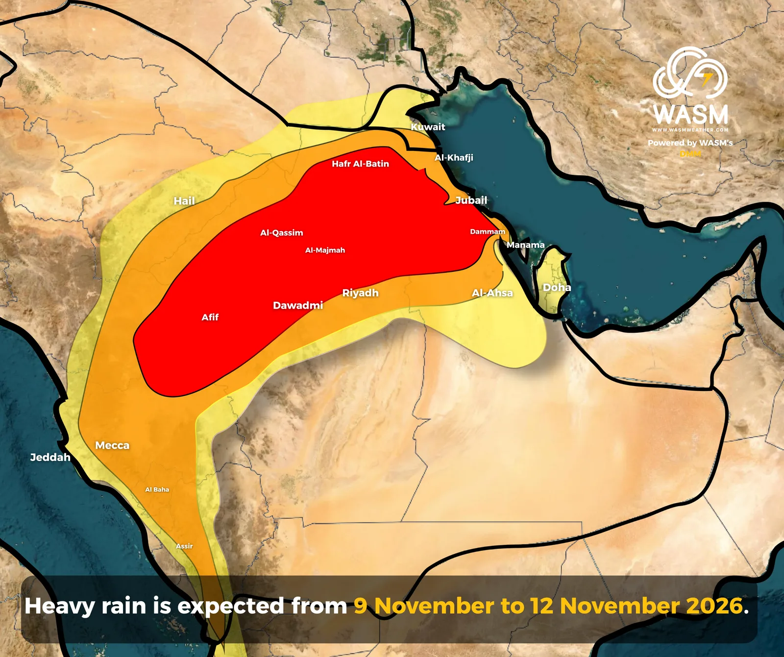
Although rainfall activity may weaken somewhat on Thursday, it is expected to intensify again noticeably toward the end of the week, focusing on Al-Qassim, Hail, western and northern portions of the Riyadh Region, and eastern parts of Al Madinah Region.
Heavy rainfall is also expected to affect the highlands of Taif, Asir, Al-Baha, and Jazan at intervals throughout the duration of this significant weather event.
Scientific Explanation Behind the Severe Rainfall Event
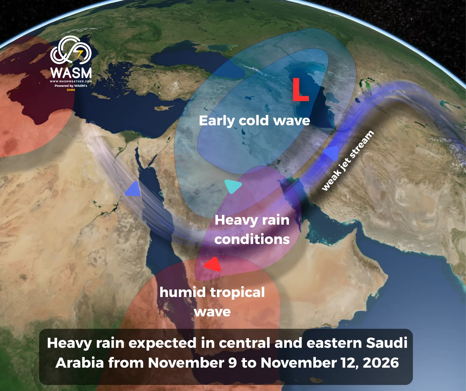
According to WASM, the primary reason for this intense rainfall event is the presence of a slow-moving polar-origin cold front across northern Saudi Arabia. The front is expected to become nearly stationary due to pronounced waviness in the jet stream.
This pattern allows a moisture-rich surge from the Arabian Sea to advance toward the cold front, resulting in highly favorable atmospheric conditions and widespread heavy rainfall.
Surface pressure charts indicate the presence of a high-pressure system stretching across central, eastern, and northern Saudi Arabia, extending from the Anatolian region and originating from the Azores High.
With cold air present throughout various atmospheric layers and a sharply meandering jet stream, a very moist and unstable air mass is expected to rise above the surface high-pressure system, producing strong atmospheric instability and significant rainfall accumulations, ranging from thunderstorms to prolonged steady rain at times.
More Rainfall Events Expected
Rainfall activity is not expected to end with this event. The WASM Regional Center is monitoring strong tropical activity emerging from the Arabian Sea after mid-November, coinciding with active Mediterranean low-pressure systems.
This pattern is expected to increase the likelihood of additional heavy rainfall events affecting western, northern, and central Saudi Arabia, as well as Iraq, Kuwait, and the Red Sea coastal regions.
For more information and smart weather alerts, download the WASM Weather app:
iOS: WASM Weather on the App Store
Google Play: WASM Weather on Google Play