
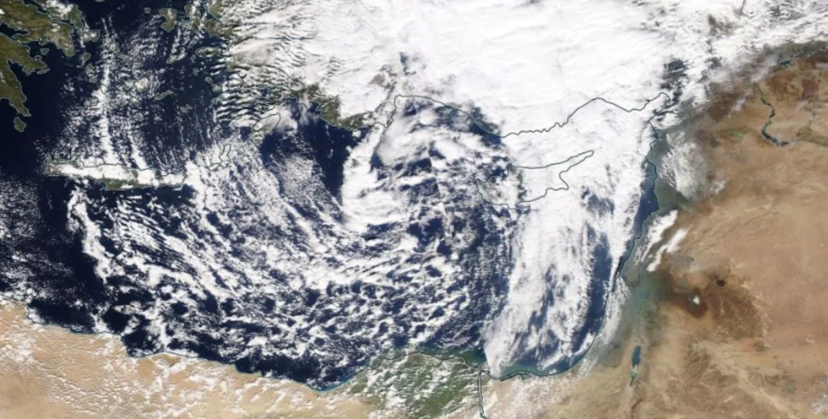
WASM - The WASM Regional Center is monitoring successive weather depressions expected to affect the Kingdom starting at the end of this week and continuing until the end of the month at least, resulting in large amounts of rainfall, sharp temperature drops, and increased chances of snow in high mountains, especially during the final third of the month.
- Temporary weather stability from Sunday evening until Wednesday|
Weather will stabilize temporarily from Sunday evening until Wednesday, with temperatures rising slightly before the beginning of successive weather depressions during the end of the week. Scattered rainfall is not ruled out on Wednesday.
- Series of successive weather depressions at week's end|
A series of successive weather depressions will begin at the end of the week, intensifying clearly during the coming week with increased cold. These weather depressions will reach their peak during the final week of this month and into early February, with expectations of large amounts of rain in most areas of the Kingdom.
- Large amounts of rainfall|
These weather depressions are expected to produce large amounts of rainfall, and it is not ruled out that some areas will achieve a large portion of the seasonal rainfall due to the expected succession of these weather depressions and their high effectiveness during the second half of the month.
- Increased chances of snow during the final third of the month|
As a result of the source of cold air masses of polar origin, snow chances increase noticeably during the final third of the month in periods, especially during the final days of this month.
- Scientific Analysis|
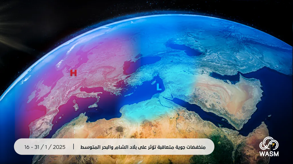
The expected activity of these weather depressions is primarily due to the activity of what is called Rossby waves in the atmosphere, which contribute to the transport of very cold polar winds toward mid-latitudes.
Looking at weather maps, polar activity has increased again since the end of December, especially over North America and parts of northern and western Europe, and this activity increased with the beginning of January, resulting in significant polar activity in western and central United States and its south, causing the activity of dry winds rushing from the western and central United States toward California and causing major fires due to increased vegetation cover resulting from large amounts of rainfall in recent years, followed by a dry spell that made it easier for fires to spread.
This major polar activity is expected to gradually reflect on Eastern Europe primarily, especially before mid-month and coinciding with a significant rise in atmospheric pressure values over most areas of Europe.
This major polar activity over Eastern Europe causes the gradual transport of polar winds toward the Mediterranean, especially its eastern regions during mid-month, which stimulates the activity of successive weather depressions on the Kingdom that will follow an upward curve in terms of strength and reach their peak impact during the end of the month.
- Current rainfall season|
The current rainfall season has shown excellent performance through 31-12-2024, with more than one-third of the seasonal rainfall recorded in many areas. Despite a short dry period during the first half of December, large amounts of rainfall during the final days of the previous month caused significant improvement in the season's performance, with quantities exceeding 100 mm in a short time in many northern and central areas, along with flooding of several dams in the Dead Sea basin and flooding of several valleys.
Rainfall conditions and weather depressions in recent years are characterized by causing large amounts of rainfall due to climate change and increased water content in the atmosphere due to increased evaporation rates and intensified atmospheric activity.
With expected greater regularity in the intensity of weather depressions during the coming period, it is highly expected that the current rainfall season will exceed its seasonal averages as has happened in recent years and unusually early.
The frequency of strong rainfall seasons during the last two-thirds of these seasons (meaning the period between January until the end of May) has increased significantly, and it was found that among 7 previous seasons, 5 seasons were recorded with rainfall concentrated between mid-winter until the end of spring, an increase of more than 72%.
The chances of rainfall during the beginning of summer season in the last 8 years have risen to 75% compared with previous years, and rainfall rates have increased by more than 60% over the last 10 years.
Climate change does not mean a decline in rainfall amounts as is commonly believed, but rather a change in the characteristics of rainfall seasons, intensification of their impact, and increased rainfall rates.