
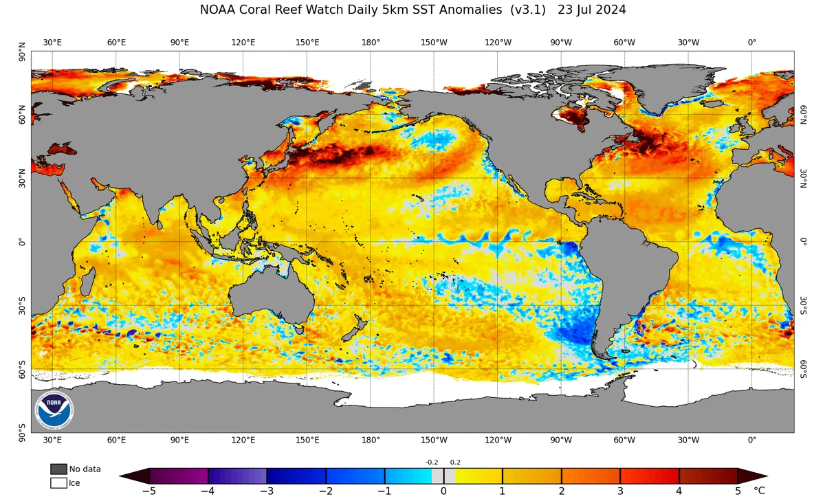
Label- The atmosphere was affected by the El Niño climate phenomenon during the 2023-2024 season, which was a rare El Niño phenomenon, and this phenomenon caused a severe impact on atmospheric circulation. The "El Niño Warming" phenomenon was one of the most important of these phenomena, which was also reinforced by climate factors that did not coincide with it during previous El Niño phenomena.
The El Niño Climate Phenomenon..
It is the rise in water temperature of the tropical region of the Pacific Ocean between 5 degrees north and south, and this phenomenon causes a direct and strong impact on tropical and subtropical circulation in the Pacific Ocean region, which indicates its severe impact on atmospheric circulation, especially in mid-latitudes and subtropical zones. However, its impact on polar circulation depends on its coincidence with other climate factors.
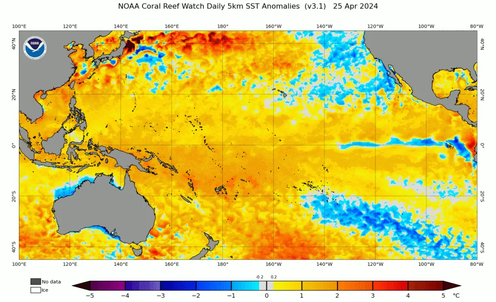
El Niño 2023-2024..
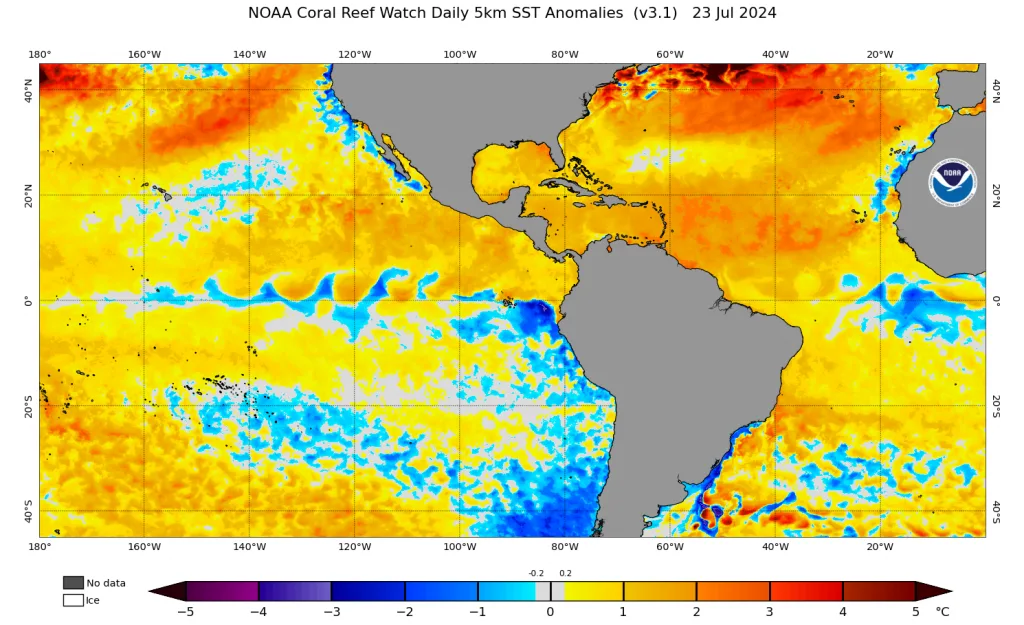
The atmosphere was affected by the El Niño phenomenon in the previous 2023-2024 season, which was characterized as a moderate to strong phenomenon that reached its peak in late autumn and early winter. This phenomenon coincided with a significant and rare increase in temperatures in the North Pacific Ocean region, and contrary to what is customary in El Niño climate phenomena, which usually coincide with a decrease in North Pacific temperatures due to their impact on the general circulation of the atmosphere in the Pacific Ocean region.
The severe increase in temperature in the North Pacific region is still completely unknown, as we have not seen previous records that coincided with the El Niño climate phenomenon. This caused a severe boost and reinforcement of the "El Niño warming" phenomenon in the atmosphere.
El Niño 2023-2024 was a rare climate phenomenon..
The El Niño phenomenon in the 2024 season is considered one of the rarest El Niño climate phenomena in climate records, which coincided with unusual and completely unprecedented atmospheric conditions for the El Niño phenomenon. The El Niño phenomenon for the 2024 season may be classified as unprecedented due to its combination with climate factors that are completely different compared to other El Niño phenomena.
The negative PDO zone in the North Pacific, which means an acute rise in temperature in the North Pacific region relative to the west coasts of North America, caused different results, especially in terms of warming the atmosphere to unprecedented numbers in modern climate records.
The coincidence of the strong El Niño phenomenon with the elevated Pacific Ocean temperatures caused a significant disruption in the path of the polar jet stream, which is supposed to be weaker than that in many regions of the world. However, this caused the polar circulation to be completely isolated from circulation in mid-latitudes and subtropical and tropical zones in many periods, resulting in a significant disruption in the thermal balance process that occurs between tropical and subtropical regions on one hand and sub-polar and polar regions on the other hand through mid-latitude circulation in which baroclinic low-pressure systems of all types contribute.
The activity of the El Niño climate phenomenon increases the process of dynamic heating in subtropical and mid-latitudes in the Pacific Ocean region as a result of intense tropical activity along the ITCZ zone in the tropical Pacific region. This, through more thermal energy released from the condensation process, causes severe heating across subtropical latitudes through the Hadley cell circulation, which usually takes about 3 weeks.
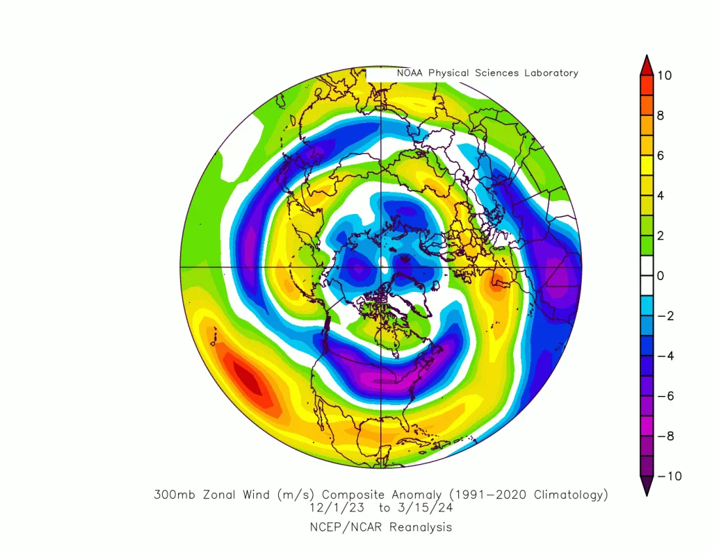
And due to the coincidence of the El Niño phenomenon with an acute and abnormal rise in North Pacific temperatures, which is supposed to be colder, it resulted in the intensification of polar circulation in the northeast Pacific and central and western United States in many instances. This, combined with the added effect of warming in the North Atlantic, caused the strengthening of the polar jet stream and the isolation of polar circulation from mid-latitudes and subtropical zones. This caused a significant disruption in the atmospheric thermal balance process and confined sub-polar storms further north than usual, which gave a character of heavily rainy and warm weather systems to many mid-latitude regions and the absence or delay of snowstorms.
While northern Europe and sub-polar latitudes experienced rare and unprecedented snowstorms in modern climate records. The strong confinement of polar air and the continuous intensification of its circulation in those regions caused these rare weather conditions and a disruption in the usual thermal balance.
The Collapse of El Niño..
El Niño collapsed rapidly towards the end of spring, and despite forecasts that it would transform into the opposite phenomenon, it did not succeed. It is expected that a neutral condition will continue, which means a significant decline in tropical activity in the tropical Pacific Ocean region. Usually, this causes a slow cooling of the atmosphere due to the activity of the polar jet stream. However, forecasts indicate different things, and with data processing in the WASM climate model, the cooling will be rapid in the mid-latitude region, and the thermal exchange process between the poles and subtropical latitudes will be at its peak, which clearly indicates very high chances of strong storms in mid-latitudes and subtropical zones in various regions of the world, especially during autumn.
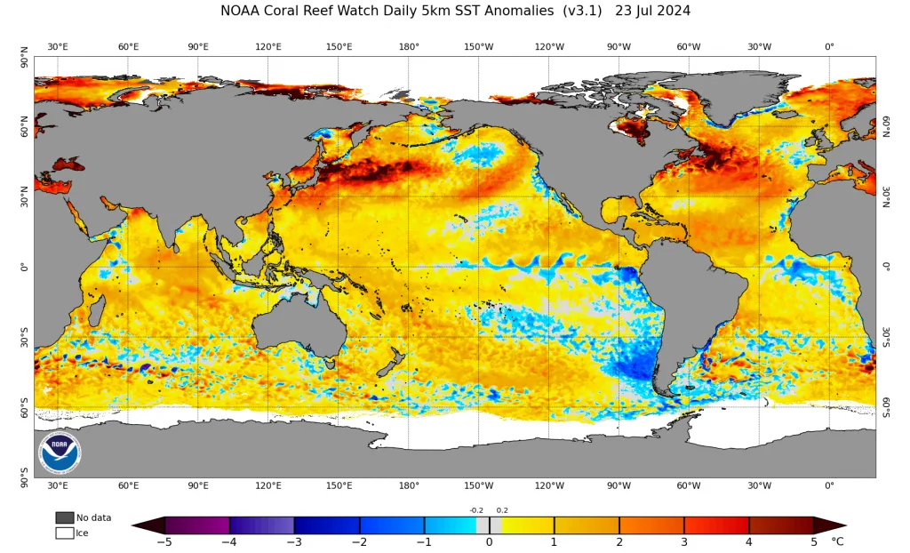
What is noteworthy is a transformation in the temperature of the North Pacific region, which has begun to decline rapidly, which is contrary to what happens when El Niño phenomena collapse, making this phenomenon very rare even during its decline and disappearance.
And with the beginning of the Atlantic La Niña phenomenon, which is the cooling of tropical and subtropical waters in the Atlantic region, which also causes significant weakening of the subtropical jet stream near western Europe, which did not appear clearly during the previous year. These results will reflect a significant weakness in the polar jet stream, making it highly undulating, especially over the eastern European continent and western Siberia on one hand and over the North Atlantic on the other, which makes Europe susceptible to strong and persistent high-pressure systems that may last for long weeks. and they have already begun to appear as severe and rare heat waves in recent weeks.
The expected decrease in temperature over wide areas of the Arabian Peninsula, eastern Mediterranean, and Levantine countries in the coming weeks is a result of these unusual atmospheric conditions.
The large thermal energy arising from the previous rare El Niño climate phenomenon, and as a result of the weakening of the polar jet stream, will increase the strength of warm or vertical air masses during the coming months, raising the high probability this time for the occurrence of severe cold waves in mid-latitudes and subtropical zones sharply and perhaps unprecedentedly in some regions.
So was global warming the only explanation for the rise in temperatures to record numbers during the previous period? Or do the major climate phenomena resulting from natural atmospheric circulation, in addition to geological causes, play a much larger role in the variation and rise of temperatures, which provide the only explanation for the high temperatures that affected Earth in many periods over the past millions of years?