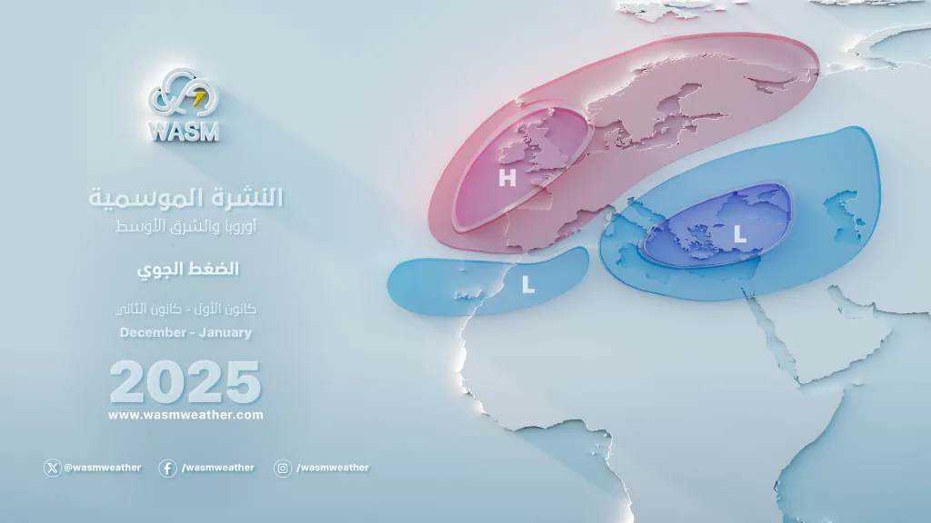
WASM – WASM Regional Center is monitoring a strong and prolonged control of a powerful, dry and warm high pressure system that will bring temperatures above normal across the European continent and minimal rainfall, or weak weather conditions to the point of complete rainfall cessation in central Europe.
This warm and dry air mass surged from the sub-tropical African regions and the Atlantic Ocean area, and as a result of sudden activity of strong storms in the north-central Atlantic and high activity of the polar jet stream over the western European continent.
Extended dry periods across the European continent|
And with forecasts that occasionally coincide with frost and dry waves in some areas of southeastern and eastern Europe, this strong and long-lasting high pressure system causes the pushing of cold air masses from the north of the European continent towards the Mediterranean region and especially its eastern parts and the Arabian Peninsula region, particularly its northern areas, which causes the succession and continuity of cold waves in those areas.
Temperatures will significantly exceed their seasonal averages in those areas, with forecasts of nearly complete rainfall cessation in parts of central Europe.
Autumnal rainy weather conditions in the Mediterranean and Arabian Peninsula regions|
And as a result of autumnal weather conditions, it is expected that the impact of rainy conditions will expand over the region, especially in the northern and western halves of the Arabian Peninsula, Iraq, the Red Sea region and the northern Persian Gulf, as well as the Levantine region which includes Jordan, Palestine, Syria, Lebanon, and northern Egypt, during the last days of this month through the first half of November.
Unseasonable cold waves intensify during the end of the first week of November|
And cold waves are revived towards the Arabian Peninsula and Levantine regions primarily during the end of the first week of November through the third week of it, being high in humidity during the early stages of their impact and in the form of several consecutive main rainy conditions, followed by increased chances of frost waves.
Warm and dry periods intensify in the European continent during the end of November|
And based on WASM's climate model data, significant intensification of heat and dry waves will be observed over central and western Europe this time during the end of November, which increases the chances of large areas of eastern Europe being exposed to severe snow storms, with their impact reaching the form of very early winter weather conditions and rainy conditions in the Mediterranean and Arabian Peninsula regions (especially eastern Mediterranean).