
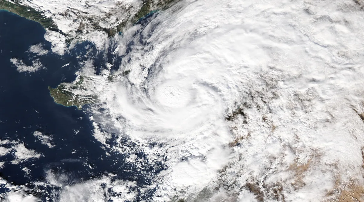
WASM - Follow storm Elaina tag that strongly affected the eastern Mediterranean basin during the previous two days and was classified as a "subtropical storm" or Medicane, which means in Arabic "Mediterranean hurricane", and this storm had a strong impact on Palestine, Lebanon, western Syria and even northern Jordan, but its impact was moderate in general on the rest of Jordan's regions due to the distance of its moisture currents from those areas because of the strong rotation of air around its center.
This storm caused the fall of large quantities of rain exceeding 100 mm in many areas of the eastern Mediterranean basin and active strong winds that exceeded 100 km/hour in the Cyprus basin and coasts of Syria and Lebanon, and this storm is classified as a rare and hybrid type, which means it combines tropical characteristics and winter or "baroclinic" characteristics at the same time, and the eastern Mediterranean recorded yesterday the third storm of this type since 2019.
The first storm of this type in the eastern Mediterranean occurred at the end of October 2019, as the central and western Mediterranean usually witness these storms, but it is rare for the eastern Mediterranean regions to witness them.
The reason for the appearance of this rare type of storms is the significant rise in sea water temperatures in the eastern Mediterranean in the last two years as a result of rising temperature levels, as these storms require a water surface temperature exceeding 20 degrees Celsius and preferably above 23 degrees Celsius.
The impact of this storm was of moderate intensity on most areas of Jordan except for the northern regions that witnessed heavy rainfall lasting for hours since Tuesday evening with quantities exceeding 70 mm.
The atmospheric surface pressure value decreased according to satellite imagery monitoring below 1000 millibars and this is considered deep compared to the surrounding areas and is an indicator that it reached a stage approaching the strength of a subtropical storm or a first-degree hurricane, and this storm was the subject of interest and amazement by many meteorological agencies and international weather monitoring centers and volunteers due to its strength and rarity in areas such as the Mediterranean Sea.
WASM expects that these weather phenomena will increase continuously during the coming years due to rising global temperatures and severe climate changes that have begun to occur in the region.
Characteristics of storm Elaina..
Storm Elaina's formation phase began on Friday and Saturday as a strong winter storm accompanied by a cold polar-origin air mass but maritime and of type mP (maritime polar), and the storm had a very strong impact on the Maghreb countries, Greece and Italy at the beginning of the week and this led to the surge of its warm air front towards the Levant and Jordan and a significant rise in temperature during Sunday and Monday.
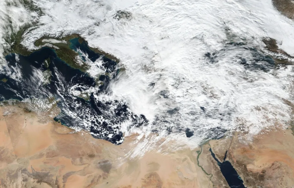
Starting from Monday night, its cold front reached Jordan and the Levant and caused widespread thunderstorms with heavy rain, formation of floods, a significant drop in temperatures, active winds and the raising of sandstorms in desert areas.
Due to the continued push of the low pressure system towards the east due to the presence of an area of high atmospheric pressure over North Africa and also over the eastern part of the European continent, the final phase of the storm began which is the phase of dissipation, but it did not happen to begin the low pressure system to pass through a "rare" phase which is the transformation into a Mediterranean hurricane, and the reason is due to the significant rise in sea water temperature in the eastern Mediterranean, as well as the presence of the cold air mass accompanying it above the eastern Mediterranean basin area in a manner called "Tear off" which is almost a separation from the main cold air masses and main westerlies, and this caused "baroclinic" atmospheric instability and it indicates a change in heat vertically significantly as we ascend.
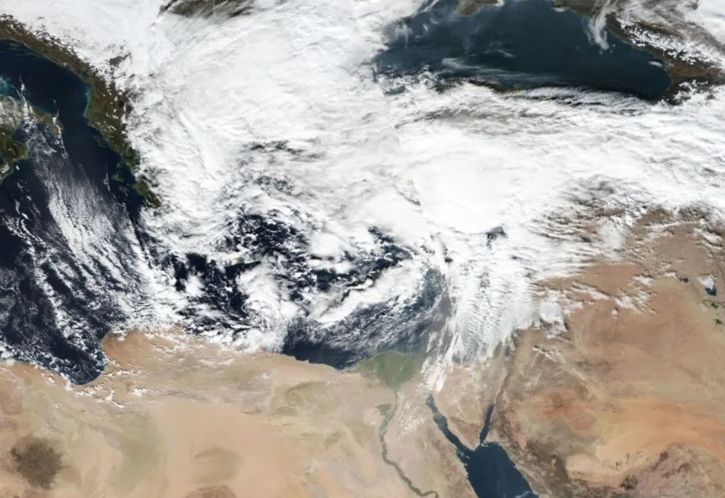
This caused the air to rise vertically rapidly upwards and resulted in a sharp and continuous decrease in the atmospheric surface pressure value to enter the low pressure system that was supposed to dissipate into the subtropical storm phase, to deepen significantly and sharply and the winds around it intensify and then the eye of the storm appears and acquires clear tropical characteristics that amazed specialists and weather condition observers, acquiring these characteristics means difficulty in predicting its movement within the Mediterranean Sea and randomness of its movement as well to resemble hurricanes exactly, but at the same time it still has air fronts, which is the reason for calling it a "subtropical storm", and the name Subtropical Cyclone is considered much better as a scientific description compared to the word Medicane which suffers from incorrect description of the weather system.
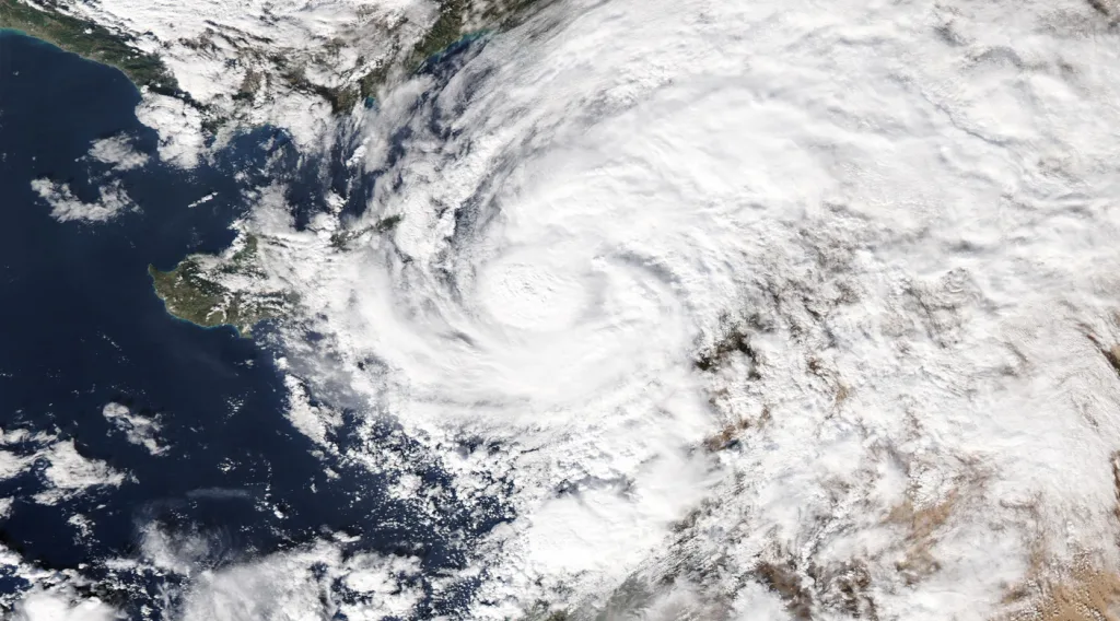
The subtropical storm was able to develop significantly on Tuesday and Wednesday to approach the level of a first-degree hurricane within the Cyprus basin at a wind speed rate reaching 80 km/hour and causing severe rain on Lebanon, Syria, Palestine and extending this rain to parts of northern Jordan, but the impact was of moderate intensity over central and southern Jordan due to the surge of dry winds from Egypt which caused the weakness of rain clouds in many periods, and it is difficult to predict such weather systems due to insufficient studies on their formation and their rarity, and numerical computer models cannot simulate them correctly, and it has begun to recur continuously and we may reach a rate of two hurricanes in the eastern Mediterranean annually due to rising temperatures.
This storm surged with force towards Lebanon on Wednesday evening but the lower part of the storm was unable to surge across Lebanon's high mountains and continued over the coasts of southern Lebanon while the upper part surged rapidly towards Syria due to the strength of what is called the upper westerlies, to occur what is called "weather system tearing" which is common for hurricanes and which causes them weakness, for the northern winds to push it towards the coasts of Palestine on Thursday evening and gradually dissipate.
Despite the weak impact of this storm on Jordan compared to the rest of the Levant regions, it caused the fall of large quantities of rain in the northern regions and the formation of floods which is the reason for raising high alert levels in some areas especially the northern ones.