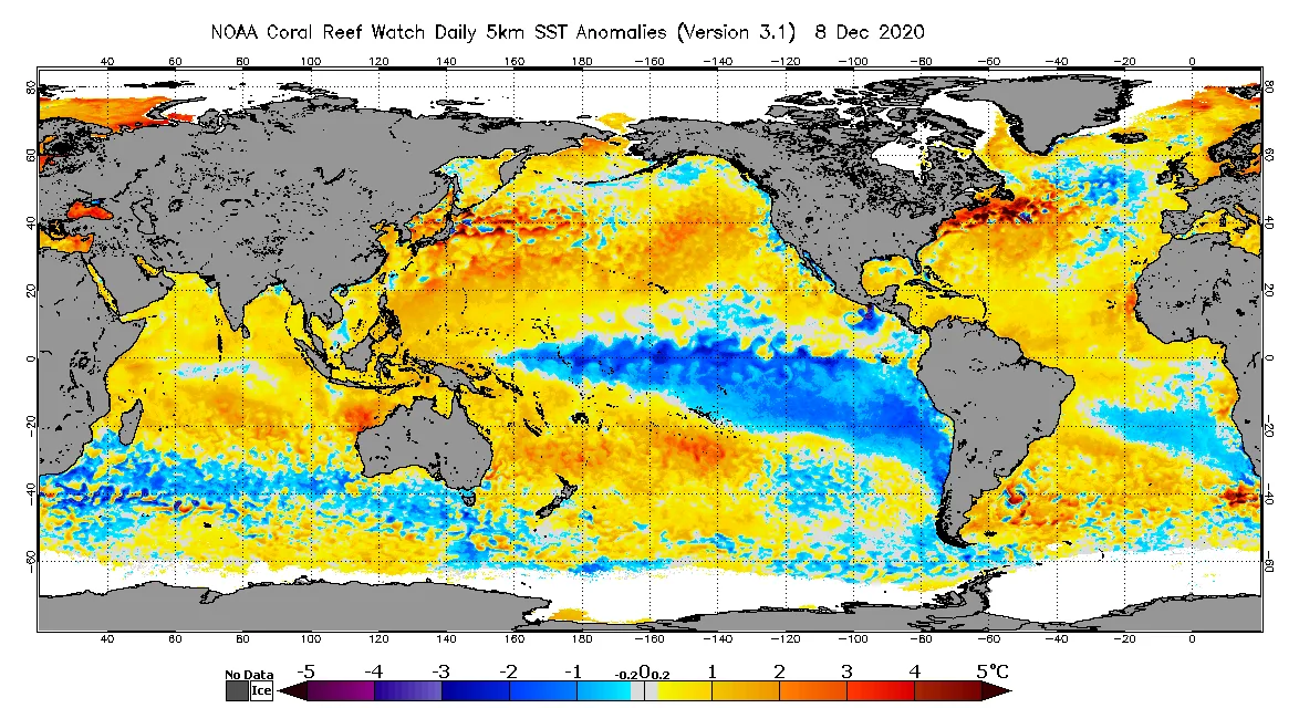
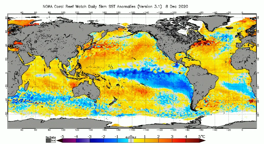
WASM – The La Niña climate phenomenon has begun a phase of rapid decline, which contradicted the predictions of global numerical climate models due to a sudden weakening that occurred in the speed and direction of trade winds responsible for transporting cold water in the Pacific Ocean. Despite the La Niña phenomenon that occurred during autumn, its impact on atmospheric circulation and movement was weak.
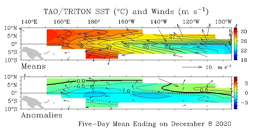
The general atmospheric circulation continues to contradict what usually occurs during the La Niña phenomenon. The major climate patterns do not yet match what typically happens during this climate phenomenon, which has begun its final stages starting from the eastern parts of the tropical Pacific region. WASM issued a report warning of the possibility of the phenomenon weakening and its inability to affect atmospheric circulation in the correct manner.
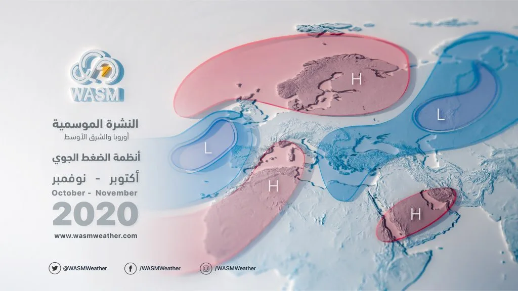
In detail, the positioning of tropical waves over the eastern and central tropical Indian Ocean in the tropical and subtropical latitudes was met in the upper latitudes by active North Atlantic storm activity, followed by rising atmospheric pressure over wide areas of the European continent during several periods. This contributed to the displacement of the Siberian high-pressure system eastward more than usual in similar years, which helped push some tropical waves toward the western Indian Ocean and the Arabian Sea. This resulted in heavy rainfall over wide areas of the Arabian Peninsula, and this atmospheric organization contributed to heavy rainfall conditions over the Levant, Arabian Peninsula, Egypt, Iraq, and reduced rainfall in the Maghreb region.
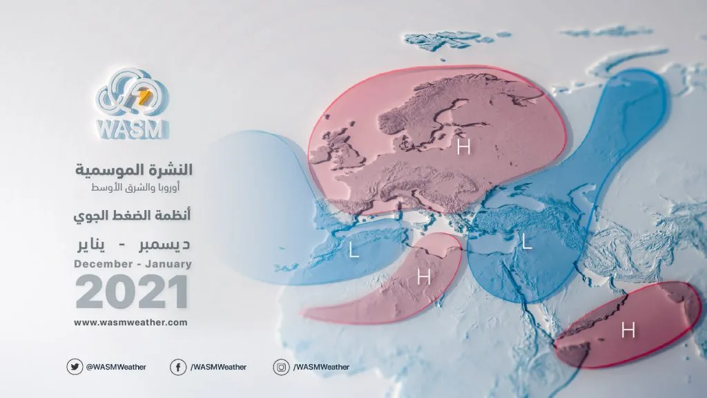
With the end of the La Niña phenomenon or its expected weakening during December and January, this will increase the push of cold air masses toward the region and continue and intensify rainy conditions over the Arabian Peninsula, the eastern Mediterranean basin, Iraq, the Levant, and Egypt during the coming weeks, coinciding with cooler weather than usual. This is due to the intensification of North Atlantic storms and the strength of the atmospheric high pressure over the European continent.
Long-term forecasts indicate intensification of rainy conditions over the Arabian Peninsula, eastern Mediterranean, Iraq, and intensification of cold waves stronger than usual, lasting until the end of the spring season. The intensity of rainy conditions will be concentrated during the beginning and middle of winter compared to its end.
Therefore, utilizing these climate phenomena in long-term forecasts must be done with caution and precision. La Niña does not necessarily mean drought or reduced rainfall or its cessation. According to estimates, the percentage of rainy La Niña years in the region exceeds the 30% threshold. However, because the atmosphere is suffering from global warming, this significantly affects tropical Pacific phenomena and weakens La Niña phenomena while strengthening the El Niño phenomenon. This warns of major climate changes in the future that increase drought severity in Europe and the Maghreb region and heavy rainfall in the eastern Mediterranean and Arabian Peninsula.
WASM expects the beginning of El Niño phenomenon growth during the end of spring and the beginning of summer, which means more severe climate conditions and extremes in atmospheric circulation, and possibly repeated flash floods and flooding in Levantine countries, the Arabian Peninsula, the eastern Mediterranean, and Turkey as well as the western and southern United States. These weather conditions sometimes extend to parts of southwestern Europe and intensification of rainy conditions over the Horn of Africa region. This corresponds to severe dry spells and high temperatures over wide areas of the European continent and eastern United States, and increased global hurricane rates
.
We have indeed begun detecting climate changes that are increasing sharply and noticeably, and it is expected that the severity of climate changes will increase during the coming period, which means preparing all sectors and international organizations for these changes and working seriously to reduce greenhouse gas emissions. However, in reality, we do not expect a positive change in the region's climate during the next 10 years, but rather more severe and negative changes that require a modern and advanced monitoring system.
WASM incorporated large amounts of climate data into its developed climate model, and the climate model was able to predict atmospheric patterns that differ from what occurs in the La Niña climate phenomenon, showing results different from many global climate models that were unable to detect these changes and expected conditions. It was also able to predict the weakening of La Niña at the end of autumn and beginning of winter, as it relies on numerous data points, years of similarity, and its ability to predict the magnitude of change in these climate phenomena in a flexible and modern manner. Typically, climate model errors increase during periods of change and transformation in major climate phenomena.