
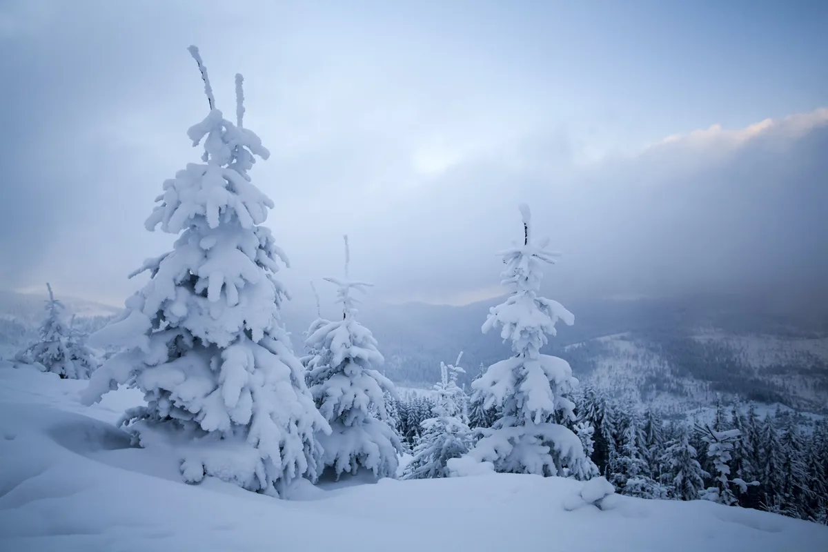
WASM- The impact of strong and historic snowstorms extended across many countries worldwide, most notably the Texas storm and American South, as well as the massive regional storm that struck Jordan, the Eastern Mediterranean, and Turkey, extending to Spain and numerous other countries worldwide.
Experts from the WASM Regional Center studied the atmosphere this season and found a sharp extreme in "Rossby" wave undulations that took on strong wave patterns with sharp fluctuations in atmospheric pressure values in the Arctic region, and tropical wave activity in the tropical belt in different ways. Rossby waves are zones where heat exchange occurs in the atmosphere, with warm air moving northward and cold air southward in the Northern Hemisphere, and these waves are considered one of the most important ways the atmosphere maintains better thermal balance.
Rossby waves..
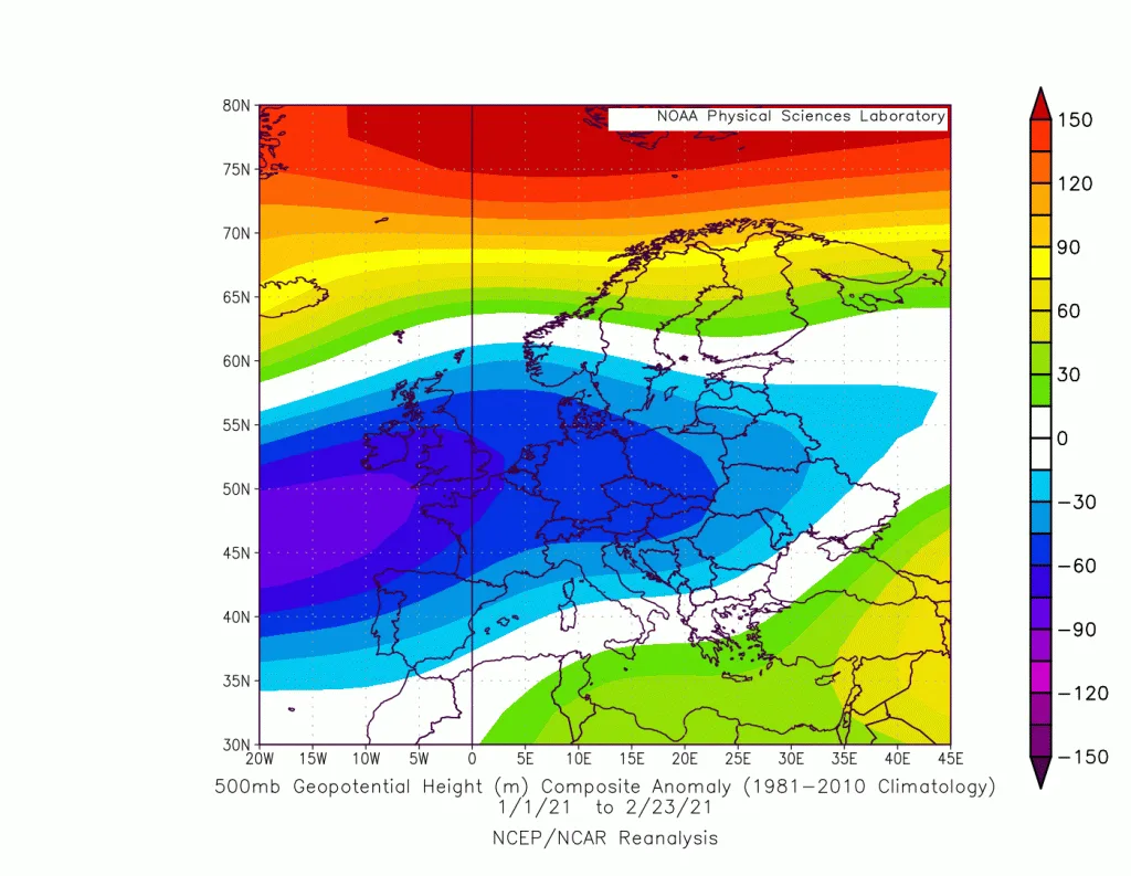
They appear in the form of waves resembling ocean waves when viewing the atmosphere from a two-dimensional cross-section via 500 millibar level maps. These waves are among the most important atmospheric phenomena that determine cold and turbulent zones from warmer and more stable zones in the middle and upper latitudes of the atmosphere. The width and length of these waves reaches 4000 km and may exceed that in many cases, resulting in severe atmospheric instability cases "baroclinic instability" which develop into a family of low-pressure systems starting from the mother low, which is called the subpolar low or Subpolar low, which is located exactly at the edge of the main polar front and lows on the same longitude. These waves were more extreme this season, with the Arctic recording warmer conditions than normal, which allowed polar air to frequently surge and penetrate southward until reaching subtropical latitudes. Snow was recorded in the mountains of Yemen and Asir in a rare and perhaps unprecedented manner in many of these highlands, but why were Rossby wave undulations extreme? This question will be answered in the following paragraphs.

The extreme polar oscillation "AO"..
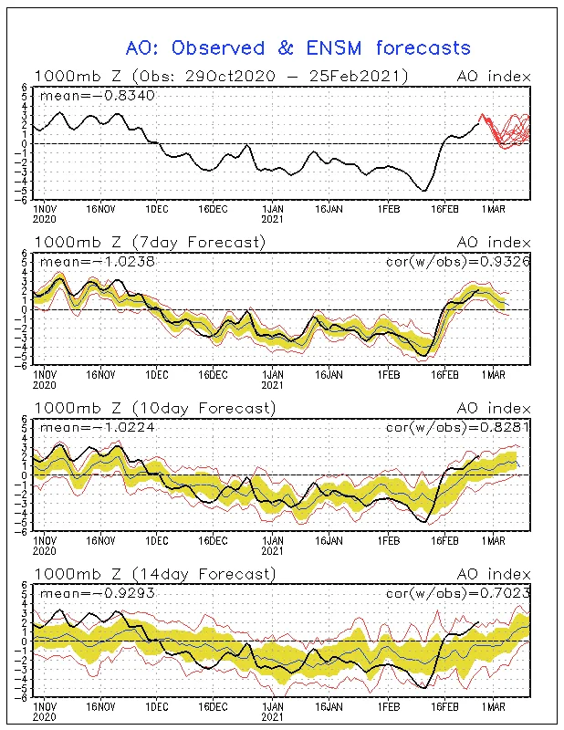
The polar oscillation this season was extremely extreme, called Arctic Osculation, and extreme means sharp oscillation between its rise and fall, resulting from atmospheric systems called cold high-pressure systems or Cold Anticyclone, which are cold and homogeneous atmospheric systems with severe density in a thickness of 3000-4000 meters starting from the surface layers of the atmosphere, and a strong thermal inversion layer located in the surface layers of the atmosphere due to snow and ice helps maintain their cohesion. The strength of these atmospheric systems was noted this season and recorded large numbers in the Arctic region, which allowed severely cold polar air to surge toward upper-middle latitudes by activating the Polar Jet Stream, which caused severe cooling of these latitudes as well as increased the rigidity of these high-pressure systems. However, there were incidents that occurred between times coming from subtropical latitudes and resulting from high activity of the tropical cell (tropical waves), especially in the Indian Ocean and eastern Pacific regions, which contributed to the existence of other new atmospheric systems, namely subtropical high-pressure systems.
This resulted in sudden strength between times of high-pressure systems called subtropical highs or Subtropical Anticyclone, which are dynamic and deep high-pressure systems homogeneous in all atmospheric layers. These highs form in stages exceeding 2-3 weeks starting from tropical activity. High tropical activity reflects strong and large activity of these warm, deep, and homogeneous high-pressure systems. This causes warm air to move toward upper latitudes and the Arctic region and increase the negative extreme of the polar oscillation value (atmospheric pressure rise). However, as a result of sharp horizontal temperature differences, this generates extremely severe storms called subpolar lows or Subpolar Low, along the severely cold polar front, and that is the spark of severe "Rossby" waves, allowing the polar jet stream to penetrate southward rapidly and push the enormous amount of bitterly cold polar air toward very low latitudes.
Subpolar lows Subpolar low..
In meteorological science, there is no such term as "polar low" which is common among many media outlets. Atmospheric low-pressure systems have many classifications and main classifications. The main classifications of atmospheric lows start from non-dynamic surface thermal lows, then deep tropical lows Tropical Cyclone which start their spark from barotropic instability then transform to dynamically active, and frontal or baroclinic atmospheric low-pressure systems, under which many types fall, including the giant low Subpolar low. These lows increase in strength from large horizontal thermal change or baroclinic atmospheric instability. Therefore, describing a weather condition as "unstable" is an incorrect and unscientific description except in weather conditions characterized by barotropic atmospheric instability, which usually occurs in hot and warm regions that result in spontaneous air rise without external intervention".
After a brief explanation of the types of atmospheric lows, the focus will be on subpolar atmospheric lows, which form directly at the edge of the extremely cold polar front "cA Front". These atmospheric lows are concentrated mainly in the North Atlantic and North Pacific, as the high humidity and warmth they receive from the oceans increase the depth of their centers as a result of thermal energy thrust from the severe condensation process, which is later converted to kinetic energy that feeds and deepens the strength of the atmospheric low. Higher temperatures mean deeper and stronger lows. The greater the thermal extreme, the stronger these atmospheric lows become.
Observing the temperatures in giant water bodies, especially the Pacific and Atlantic oceans, warmer waters than usual were noted to exist significantly. This worked to strengthen these atmospheric lows, and great heat was also noted in the warm Gulf Stream current that rushes from the southern United States to the North Atlantic and the coasts of northwestern Europe. This also contributes to the depth and intensity of subpolar storms that greatly affect the nature of Rossby wave undulations.
These very strong storms coincided with rising pressure in the Arctic region, and this contributed suddenly to a very large extreme in Rossby wave undulations, causing bitterly cold polar air to surge southward, so these storms work by pressing on cold high-pressure systems, resulting in violent undulations in Rossby waves.
So strong "tropical waves" along the equator, also resulting from higher than normal heat, caused the strengthening of the surge of hot and warm air from south to north, and rising atmospheric pressure in the Arctic region, and as a result of heating ocean waters, caused "extremely severe" subpolar storms, and with the overlap of these factors significantly, caused the formation of very extreme and sharp Rossby waves, which worked to transfer severely cold air southward and warm air northward, so atmospheric circulation became extreme.
The common factor.. Global warming..
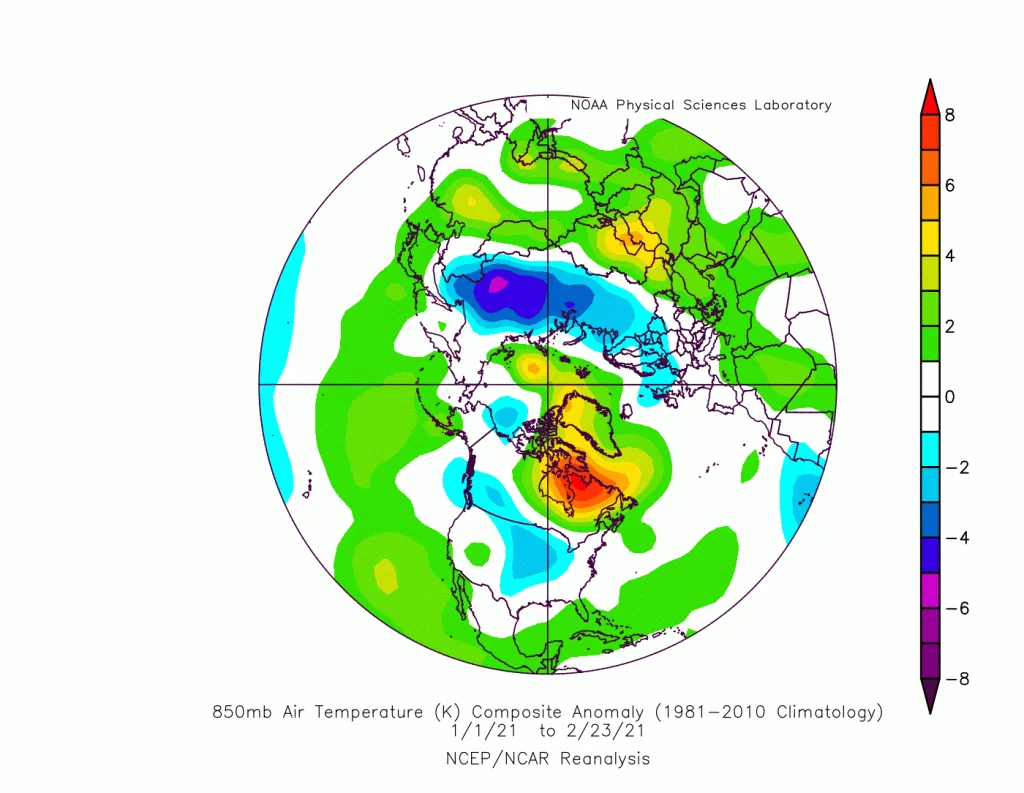
Subpolar storms were stronger than usual due to water heating and sharp horizontal thermal extremes. Tropical wave activity was due to the strength and intensity of thunderstorms along the equator, which results through atmospheric circulation in significant activity of subtropical high-pressure systems Subtropical Anticyclone. It is expected that during the coming years temperatures will rise, causing great extremes to weather conditions, so we may see very warm temperatures in winter preceding days characterized by extreme cold and record-breaking cold due to the expected effect of global warming on strong Rossby waves, and this increases the intensity of strong heat waves in summer, and the recurrence of strong hurricanes and storms during transitional seasons.
Rossby wave extreme..
Rossby wave extreme will lead to major changes in weather phenomena in all regions of the world, including Arab countries. This will increase the possibility of snowstorms in Arab countries, including Jordan, northern Saudi Arabia, and Iraq, as well as increase the strength of heat waves during the summer season, and repeat cases of floods and torrents, and will affect the rainy season to extend for longer periods than usual, starting early and ending late, as well as increase rainfall rates.
Rossby wave extreme causes increased hurricane rates and extreme in their movement, allowing hurricanes to move northward more than usual and affect areas that had not previously been affected by these atmospheric systems. Increased atmospheric and ground heat will cause large horizontal temperature differences and feed storms in the future more than usual.
Will snowstorms recur?
The recurrence of snowstorms has become highly likely even during the coming years in the Eastern Mediterranean and Jordan region and more frequently than before despite global temperature rise, and the possibility of polar and snowy waves remains likely during spring.
WASM Climate Model and W.DMM Technology..
For these reasons, we are developing new technology to increase the accuracy of long-range weather forecasts and even short and medium-range forecasts. This technology helps us monitor these sharp weather and climate changes, and our ability to accurately predict severe weather cases with very high accuracy, away from confusion and chaos especially that spread before the beginning of the snowstorm in the media within Jordan, which causes great losses and confusion among the public and various sectors operating. We expect more of these storms and climate extremes, and with the continuation of this chaos and confusion, we will expect more losses in various sectors unless an important change is made and the meteorological sector is developed in Jordan and the Arab region.
And because of major climate changes, we expect more extremes and fluctuations and the emergence of more powerful weather situations, and increased hurricane and storm rates, which means an urgent need to develop the meteorological sector and increase accuracy, and use modern protocols in communicating meteorological information away from confusion, chaos, and ambiguity. This is what WASM Regional Center has been doing for some time, and we have proven our high capabilities in accurately predicting and monitoring weather situations weeks in advance in the Arabian Peninsula, Saudi Arabia, Gulf Arab countries, and Jordan, due to our development of our own climate model.
To learn how W.DMM technology works and how it maintains the accuracy and stability of weather forecasts, please visit the following link..
https://wasmweather.com/article.html?slug=%D9%83%D9%8A%D9%81-%D8%B1%D8%B5%D8%AF%D8%AA-%D8%AA%D9%83%D9%86%D9%88%D9%84%D9%88%D8%AC%D9%8A%D8%A7-dmm-%D8%A7%D9%84%D9%85%D8%B7%D9%88%D8%B1%D8%A9-%D9%85%D9%86-%D9%85%D8%B1%D9%83%D8%B2-%D9%88%D8%B3