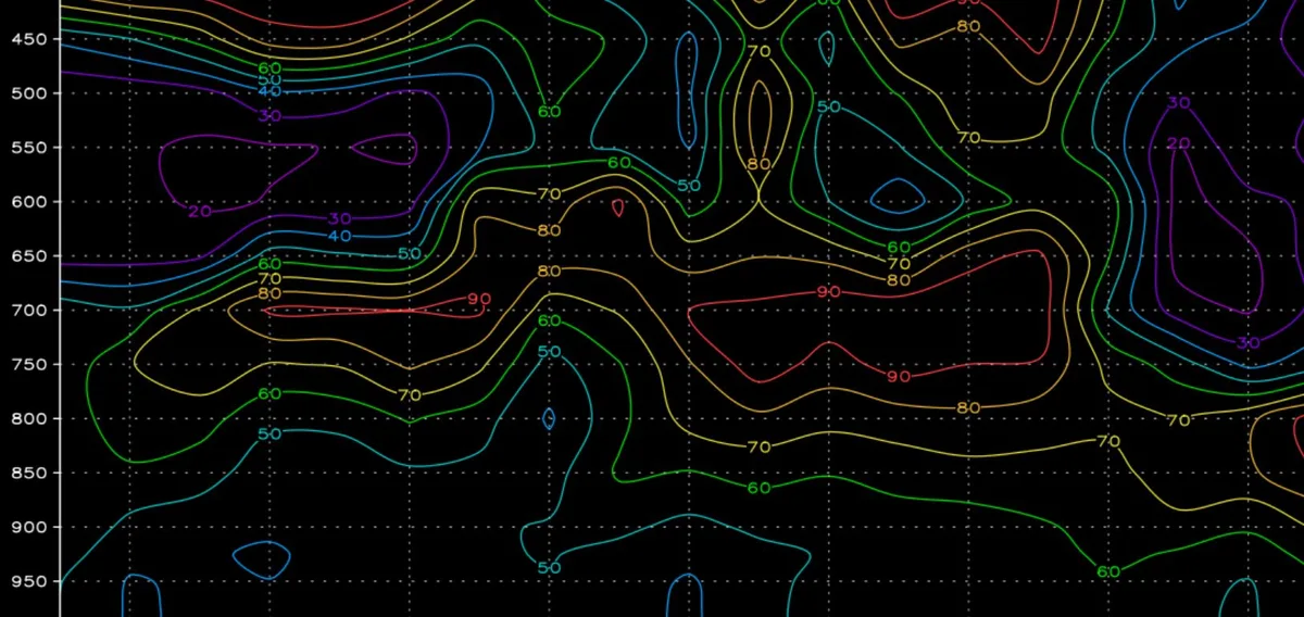
WASM- Jordan was affected by a "powerful" snowstorm that focused its impact on the northern and central parts of the country, with snow accumulations reaching up to 80 cm in the high elevations of Ajloun and 40 cm on the central peaks, including the capital Amman and Salt. This was considered the strongest snowstorm since 2013, accompanied by strong winds that caused damage and losses. This snowstorm disrupted public life, disrupted institutions, closed roads, and affected the electricity sector as well as land and air navigation. The impact of this powerful snowstorm was "regional," meaning it affected multiple countries at the same time.
The W.DMM technology developed by the WASM Regional Center was able to detect this powerful snowstorm with "high precision" details and several days in advance with consistent weather bulletins, despite complete confusion in the media regarding this snowstorm and the lack of accurate information about it even hours before it began.
W.DMM technology reads all numerical computational models. This technology works to detect the strengths and weaknesses of each available numerical model so that it can ignore specific data and focus on other data. It also reads the rate of change variation for each update, so it excludes numerical models that change suddenly, and it also focuses on all members of the Ensembles for each numerical model, which are the complete probabilities regarding weather conditions in future periods, numbering more than 120 possibilities, then assigning different weights continuously, variably, and flexibly.
This technology works by reading all of this massive data without focusing on a specific numerical model, as doing so would cause confusion and lack of accurate information even a few hours before the snowstorm begins. This was the reason for the great confusion that spread through the media about the strength of the snowstorm that affected Jordan, without the user and the public knowing what would happen in the coming days, and this increases losses from snowstorms and weather conditions in general.
W.DMM technology is under development and multiple regional numerical models, or as they are called Regional models, will be introduced and also developed by the WASM Regional Center. These numerical models specialize in fine details and internal forecasts and hourly predictions, which may reach minute-by-minute forecasts. The WASM Regional Center will also develop artificial intelligence technology to work with W.DMM technology, which will help us in the future to achieve high forecast accuracy exceeding 95% for the first time in the Arab world and the region.
The WASM Regional Center also used the climate model developed by WASM, which specializes in long-term forecasts, and was able to detect the entry of the snowstorm several weeks in advance with high precision details, especially after the recent development that we activated.
W.DMM technology is abbreviated as Dynamic Multi-Model Method, and it is a technology developed from the Multi Model technique. The traditional technique is fixed in terms of readings and depends on fixed equations in terms of the superiority of each model over a specific area, but the technology we developed is characterized by flexibility, where one model does not always outperform another.
We have used this technology extensively in recent months, which has proven its high efficiency. The WASM Regional Center is financing this massive project, which will have great benefits for Jordan, the Arab region, and the region, and will save billions of dollars through early preparation by providing high-precision weather information for a long time period with clear alert levels to help all government sectors prepare properly, far away from the confusion and chaos in weather information that spread through the media in recent times.
The WASM Regional Center has received many messages about this technology, which helped detect all weather conditions with great accuracy. All weather bulletins were characterized by complete consistency despite changes in numerical model data. However, our system was characterized by providing accurate and consistent data. We also excelled in timing and determining the peak of the snowstorm, the thickness of dense snow accumulations, wind speeds, and our assessment of losses based on the data available to us.
W.DMM technology started development at the end of 2018 and continued during 2019 and 2020. Work to improve it is still ongoing. This technology will work widely and regionally in the future, and all government, private sectors, and airports will be provided with high-precision data that will significantly reduce losses from weather conditions. Our weather bulletins will also be characterized by "complete consistency" and "high accuracy," away from the confusion and chaos that constantly occurs, especially before the last snowstorm.
Due to the confusion in weather information spread through the media, this caused confusion, the spread of rumors, and lack of understanding of weather information, especially with changes and ambiguity in issuing weather information. Because of the strength and magnitude of the snowstorm, this problem was very apparent. The technology available to us will solve a large part of this problem and will help the media sector issue accurate and clear weather information to the public, away from the confusion that occurred before the snowstorm began.
To know the temperatures in your cities, please visit the following link.. www.wasmweather.com
How did W.DMM technology developed by the Regional Tagging Center detect the snowstorm that struck Jordan?