
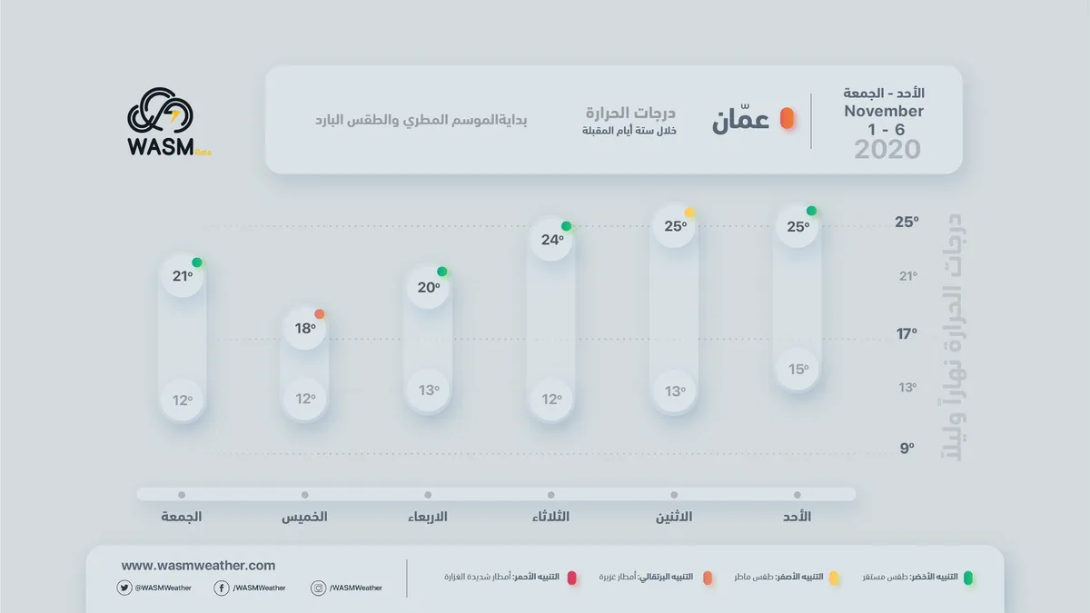

WASM – Temperatures are expected to drop noticeably over the coming days as Jordan is affected by cold and humid winds accompanied by weather disturbances and atmospheric instability, with thunderstorm showers expected, particularly during Sunday night/Monday night and throughout Monday, intensifying again on Wednesday evening and Thursday.
In detail, a cold air front will pass through the country tonight, located in the lower and middle atmospheric layers, coinciding with unstable weather conditions leading to scattered thunderstorm showers that will be heavy in limited areas, causing water accumulation in low-lying areas and valleys, with alert level reaching yellow.
Unstable weather conditions and weather disturbances are expected to continue tomorrow during Monday daytime, with the severity of the weather condition decreasing tomorrow Monday in the evening hours, temperatures dropping, and the weather becoming generally cold.
Jordan is expected to be affected by a low-pressure system starting from Wednesday night/Thursday night and throughout Thursday, causing a further drop in temperatures and heavy thunderstorm rainfall. Caution is advised regarding the danger of flash flood formation and mobile floods, along with active winds, with alert level rising to orange.
WASM continues to monitor weather fluctuations expected over Jordan in the coming period due to the presence of a cold air mass over the eastern Mediterranean coinciding with warm and humid winds in northern Saudi Arabia.
To know the temperatures in your cities, please visit the following link.. www.wasmweather.com