WASM- The Kingdom will be affected by a "rare for this time of year" weather low-pressure system, which will bring cold and heavy rainy winter conditions to all regions of the Kingdom. Its impact is expected to begin from Monday evening until Thursday evening. Today, Sunday, the Kingdom is being affected by its warm front, which has resulted in rising temperatures and small amounts of dust in some areas.
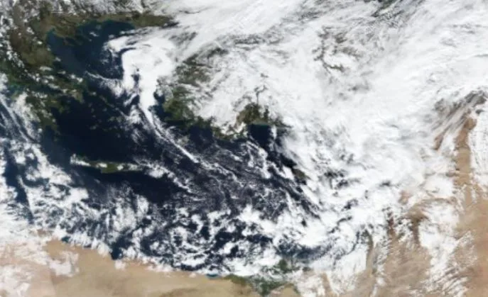
The weather low-pressure system is positioned north of Egypt on Monday morning..
The weather low-pressure system will be positioned northeast of Egypt on Monday, acquiring some Khamsin characteristics, as warm southerly winds activate alongside moderate and high cloud amounts and warm atmospheric conditions. Winds intensify at times in some areas causing light dust.
The weather low-pressure system deepens and gradually moves toward Cyprus Island on Monday evening..
The weather low-pressure system deepens on Monday evening and gradually advances toward Cyprus Island, causing the formation of a highly effective cold weather front that results in heavy rainfall amounts in wide areas of the Kingdom, concentrated initially in the southern regions as the front begins its impact, then in the central and northern regions with nighttime hours. This is expected to cause flash flood formation in wide areas of the Kingdom, especially in the Aqaba, Petra, and Dead Sea regions.
Temporary decline in the weather low-pressure system impact after Tuesday afternoon..
Scattered rain showers continue to fall in different areas of the Kingdom on Tuesday coinciding with occasional wind activity. With the weather low-pressure system positioned west of Cyprus Island in the afternoon, cold southwesterly winds with less humidity advance toward the Kingdom beginning Tuesday afternoon, causing a decrease in cloud amounts as a result of another deep cold front forming across different atmospheric layers.
Large amounts of rainfall on Wednesday and Thursday..
Large amounts of rainfall are expected to fall in most regions of the Kingdom on Wednesday and Thursday, especially in central areas of the Kingdom as a result of the country being affected by a cold, high-humidity air mass accompanying the weather low-pressure system, coinciding with rare winter cold conditions compared to this time of year. Some areas are expected to record large amounts of rainfall.
WASM issues red alert from strong weather conditions|
As a result of the large amounts of rainfall in most regions of the Kingdom, WASM issues a red alert level from strong weather conditions, as the chances of floods and flash floods increase. Therefore, WASM recommends following the warnings of the Jordanian Meteorology Department and the guidance of Civil Defense and Public Security and avoiding taking risks and approaching water accumulation sites and flood-prone areas.
Jordan | Details of the Highly Active Weather System from Monday Evening Through Thursday Evening