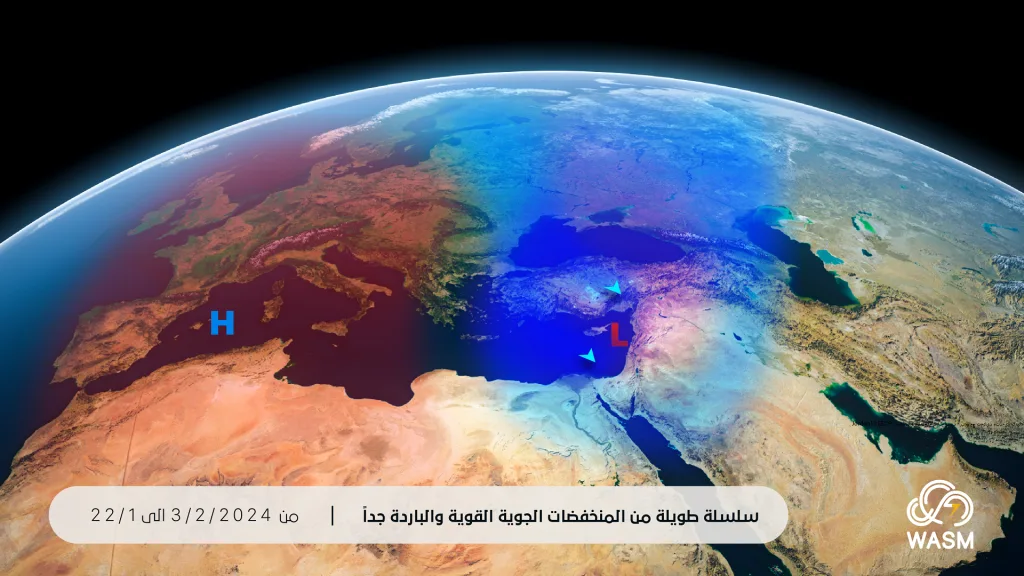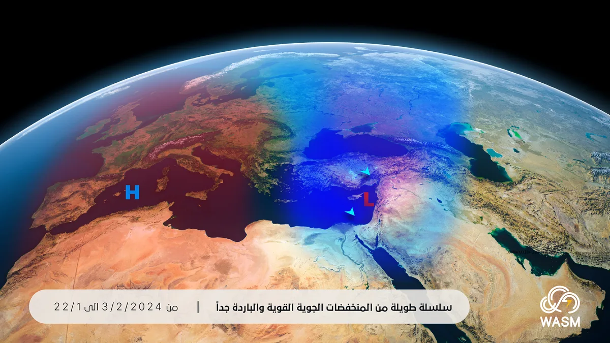
WASM – The Kingdom will be affected by a long series of strong and very cold atmospheric depressions expected to begin mid-next week and continue consecutively over Jordan, the eastern Mediterranean region, and Palestine. These will sometimes coincide with "very cold polar air masses" during certain periods. The anticipated series of atmospheric depressions is expected to be the strongest since the beginning of the current rainy season and the most severe in terms of coldness.
Stable conditions at the end of the week and slight temperature rise|
The weather will be stable at the end of the week with rising temperatures, but it will remain generally cold, especially in the mountains. Typically, temperatures rise slightly before the series of atmospheric depressions begins to affect the region, as occurred in the previous period.
Strong atmospheric depressions begin mid-next week|
Temperatures will drop significantly and noticeably mid-next week, and the Kingdom, eastern Mediterranean countries, and Palestine will begin to be affected by a long and strong series of atmospheric depressions expected to extend at least to the beginning of February. The atmospheric circulation is not expected to change much after the long series of atmospheric depressions during February, with a high chance of recurring atmospheric depressions.
Chance of snow during the coming period|
According to the results of the climate model at WASM Regional Center operated on January 16 and the advanced W.DMM technology developed within WASM, snow is likely during the end of this month and the beginning of February. More precise details will be issued in the coming period as the atmospheric depressions approach. The impact of polar air masses is sometimes highly complex due to many reasons, especially during the current rainy season due to the sharp fluctuations occurring in the Arctic region since the beginning of the season, which cause rapid and sudden changes.
Very large rainfall amounts|
The anticipated series of atmospheric depressions is expected to cause very large amounts of precipitation. The rainfall amounts during the recent series of atmospheric depressions that occurred between January 10-15 exceeded 140 mm in some northern areas and reached 85 mm in the capital and mountains, raising the seasonal performance compared to this time in some northern and central areas to exceed 200%.
Scientific Analysis|
When analyzing the data received at WASM Regional Center, especially that which feeds the advanced W.DMM technology developed within WASM, a strong continuation of a very warm and unusual atmospheric high-pressure system over most parts of Europe is observed. This could cause early semi-spring conditions in many areas of Europe and North Africa. This high-pressure system is expected to persist until the beginning of spring on successive periods, which increases the strength and coldness of weather conditions over the eastern Mediterranean region and Jordan, and significantly increases the likelihood of winter storms or snowy conditions.
WASM Regional Center continues to monitor the expected weather conditions during the coming period, especially between January 22 and the beginning of February. More detailed information will be issued in the coming days and as the time period approaches.