
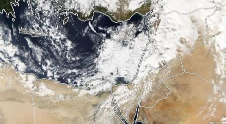
WASM- The Kingdom is being affected by the first atmospheric low pressure system of this season, which is expected to begin its impact during the late hours of Sunday/Monday night, starting from the north of the Kingdom and gradually extending towards the center, and its effects will continue intermittently over Monday and Tuesday of next week.
The atmospheric low will coincide with a significant drop in temperature, with readings falling within winter temperature levels. The atmosphere will mostly be cloudy and occasionally foggy, particularly in the central and northern regions, accompanied by active humid westerly winds carrying quantities of rain-bearing clouds.
Friday and Saturday.. Cold weather in mountains and plains|
The weather will remain cold in the mountains and plains, especially during the evening, night, and morning hours, with minimum temperatures around 10 degrees Celsius. Temperatures continue to record below seasonal averages since the beginning of autumn, which is statistically linked to strong seasonal rainfall performance.
Sunday night.. Beginning of the atmospheric low's impact|
The Kingdom will begin to be affected by an atmospheric low pressure system expected to be centered over the island of Cyprus, with effects beginning from the north during the late hours of the night, gradually extending towards the center during Monday's dawn and morning. Heavy rainfall is not ruled out in many northern and central regions during certain periods. The atmospheric low's impact is expected to manifest as heavy rain in Palestine and parts of northern Jordan and some areas of the west-central Kingdom, accompanied by substantial quantities of rainfall.
The atmospheric low continues until early Wednesday|
The atmospheric low's effects will continue until early Wednesday, but intermittently, meaning rainfall will not be continuous throughout the day, but rather affect several consecutive hours then resume after several more hours. Rainfall effects will concentrate on the north and center of the Kingdom, while taking the form of scattered showers in the northeast and southwest of the country.
Is the atmospheric low typical for this time of year?
The atmospheric low is not considered typical for this time of year, as it carries early winter characteristics. Referring to climate archives, winter lows increase their activity during months 12, 1, 2, and 3 during rainy seasons, while cases of atmospheric instability or those accompanied by extensions of atmospheric lows or semi-Mediterranean atmospheric lows increase during November. Despite Jordan being affected by a strong rainy condition at the beginning of this month, it was not comprehensive and is considered typical for this period.
Although rainfall from atmospheric lows covers wide areas, weather conditions are usually not dangerous due to regular and organized rainfall occurring as "rain" rather than "showers." Showers are characterized by randomness, intensity of precipitation, and high danger, while rain is characterized by widespread coverage, moderate precipitation rates, and long duration, which reflects significant benefits for the agricultural sector.
Rainfall occurring climatically during the period from 9-10 through the first half of November represents no more than 3-5% of the entire rainy season. There is no truth to any circulating information about delayed rainfall, drought conditions, or weak rainfall performance due to Jordan being affected by a strong rainy condition during early November. However, due to the absence of weather monitoring stations, it is difficult to estimate quantities except through the use of satellites, which estimate significant rainfall in many eastern and southern regions and parts of the north and center of the Kingdom.
Extended forecasts|
Mediterranean atmospheric lows are expected to continue affecting the eastern Mediterranean during the final third of November. WASM Regional Center is monitoring an unusual polar wave that will affect a wide range of eastern Europe, southeastern Europe, and the eastern Mediterranean during the final days of November and the beginning of December, due to an expected sudden oscillation of the northern polar region followed by rapid high-pressure recovery over western Europe. Details will be issued gradually.
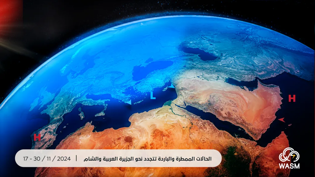
WASM Regional Center is also monitoring a "severe" rainy condition expected in the Arabian Peninsula that will begin to show signs from the end of next week and intensify during the final third of the month, particularly over the Red Sea region, central Saudi Arabia, and the northern Persian Gulf, due to the surge of a strong tropical wave from the Arabian Sea towards the Arabian Peninsula, which will coincide with the activity of Mediterranean Sea lows (it is unlikely that tropical waves will directly affect the Levant).