
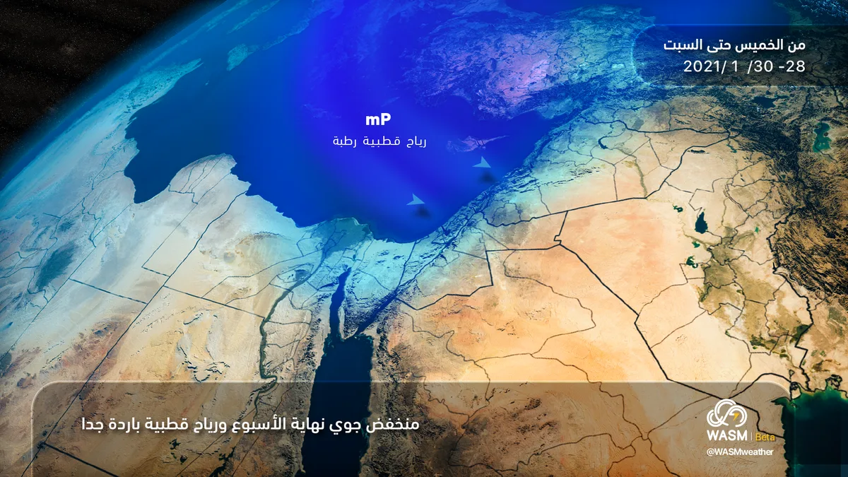
WASM – Jordan will be affected by a strong and intensely cold weather condition at the end of this week, resulting in heavy precipitation, strong winds, which begin on Thursday with moderate intensity and reach their peak and climax on Friday, continuing until Saturday morning.
In detail, Jordan will be affected by a rainy and cold atmospheric depression on Thursday in a moderately severe manner and within the yellow alert level across various regions, including the southern regions of Jordan. The severity of the weather condition will ease "temporarily" on Thursday/Friday night, as a new atmospheric depression forms to the southwest of Cyprus Island accompanied by cold, severely cold and polar-origin winds.
Starting from Friday morning, the atmospheric depression will approach and deepen to the south of Cyprus and near the coasts of northern Palestine, accompanied by severely cold polar winds, causing renewed heavy rains mixed with snow and hail, resulting in floods in low-lying areas and valleys. However, precipitation is expected to be in the form of snow showers above high peaks exceeding 1000-1050 meters above sea level, covering various high mountain peaks including the south of the Kingdom, with limited and modest accumulations expected. WASM raises the alert level to orange and reaches red on high mountain peaks, especially the southern mountains of the Kingdom due to snowfall.
This rise includes the high peaks of Amman, especially the areas of Sweileh, Tlaa Al-Ali and Khalda, with expected accumulations being limited and temporary, occurring only during precipitation. Meanwhile, the capital Amman will witness rains mixed with snow and hail, and it will also include the peaks of Jerash and Ajloun with better and stronger effect in the Karak and Tafila regions with generally limited accumulations.
The weather condition will continue until Friday/Saturday night but with less severity and continued rains mixed with snow until Saturday dawn. The weather condition will significantly improve on Saturday, becoming in the form of rain showers until noon, after which the weather will stabilize and temperatures will rise at the beginning of the coming week.
Renewed rains are expected at the end of next week due to renewed activity of atmospheric depressions. WASM advises caution regarding the strong weather conditions expected on Friday and staying away from low-lying areas and valleys due to flash floods, and caution against landslides on high mountain peaks experiencing hail and snow showers.
To know the temperatures in your cities, please visit the following link.. www.wasmweather.com