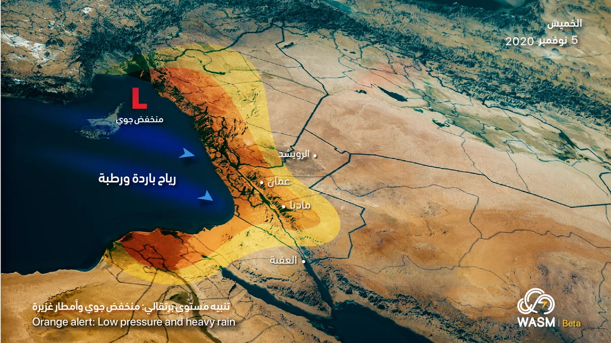
WASM – Jordan will be affected by a low-pressure system starting from Wednesday evening, beginning from northern Jordan and gradually extending during Wednesday/Thursday night and Thursday morning towards the central regions including the capital Amman, and later extending towards Karak.
The low-pressure system is expected to cause heavy rainfall at times and the formation of floods and flash floods, particularly in northern and central Jordan. It will also cause significant activity in wind speeds and dust storms, reducing horizontal visibility in desert areas, and a significant drop in temperatures.
The impact of the low-pressure system will continue until Thursday evening in the form of rainfall, active winds, cold conditions, and reduced horizontal visibility at times due to low clouds touching high mountainous areas.
In detail, northern Jordan will be affected by a highly active cold air front on Wednesday evening, resulting in heavy rainfall and hail with thunderstorms gradually extending during Wednesday/Thursday night towards central Jordan and the capital Amman, then towards Karak with the early morning and morning hours of Thursday. Jordan will continue to be affected by cold and humid winds on Thursday, with rainfall continuing, being heavy during morning hours and gradually decreasing during the day.
The weather will stabilize on Friday, being generally cold and moderate during the day, humid and partly cloudy with limited rainfall showers in some areas.
WASM advises staying away from low-lying areas and valleys due to water accumulation and the formation of floods and flash floods due to heavy rainfall starting from Wednesday evening. The weather condition is classified as orange level.
To know the temperatures in your cities, please visit the following link.. www.wasmweather.com
Jordan: Low-pressure system and heavy rainfall beginning Wednesday evening and continuing through Thursday