
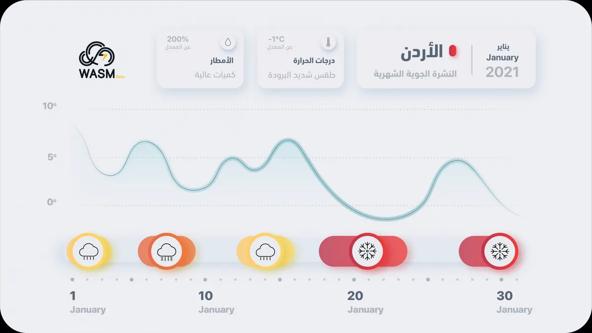
WASM – The WASM Regional Center issues the monthly weather bulletin based on data from an internally developed climate model that is still undergoing updating and development phases. The model was activated on December 24, 2020, and forecasts for January 2021 have been issued.
January 2021 is expected to be characterized by a renewal of strong atmospheric depressions toward the region and the Eastern Mediterranean basin, with sharp cold conditions more severe than usual. The strong cold weather coinciding with deep atmospheric depressions is expected to be concentrated in the second half of January 2021 and extending into early February 2021.
In detail, the following is expected..
- Cold conditions during the first week of the month with continued scattered rainfall cases that intensify between January 6-10 with a significant drop in temperatures.
- Continuation of scattered rainfall between January 10-16 with colder than usual conditions.
- The region is expected to be affected by a series of deep and very cold atmospheric depressions during the period from January 18-31, with intensification of cold weather expected on January 20-24, and from the 28th through early February 2021.
- The chance of snow is high during the last two weeks of January 2021.
- WASM relies on data from an internally developed climate model under the December 24, 2020 version, which is based on massive statistical and complex climatic data. This model is characterized by high flexibility in dealing with statistical data.
- WASM issues expected weather conditions in graphical charts combined with a color system that begins with the weakest level which is green, then yellow, then orange, then red.
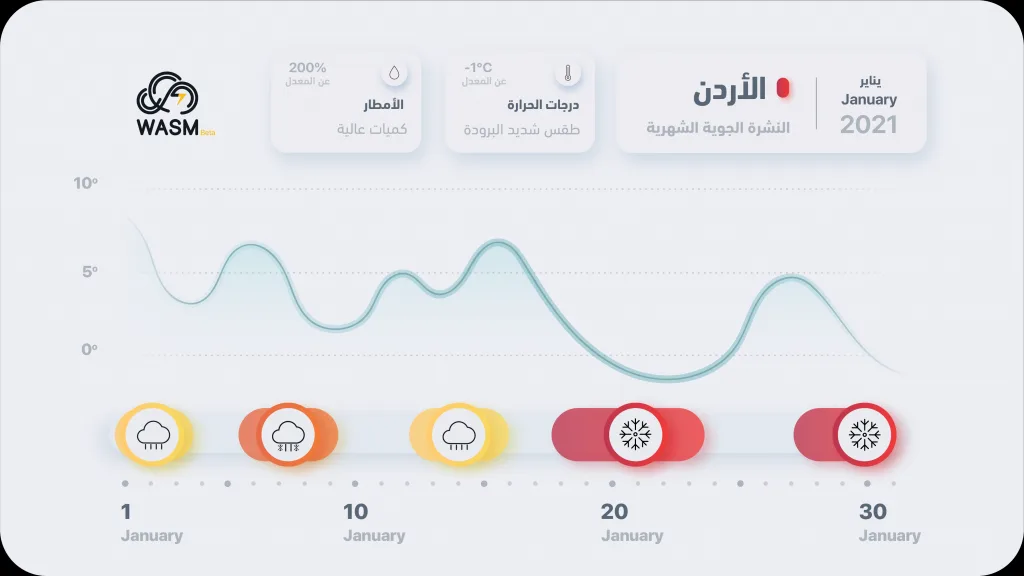
.
Scientific Analysis..
The Eastern Mediterranean basin and Jordan region at the beginning of the month are affected by cold and moist air masses coming from southern Europe and sometimes from the southeastern parts of Eastern Europe, which tend to be drier and stronger in terms of cold intensity. This is due to the high atmospheric pressure over the Eastern Atlantic extending to North Africa and sometimes southern Europe. It is not ruled out that weather conditions between January 7-10 will be strong and highly humid due to the expected positioning of cold air masses in the center and east of Europe, which may contribute to pushing a high-moisture mass from east of the Atlantic Ocean.
Beginning from the mid-month period, the high atmospheric pressure zone gradually moves toward central Europe, then to Eastern and Northern Europe, which allows for very cold air mass intrusions coming from Siberian regions and Eastern Europe toward the Eastern Mediterranean basin and northern Arabian Peninsula. These severely cold air masses are expected to take control of Eastern and Southeastern Europe, Turkey, Iraq, and then the Eastern Mediterranean basin, Jordan, and northern Saudi Arabia.