
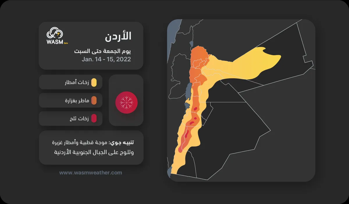
WASM- The Kingdom will begin to be affected by the polar wave on Friday with heavy rainfall in wide areas including the southern highlands and northern and central regions, with precipitation turning into snow showers on southern peaks exceeding 1400 meters.
Heavy rains Friday and Saturday with snow showers on southern peaks..
In detail, rainfall begins tonight on the northern and central regions, becoming heavy from Friday dawn and throughout Friday, with polar air gradually advancing during Friday evening, causing precipitation to become snow showers in the southern mountains and heavy rainfall mixed with snow and hail on the highlands of the north and center, with these weather conditions continuing until Saturday.
Intensification of the polar wave on Sunday with heavy snow in the southern mountains..
Gradually during the night of Saturday/Sunday, a new weather low forms over Lebanon and rainfall intensifies and becomes heavy and continuous on the northern and central regions, while precipitation intensity decreases in the south temporarily due to southwesterly wind movement, with the impact of the polar wave intensifying on Sunday, resulting in heavy to very heavy rainfall on the northern and central regions leading to the formation of widespread floods, gradually extending as heavy and accumulated snow on the southern highlands of the Kingdom including the highlands of Tafila, Shobak, and Karak, with snow effects also extending to areas of the eastern desert and northern Saudi Arabia due to the strength of the polar wave.
Scattered snow showers fall on the highlands of northern and central Jordan during the night of Sunday/Monday without significant accumulations, then the region is affected by a strong frost and freezing wave with temperatures dropping below -2 Celsius in Amman city on Monday dawn.
Renewal of the polar wave in the middle of next week.
The polar wave renews in the middle of next week and continues for additional days, leading to heavy precipitation and severely cold conditions across various regions of the Kingdom.
Alert from the extension of the frost and freezing wave to the northern valleys on Monday..
The freezing and frost wave on Monday is considered "strong" and is expected to affect the northern valleys with temperatures in the capital Amman dropping below -2 Celsius with widespread freezing and frost occurring, while the southern mountains are also affected by heavy accumulated snow on Sunday evening and the night of Sunday/Monday that hinders normal life activities.
WASM issues an orange alert level for weather conditions, and red color in the southern mountains due to snow showers on Friday and Saturday, but the level rises to red across all regions on Sunday and until Monday morning due to widespread floods and heavy snow in the south and an extensive frost and freezing wave affecting the northern valleys
.