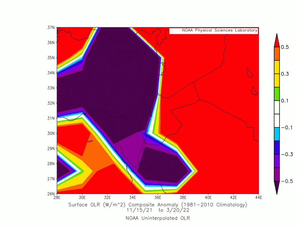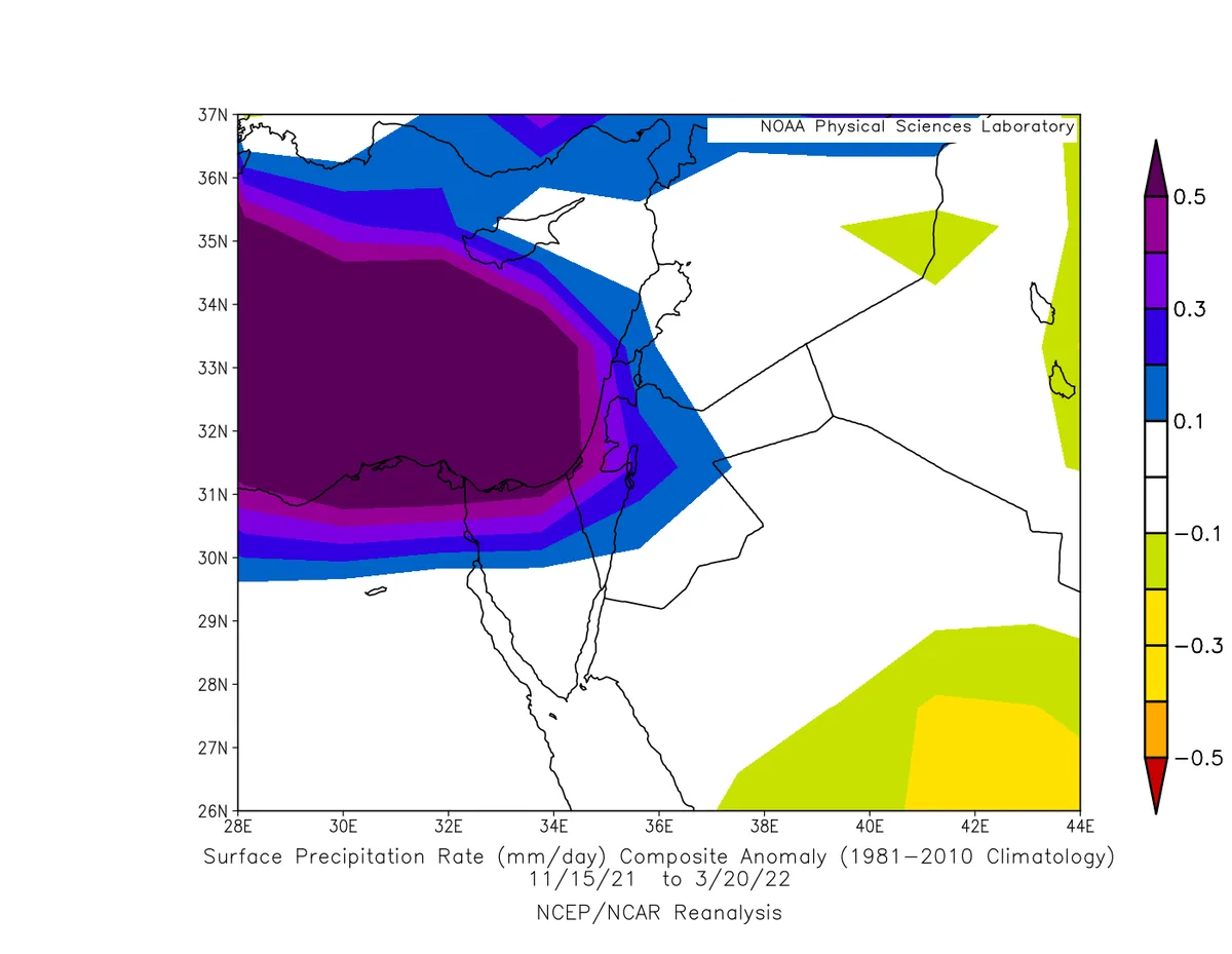
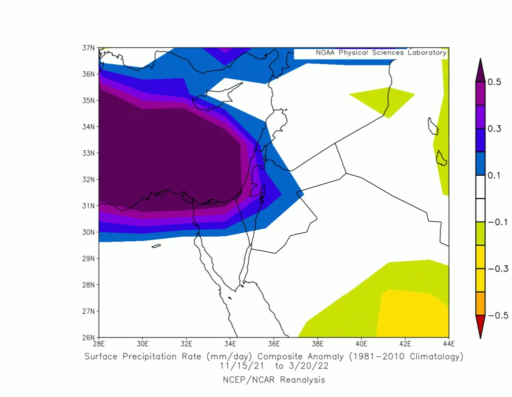
WASM- The Kingdom was affected by a strong and unusual rainy season that was the coldest in many years. The rainy season exceeded 150% performance in the central regions of the Kingdom and around 120-130% in the northern regions, with parts of west of the capital and Balqa recording huge amounts of rainfall approaching 700 mm, equivalent to one and a half rainy seasons. Cold temperatures were also recorded, dropping by approximately 1.5 to 2 degrees Celsius, with three snowy conditions, one of which was a strong snow storm, and distinctive rainfall distribution with frequent rainy conditions occurring at a rate of once every 3 days based on 300 meteorological observation stations in the region.
Scientific Reasons..
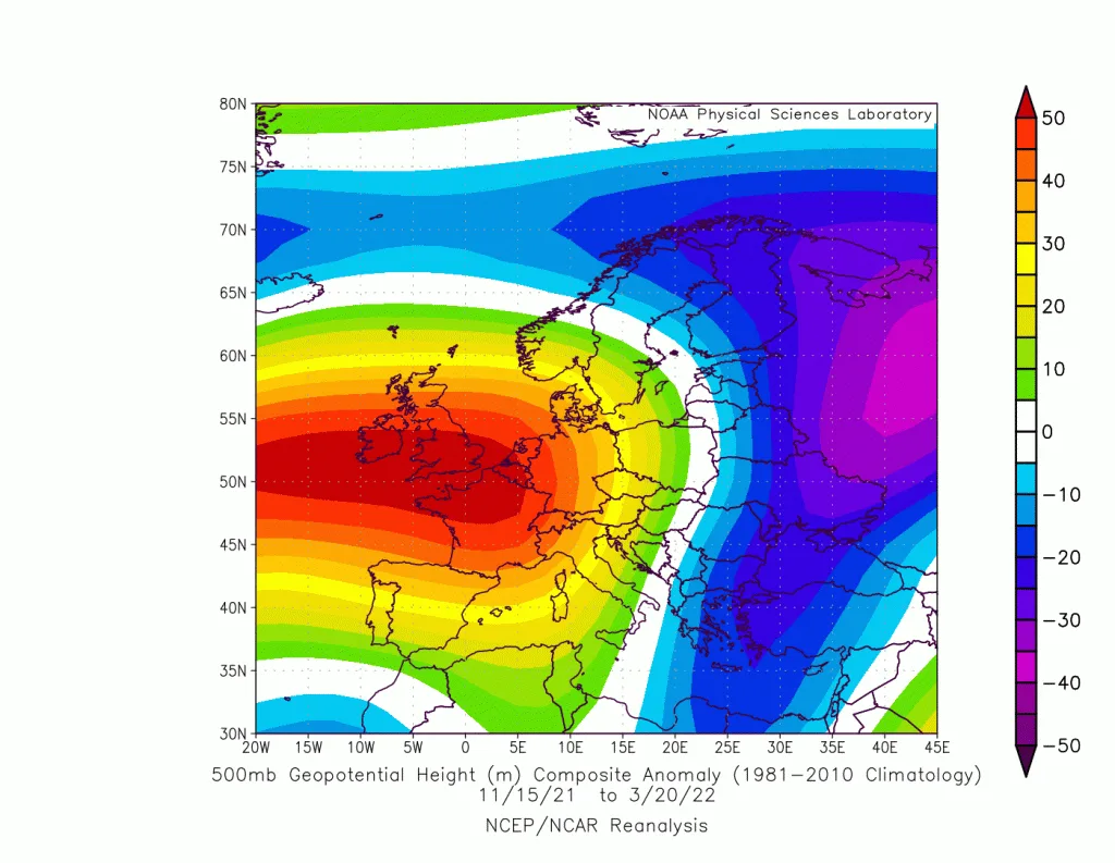
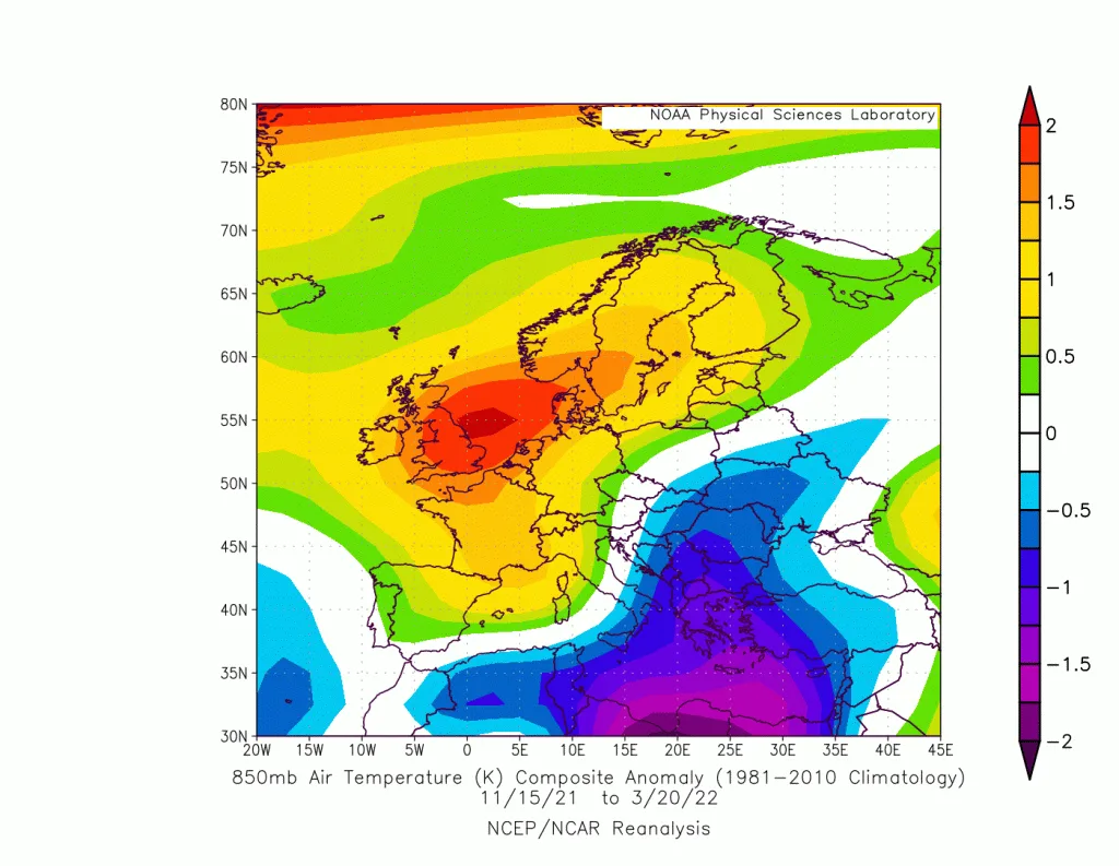
Returning to the maps referred to as "Reanalysis" which we relied on primarily in this scientific study, issued by the American National Oceanic and Atmospheric Administration "NOAA" and internationally recognized, an unusual distribution of atmospheric systems was observed. A strong high-pressure system was positioned over central and western Europe and North African countries, bringing prolonged stability, severe drought, and warm conditions to those areas. This allowed polar air to push repeatedly throughout the rainy season into the eastern regions of the European continent, passing through Turkey and then the eastern Mediterranean basin, causing frequent low-pressure systems and "massive" amounts of rainfall and precipitation, with continuous significant temperature drops.
With more detailed study, the strong and frequent activity of the jet stream over Italy was noted, which was forcing polar air to change course eastward toward Egypt and eastern Mediterranean countries. This led to the formation of a strong baroclinic zone – an unstable Mediterranean front – over the Cyprus basin region, northern Egypt, and Lebanese coasts, with repeated activity of low-pressure systems. This unstable zone caused atmospheric pressure to drop in the eastern Mediterranean, enhancing the push of polar winds toward the eastern Mediterranean and bringing very large quantities of rainfall and precipitation.
September, October, and November recorded rainfall around the average to slightly above, with an early arrival of the rainy season recorded at the end of September. December, January, and February recorded extremely massive quantities of rain and snow exceeding 200% of the monthly average in the north and center of the Kingdom. The current month of March recorded historically severe cold, the strongest in many years, and massive amounts of rainfall.
Precipitation Distribution..
The northern and central regions of the Kingdom and its northeast, as well as the southern and southeastern regions, benefited the most from this strong rainy season, recording three times the seasonal rainfall! The southwestern southern regions recorded a modest rainy season and were the least benefited from this strong rainy season.
Jordan Records Strong Rainy Seasons Repeatedly..
Jordan has recorded a significant increase in rainfall and precipitation amounts since 2014, which became more evident since 2018, with rainfall quantities doubling to around 200% in the last 4 years, especially in the north and center of the Kingdom. These causes are attributed to sharp climatic changes experienced by Jordan, with temperatures rising by approximately 1.5 degrees Celsius during the summer season. Over these years, this has caused the warming of eastern Mediterranean waters and an increase in evaporation rates, resulting in increased amounts of rainfall and the strength of low-pressure systems and winter storms.
There has been a change in the atmospheric systems affecting the Atlantic Ocean and the European continent, with Atlantic storms intensifying in recent years, which reflected the continuation of the European high-pressure system and the push of polar waves and continuous activity of low-pressure systems. WASM expects that strong rainy seasons will continue in the Kingdom during the coming years due to sharp climatic changes affecting countries worldwide. In contrast, increased drought waves are expected in North Africa and European countries. The World Meteorological Organization predicted an increase in rainfall rates in desert areas with a significant rise in temperature, which reflects increased fluctuation in rainy seasons in desert areas within the Kingdom.
Climatic Phenomena..
Despite the impact of the La Niña climate phenomenon, the rainy season was strong and historic, proving that rainy seasons should not be linked to specific climate phenomena, which would reflect inaccurate results like those that spread in local media outlets at the beginning of the rainy season. The WASM Regional Center issued scientific reports based on WASM's private climate model proving these claims incorrect. We negated the expected occurrence of rainfall interruptions or blockages on the Kingdom and issued seasonal forecasts indicating a strong and historic rainy season, which is exactly what happened, due to the unique technology we possess. The WASM Regional Center closed its first investment round at the beginning of this year, which will focus on developing our technology further in the coming years.
Long-range Forecasts..
The WASM Regional Center's statistical climate model was rerun on 24-3-2022, where WASM negates the occurrence of heat waves or any expected rainfall blockages during the coming period, and expects the continuation of rainy and cold conditions. Three to four rainy conditions are expected in April (during the blessed month of Ramadan) and two to three rainy conditions during May. Temperatures are expected to continue below average due to similar continuation of atmospheric organization.