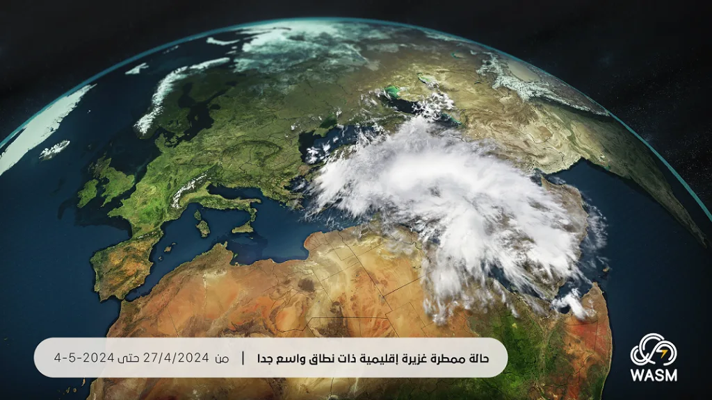
WASM – The Kingdom will be affected by a heavy and strong rainy weather system on Monday and Tuesday, with its early signs gradually appearing this Sunday evening across different regions of the Kingdom, especially the eastern areas of the country. As the tropical wave approaches the Kingdom, it will lead to the formation of flash floods and torrential floods in several regions, along with active winds and strong sudden gusts, and hail precipitation.
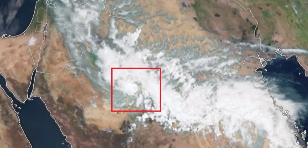
In detail, satellite imagery shows the presence of the tropical wave over the north of Hail region towards northern Saudi Arabia, gradually advancing towards eastern Jordan tomorrow Monday, then positioning itself over the central and northern parts of Palestine, Jordan, southern Syria, and Lebanon until Tuesday evening, causing heavy to extremely heavy rainfall in different areas of the Levant.
This rainy weather system is regional in nature, affecting various areas of the Middle East, Jordan, Palestine, Saudi Arabia, and even the UAE, Kuwait, Arab Gulf countries, Iraq, and northeastern Egypt.
Monday.. Beginning of the tropical wave's impact..
Temperatures will drop slightly and become in warm seasonal spring rates. Heavy thunderstorms will fall during the afternoon and evening periods across different regions of the Kingdom, with the intensity of the weather system concentrated in the central and northern Kingdom, northeast, the eastern badiah region, and the Dead Sea area, with its heavy impact also in the southern regions.
As a result of heavy and high rainfall rates in some periods, it is expected to lead to the formation of flash floods and torrential floods in many areas. Caution and alertness should be maintained regarding this weather system, even if the weather appears sunny, stable, and warm. Heavy and strong thunderstorms that cause flash floods need only 15 minutes to form, which is a short and sudden period that increases the chance of damage.
Tuesday.. Peak of the heavy rainy weather system..
The tropical wave's impact on the Kingdom will intensify, and heavy thunderstorms will fall at intervals, particularly in the central and northern regions and the northeastern areas of the Kingdom and the Dead Sea area, with increased chances of flash floods and torrential floods.Wednesday.. Remnants of the weather system and alert level lowered to yellow..
The weather system will weaken and decline clearly on Wednesday and become in the form of localized thundershower activity in different areas coinciding with a slight drop in temperature.
WASM issues a red alert level for strong weather conditions on Monday and Tuesday across different regions of the Kingdom, especially the northern and central regions, northeast of the country, and the Dead Sea area, with expected impact of heavy rainfall in the southern areas of the country. Continuous follow-up of warnings from the Jordanian Meteorological Department and guidance from the Civil Defense and Public Security is recommended.