

WASM- Temperatures are expected to drop significantly and noticeably tomorrow evening, Thursday, and fall well below seasonal averages clearly and substantially, following a rise in temperatures over the past two days and as a result of an extension of the Red Sea thermal and dry low-pressure system.
This drop coincides with increasing clouds on Thursday evening and Friday, and scattered rainfall in the north and central parts of the Kingdom and limited areas of the southwestern highlands of the Kingdom.
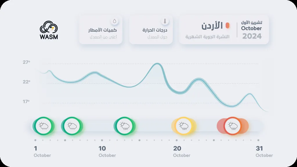
Temperatures are expected to remain generally low throughout the coming week, with continued cold nights in the mountains and plains, and chances of rain increase later in the middle and end of the coming week, with increased chances of heavy rain at the end of the month, marking the beginning of the current rainy season which was delayed slightly compared to previous years.
Significant temperature drop at the end of the week with rain showers|
Temperatures drop significantly and noticeably on Thursday evening and throughout Friday, with the passage of a weak cold front expected on Friday morning, which increases chances of scattered rainfall in the north and central parts of the Kingdom. Night temperatures are expected to drop to only 12 degrees Celsius in the mountains and plains, which is 3-5 degrees Celsius below seasonal night averages.
Rainy conditions expected during the last third of the month|
Especially during the last days of the month, and WASM regional center expects the Kingdom to be affected by major rainy conditions with unseasonably and early temperature decreases. Chances of rain increase later in the middle and end of the coming week, with rainfall intensity escalating during the last week of the current month, especially around the 26-27 of the month and until the beginning of the 11th month, becoming more widespread.
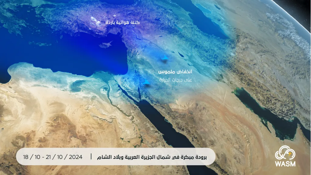
Heavy rainy conditions are expected to cover a wide range of the Middle East and Mediterranean region, resulting from the surge of cold air masses from northeast Europe as well as the northern Atlantic Ocean, coinciding with a "significant" flow of tropical and subtropical moisture from the Arabian Sea. These rainy conditions will take an escalating form in terms of strength and extent, as their signs begin at the end of this week over parts of the Levant, Jordan, Palestine, and southwest Saudi Arabia, then their chances increase during the middle and end of the coming week over other areas and scattered manner, intensifying and becoming more widespread and regular during the last week of this month and until the beginning of the 11th month at the very least.
Due to autumn weather conditions and the ease of atmospheric instability compared to cold winter periods, chances of rain will be nearly daily starting from the last week of the month until the beginning of the 11th month and in most of the region, coinciding with unseasonable coldness.
The speed of arrival of cold air masses toward the region is due to a significant weakness in the jet stream, and because of the warmth of the Mediterranean Sea, the results point to "extremely extreme" quantities throughout the Mediterranean region, including the far eastern Mediterranean area. This calls for attention and monitoring of weather bulletins during the coming period and rapid changes that may occur in weather conditions, especially during the last days of the 10th month and the beginning of the 11th month.
Rainy conditions will cover a wide range of the Arabian Peninsula, Egypt, Libya, Tunisia, Algeria, Morocco, and the Levant, extending toward a wide range of Iraq and the western and northern parts of the Arabian Peninsula during the end of the 10th month, and will include wide areas later from the beginning of the 11th month from the Arabian Peninsula and the Levant, concentrating more toward the eastern Mediterranean and Arabian Peninsula, with the intensity of weather conditions receding clearly in Maghreb countries but temporarily. The reason for this widespread coverage is the magnitude of the atmospheric high that dominates Europe and an unusual and significant weakness of the subtropical jet stream that increases the ease of the surge of moist tropical waves from tropical regions.
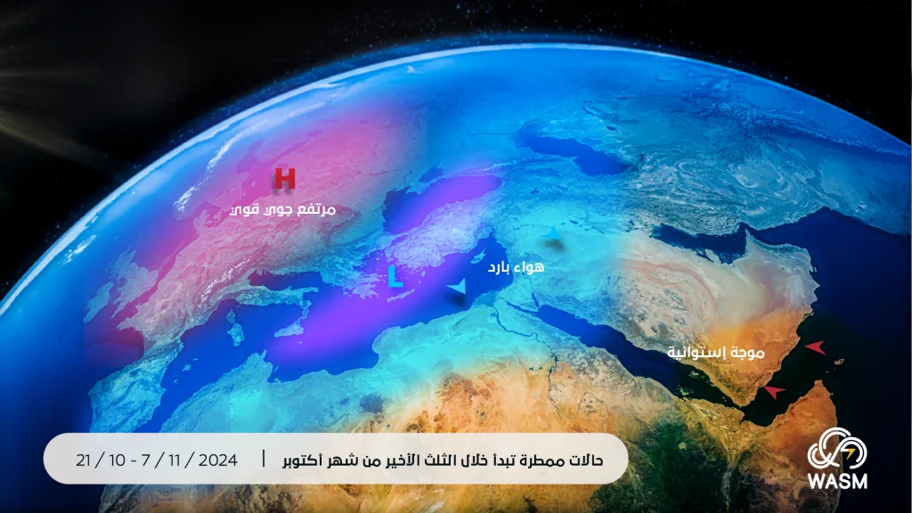
The ease of arrival of cold air masses will also increase during the end of the 11th month and the beginning of the 12th month and will be more evident, and rainy conditions will become more scattered, regular, and intense in the region as a whole, giving high chances for the impact of sharp cold waves early this season compared to previous years, and WASM regional center will issue all weather updates continuously.
The La Niña phenomenon failed to develop this season, according to what was announced by the Australian Bureau of Meteorology in its latest bi-monthly report, and most climate models have receded, which reflects the accuracy of WASM regional center's recent studies that indicated weak and short development of the La Niña phenomenon or continuation of the cold equilibrium, and this greatly reflects the latest climate data.
The WASM regional center's climate model achieved "extremely accurate" results that are considered very rare for climate models, with the match in atmospheric organization, the distribution of rainy conditions, their onset, and temperature patterns reaching an accuracy that exceeded 85%, which is a very large number for seasonal and monthly forecasts, and WASM regional center is unique in this climate model in the region
.