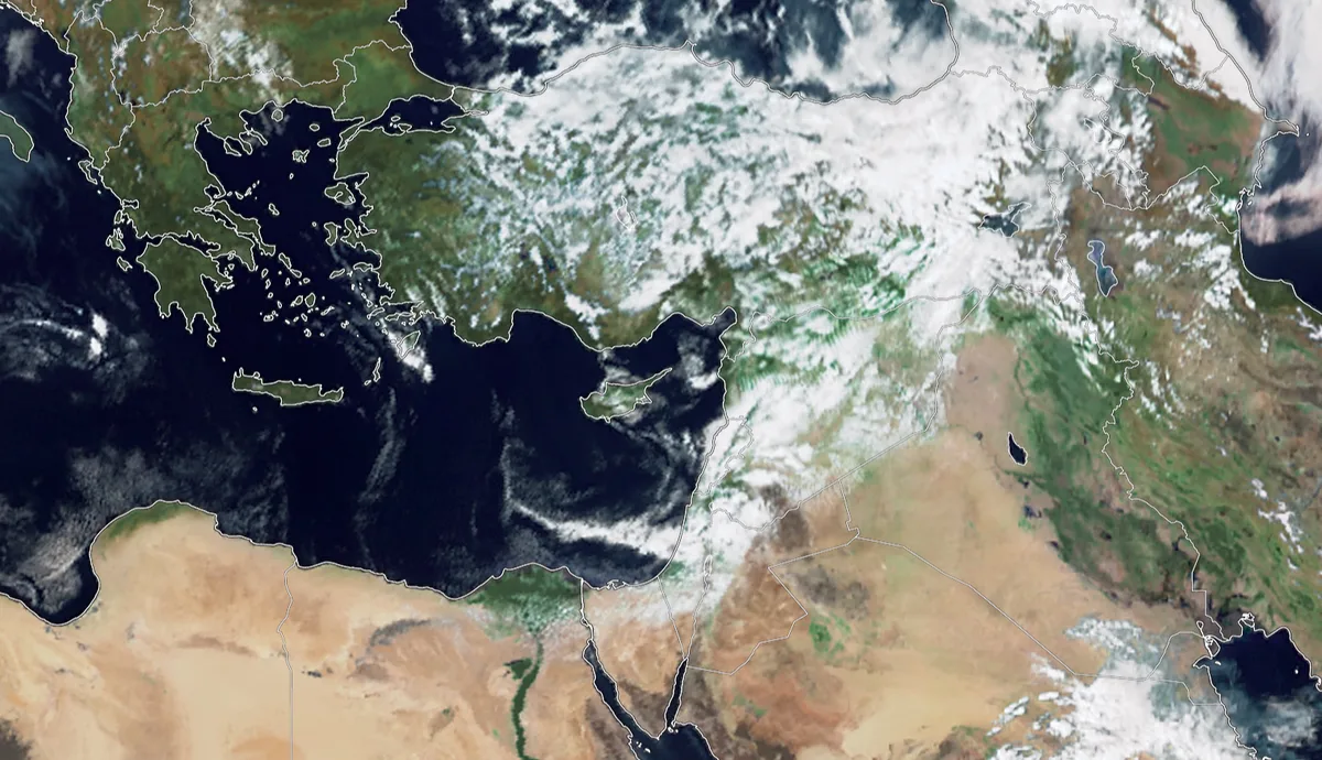
WASM - The strong and unseasonable cold wave recedes starting Saturday during the day, advancing from the far northwest of the European continent and of polar origin, accompanied by the effects of a low-pressure system positioned over Turkey.
Temperatures are expected to drop to zero degrees Celsius tonight in high mountains coinciding with frost formation, and light sleet mixed with snow is expected to fall on high southern mountains tonight coinciding with the formation of frozen fog and black frost in those areas due to temperatures dropping below zero degrees Celsius.
A short and temporary warm wave from Sunday through Tuesday..
A short warm wave affecting the kingdom will raise temperatures to more than 25 degrees Celsius in the capital and mountains, but for a temporary period resulting from a weak Khamsin low-pressure system, after which temperatures will drop at the end of the week and the chances of rain will increase.
A generally cold spring and continuation of rainy conditions..
The current spring is expected to be colder than normal conditions and wetter, with expectations of rainy conditions intensifying again starting from the second week of April through the beginning of May.
The air mass affecting "polar origin" "scientific note" ..
This cold wave is caused by a polar-origin and moist air mass that advanced from the far northwest of Europe and from the "Iceland" region, as a result of the presence of a strong high-pressure system north of Africa and south of the European continent.
Because the polar air mass does not deepen in the middle and upper atmospheric layers, this causes the absence of dense clouds carrying heavy precipitation, but rather low clouds as observed carrying light precipitation showers in general, which is called in meteorology a thermal inversion, meaning the rise in temperature in the middle layers of the atmosphere compared to the lower layers, which prevents the air from rising upward and building dense clouds, therefore the polar air mass is "moist" and not dry.
The polar air mass coincides with a deep low-pressure system positioned over Turkey, causing strong winds in the region and heavy snowfall over Turkish lands.
Climate change behind the prolongation of rainy seasons
As a result of climate change, in recent years the prolongation of rainy seasons and their extension for a longer period compared to previous years has been observed, and an increase in rainfall rates. This is due to drought waves that have begun to increase in central and western Europe as a result of the presence of a strong high-pressure system pushing cold and polar air masses toward the eastern Mediterranean.
The capital Amman and central regions of the kingdom have recorded increases in their rainfall rates this season by approximately 16% to 20%, as unusually large amounts of rain have been recorded in most desert and southern regions of the kingdom this season, therefore there is no truth to any report issued by media outlets indicating that Jordan is affected by dry waves, and the kingdom continues to record consecutive strong rainy seasons, especially since the 2015 season as a result of acute climate change.
Jordan | Strong Cold Wave Recedes Saturday with Temporary Temperature Rise Next Week