
Alert – Affected
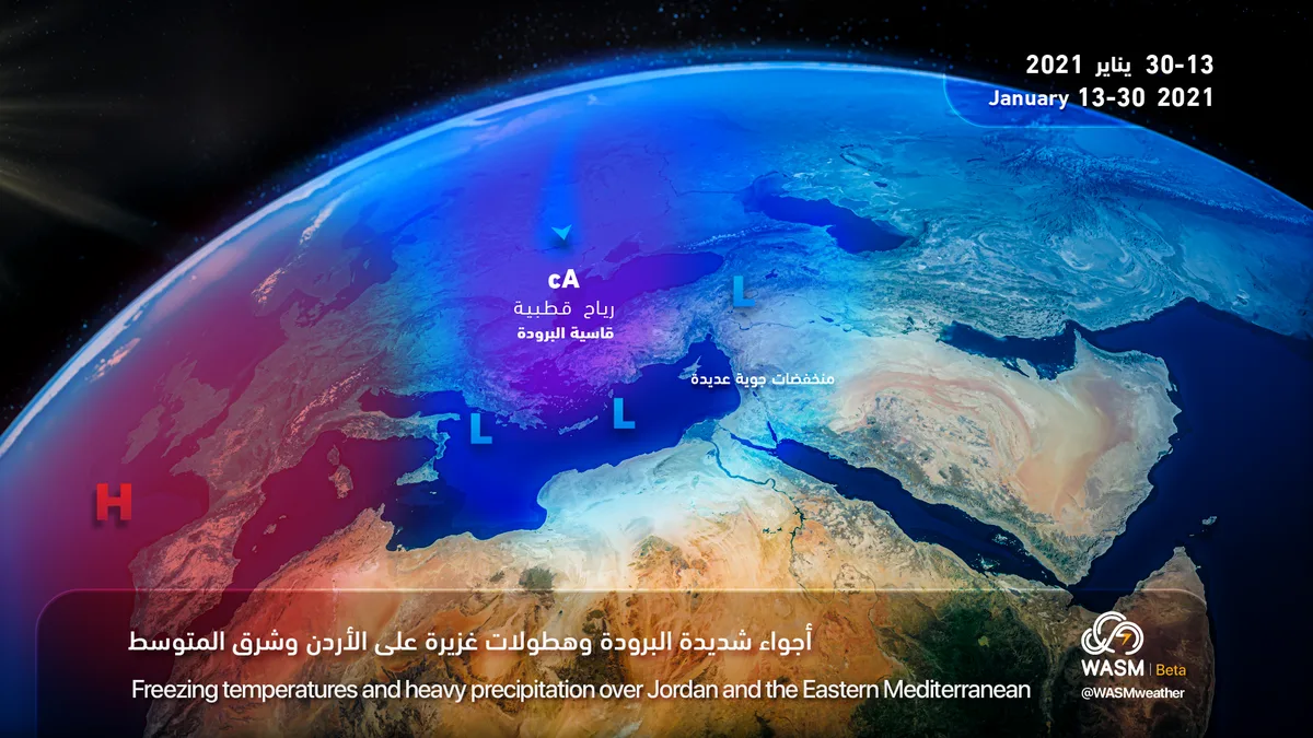
Jordan will be affected starting from Wednesday evening and throughout the weekend until the end of January 2021 by a series of successive and continuous atmospheric depressions over the region accompanied by a significant drop in temperatures, heavy precipitation, strong winds, and very cold conditions at times, indicating sharp changes in weather conditions following a period of precipitation interruption that began since the end of December until today exceeding 13-14 days without rainfall.
Temperatures will rise on Monday and Tuesday to around 20 degrees Celsius in the city of Amman due to the beginning of the Kingdom being affected by the leading edge of the atmospheric depression that will be located over Greece and the eastern Mediterranean basin with the presence of high and medium clouds.
Intense cold polar winds are approaching the region starting from the end of the week and are positioned over Turkey. Alert monitors the approach of these winds or the possibility of their impact on Jordan at the end of the week as well as after mid-month, and will issue all details about the nature of precipitation and the possibility of snowfall in the mountains during that period. The climate model developed within Alert specialized in long and medium-range forecasts indicates a good possibility of snowfall during those periods.
It is expected that atmospheric depression activity will continue until the end of January at least, starting from the end of the second week of the current month, specifically on Wednesday evening.
Alert recommends monitoring all weather updates continuously and for any changes that may occur in weather conditions. Precipitation interruption does not mean a lack of rain in the season or not expecting it to fall, but rather a natural climatic phenomenon that occurs in the Mediterranean climate, including Jordan's climate, and precipitation interruption typically recurs during rainy seasons. The current precipitation interruption is still short and is expected to end during the end of next week.
In scientific detail, a strong atmospheric high pressure system is deepening over western and central Europe and extending to the northwestern parts of it next week, which drives a bitterly cold polar air mass toward eastern Europe and then Turkey. This increases the activity of Cyprus Basin depressions due to a large temperature difference between the cold polar air in Turkey and eastern Europe on one hand and the warm Mediterranean waters on the other hand, causing baroclinic atmospheric instability resulting in continuous activity of multiple atmospheric depressions over the eastern Mediterranean basin and Jordan. Due to the atmospheric high pressure controlling western and central Europe, an important portion of the polar air mass is expected to surge toward the Mediterranean basin, which increases the chances of snowfall in mountainous areas of the eastern Mediterranean basin and Turkey region.
To know the temperatures in your cities, please visit the following link.. www.wasmweather.com