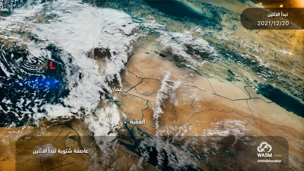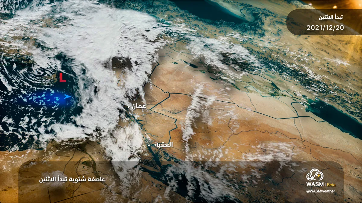
WASM - The Kingdom will be affected starting Monday morning by a "winter storm" accompanied by heavy precipitation and "stormy" winds, with snow showers expected on the peaks of high mountains mixed with heavy rain. Snow accumulation will be slight and temporary on the peaks of the southern mountains, including the peaks of Tafila and Shobak.
In detail, a low-pressure system is forming between the islands of Cyprus and Crete accompanied by polar-origin winds. This atmospheric depression will deepen and escalate to a "winter storm" affecting the entire Eastern Mediterranean region, Turkey, Jordan, the Levant, and Egypt on Monday. The storm is accompanied by winds with average speeds reaching 55 km/hour and gusts exceeding 90 km/hour coinciding with a significant temperature drop and heavy rainfall, and the formation of floods and torrential floods in valleys and low-lying areas and water accumulation sites within cities.
The storm will continue until Wednesday and will weaken and recede significantly at the end of the week with continued scattered rainfall and cold weather. Strong winds are expected to persist until Wednesday, which will cause dense dust storms in desert areas and the scattering of some materials.
"Stormy" winds ..
Wind speeds during the winter storm, which is expected to be the most impactful weather phenomenon, will reach 55 km/hour on Monday with gusts exceeding 90 km/hour. These winds will cause dense waves of dust in the eastern desert areas of the Kingdom, leading to complete absence of horizontal visibility. Similarly, damage is expected in many sectors, especially agricultural and electrical sectors, scattering of some materials due to wind force, and breaking of some trees.
Heavy rainfall ..
Heavy rainfall will begin Monday morning and continue until Wednesday and will concentrate mainly on the north and center of the Kingdom and extending to the north of the Karak region. The storm is expected to bring large amounts of rain. Monday rainfall will include the southern regions but for short periods.
Snow showers and severely cold weather ..
Snow showers will fall on the peaks of high mountains, especially the southern ones of the Kingdom on Monday. These snow showers will be mixed with severe rainfall on the elevations of the center and north, but will accumulate slightly, temporarily, and limitedly on some high peaks, especially the southern ones. Therefore, the expected condition is characterized as a "heavy rainy winter storm" with little and temporary chance of snow, and temperatures will reach only 2 degrees Celsius on the heights of Amman on Monday and lower than that on the heights of the north and south.
WASM Regional Center issues a red alert level starting Monday due to weather conditions, wind strength, heavy rainfall, and cold weather. It is recommended to follow the warnings of the Jordanian Meteorology Department and follow the instructions of the Civil Defense and Public Security.