
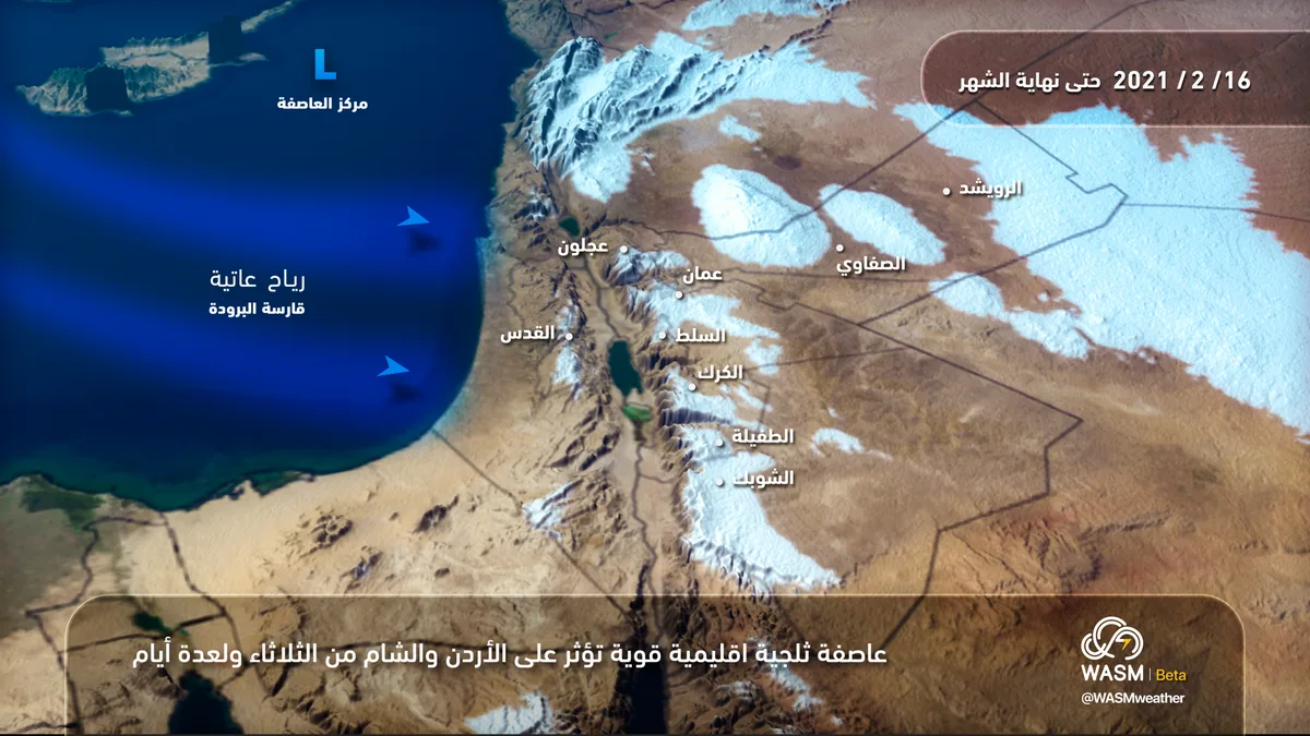
WASM - Jordan is expected to be affected by a snowstorm beginning Tuesday evening and lasting for several days, with its peak on Wednesday and Thursday, with expectations of recurrence between intervals, where the storm will weaken on Friday and its intensity will gradually decline and recur during the middle of next week, resulting in heavy snow accumulation on elevated areas covering most major cities including the capital Amman. Snow accumulation is expected to drop below 400-500 meters Tuesday evening coinciding with "severe" winds and heavy rainfall in low-lying areas and formation of strong torrents. WASM has issued a red alert level for weather conditions starting Tuesday evening.
In detail, a "bitterly cold polar air mass" is pushing toward the eastern Mediterranean region from northern Siberia directly and rapidly and will affect Jordan, leading to heavy snow accumulation on elevated areas and snow accumulation on mountainous areas above 600-700 meters Wednesday evening with (high density) in higher elevation areas, which will affect all aspects of public life.
The strong snowstorm coincides with severe winds exceeding speeds of 80 km/hour at times with gusts reaching 120 km/hour, causing damage to electrical, agricultural, and many other sectors.
The snowstorm will continue for several days, weakening and declining at times and intensifying at other times, and as snow accumulation levels change between successive waves, WASM will issue all details continuously.
Details from Tuesday through Thursday..
The storm's impact begins with strong dust-raising winds in various areas during Tuesday daytime, and gradually a cold polar-origin front pushes through during the evening, resulting in heavy rainfall in various areas, in the form of snow on mountains exceeding 1000 meters, gradually declining to 800 meters.
The intensity of heavy precipitation recedes Wednesday morning with a significant intensification in wind speeds due to the formation of a colder polar-origin air front pushing directly from northern Siberia toward the eastern Mediterranean basin and Jordan, leading to renewal of heavy precipitation, in the form of heavy snow on mountains exceeding 700 meters above sea level, where accumulations increase to be "heavy" over high mountains, and snow levels drop to 500 meters at times with slight accumulations at these elevations.
WASM advises following warnings from the Jordanian Meteorological Department, General Security, and Civil Defense, which are considered the only official warnings.
In scientific detail, a strong and deep atmospheric high pressure system is driving a severely cold polar air mass from latitude 80 north near northern Siberia through eastern Europe and Turkish lands to the eastern Mediterranean, and due to the size of the air mass and severity of its coldness, a storm is expected to form in the eastern Mediterranean in the form of a deep atmospheric low with its center depth reaching approximately 995 millibars, accompanied by polar air, and because of the size of the polar mass and the continued positioning of the strong atmospheric high pressure over Europe, this mass is expected to remain positioned for a long period over Turkey and the eastern Mediterranean, which indicates the continuation of the snowstorm's impact for many days
To know the temperatures in your cities, please visit the following link.. www.wasmweather.com