
WASM- The Kingdom will be affected by a deep cold air front penetrating various atmospheric layers starting from Sunday afternoon and continuing until Monday daytime, affecting different regions of the Kingdom, resulting in thunderstorms and active winds. Rainfall will be heavy in many areas including Aqaba and the Dead Sea region as well as desert areas.
Temperatures will rise in the morning and afternoon of Sunday as a result of warm winds advancing from western Saudi Arabia and the Red Sea region. Gradually, during the afternoon, clouds will increase at various altitudes across all regions and thunderstorm showers will fall irregularly.
Starting from Sunday afternoon and evening, a cold air front of polar origin will surge into the Kingdom, leading to cloud condensation and heavy rainfall across various regions including the Aqaba region, Wadi Rum, and desert areas.
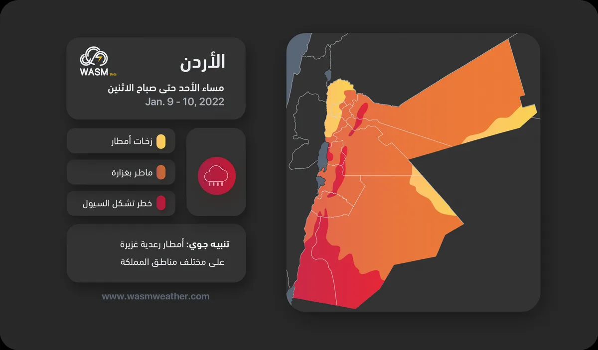
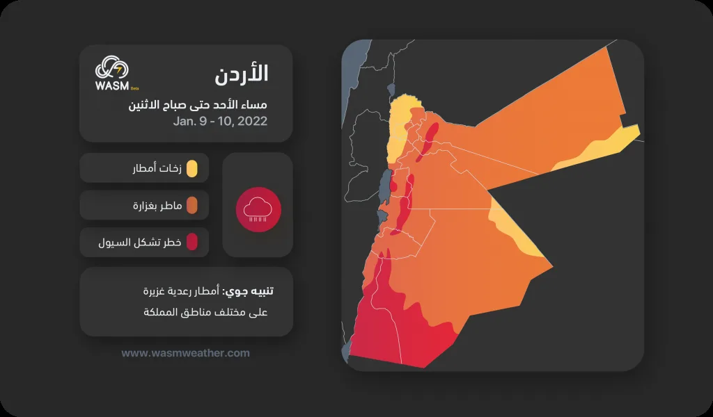
Heavy thunderstorms will continue during the night of Sunday/Monday and will begin to gradually recede during Monday morning, with conditions concentrated during Monday daytime in the eastern desert areas coinciding with the movement of the cold air front. WASM will issue different alert levels for weather conditions according to the region, with the intensity of the situation concentrated in southern Kingdom, the Dead Sea region, east of central areas, and northeast of the Kingdom as shown on the map.
Weather will stabilize Monday evening and dense fog will form in many areas. Weather will remain stable on Tuesday. Starting from Wednesday evening, rain showers will fall in northern Kingdom and rainfall will increase during the coming weekend coinciding with expected "high" activity of atmospheric depressions.
.