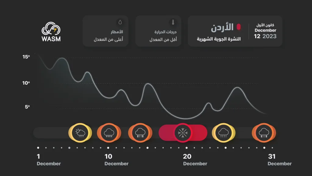
WASM- The Kingdom continues to be affected by "strong and successive" atmospheric depressions that bring large quantities of rain to various regions, including desert areas and the Aqaba region, amid low temperatures. These atmospheric depressions are expected to reach their peak intensity after mid-month.
Saturday.. Atmospheric depression and heavy rain in the north..
The Kingdom will be affected on Saturday by an atmospheric depression bringing heavy rain in the north with its extension at intervals towards the center of the Kingdom and the capital Amman in the form of scattered rain showers. Rain showers will also fall on Friday evening in various regions of the Kingdom, particularly in the northeast and north of the Kingdom as well as the far southern regions and around the Aqaba region, during the passage of a cold air front coinciding with active winds and cold weather.
Alert level.. Yellow in the center of the Kingdom and orange in the north.
Mid-next week..Large quantities of rain..
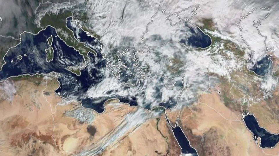
The Kingdom will be affected by an atmospheric depression accompanied by a cold and highly humid air mass that brings heavy rain to wide areas of the Kingdom, including desert regions. This atmospheric depression is expected to last for a period exceeding 60 hours, bringing rain, strong winds, and cold conditions to many regions. Details will follow within two days regarding the expected atmospheric depression mid-next week.
Expected alert level..Orange in various regions (subject to change according to precise alert protocols issued 72 hours before the weather situation).
Monitoring a polar wave after mid-month..
WASM regional center is monitoring a polar wave after mid-month, which is expected to result in a significant drop in temperatures and the formation of several strong atmospheric depressions accompanied by heavy precipitation and strong winds. Details will be issued progressively.
Expected alert level.. Red in many regions (subject to change according to precise alert protocols issued 72 hours before the weather situation).
Scientific analysis and WASM climate model data..
It is noted that WASM's climate model records the highest accuracy among all global numerical models in long-range forecasts and monitoring weather conditions. This is due to its working method, which is the "calibrated statistical method," where this model monitors all details in similar periods and the oscillations that occur in atmospheric circulation patterns, then applies complex calibration equations to these results to produce completely new results. This model has been developed to be capable of even monitoring some precise values for distant weather situations, which is still under testing and development. This project will be funded soon to make its graphical data available to everyone
.
Through detailed analysis of the atmosphere and the strong oscillations that occurred in the Arctic region and the North Atlantic, Eastern Europe was hit by a strong storm 10 days ago, causing heavy snow accumulation over a wide area extending to Germany and parts of Northern Europe.
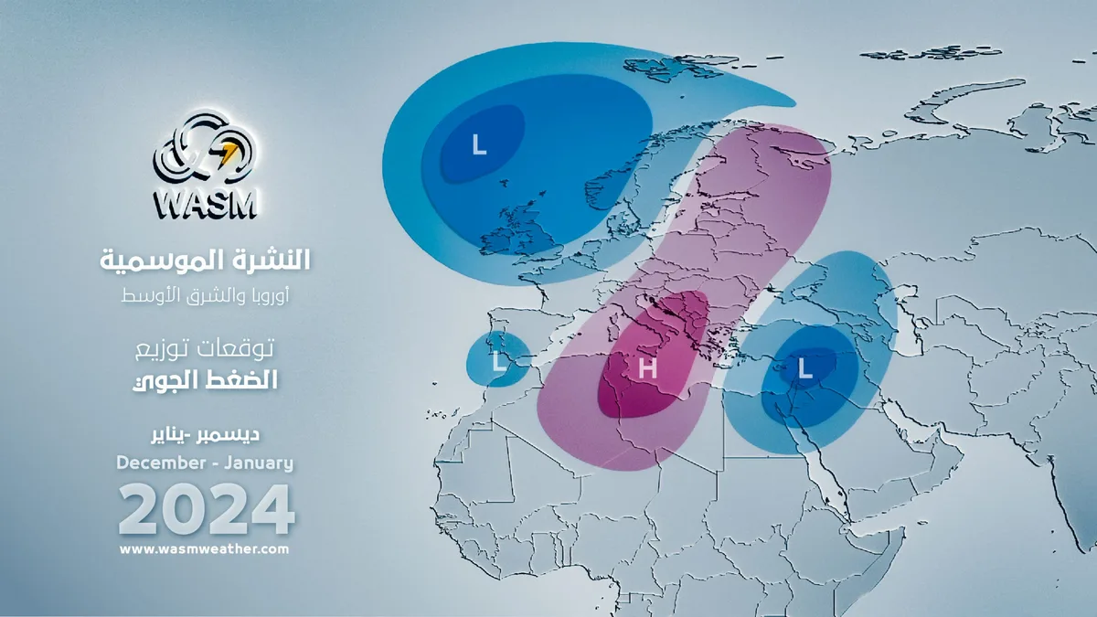
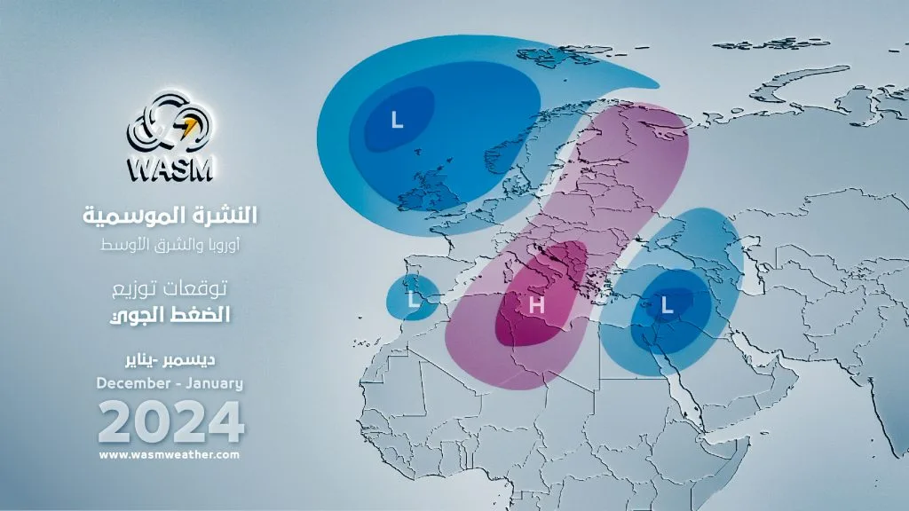
A rapid beginning of atmospheric pressure decline was observed in the Arctic region days ago, which has begun to cause strong disturbances in the eastern Mediterranean region and parts of its center, as well as areas of the European continent, which are expected to concentrate in the eastern part of Europe and parts of its center.
This will cause a very rapid rise in atmospheric pressure values in the center and west of the European continent and parts of its east, supported by the density and thickness of snow in those areas (strengthening centers of dynamic atmospheric highs), thus pushing polar air to expand rapidly towards the eastern Mediterranean, increasing the chance of a polar wave occurring in the eastern Mediterranean, where WASM regional center continues to monitor the expected results.
The weakness of the subtropical jet stream over northern Egypt continues to cause active strong cold fronts towards the region and penetrating into atmospheric layers, such as the one that occurred two days ago, which resulted in a heavy, strong, and widespread rainy condition due to the strength of the system and high humidity and not just atmospheric instability.
WASM expects similar strong and thundery cold fronts to recur mid-next week as well as after mid-month before the arrival of the new polar wave, as a result of the weakness of the jet stream north of Egypt, which strengthens Rossby waves advancing towards the region. This will also result in the descent of the polar jet stream towards the eastern Mediterranean at the beginning of the forty-day period.
Climate model results may differ slightly from reality, especially regarding time periods and the intensity of affecting weather conditions, but what usually occurs is a convergence of reality with climate model results at a rate of 69%, which is the highest accuracy rate in the Arab region for a long-range climate model, which has also surpassed even global long-range climate models in the Arab region.