
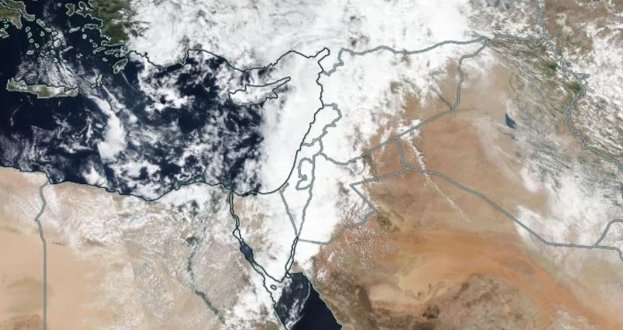
WASM – The Kingdom is expected to be affected by a "deep" cold air front on Tuesday evening, causing heavy thunderstorms sometimes in various regions, significant temperature drops, and active winds. This is at the front of a "long" series of cold, rainy atmospheric depressions expected to impact the Kingdom during the second and third weeks of the current month, resulting in large quantities of rainfall.
- "Relatively warm" conditions on Sunday and Monday..
Temperatures will rise further on Sunday and Monday ahead of the cold front crossing on Tuesday evening, which will cause temperature drops and heavy rain in many regions including desert areas and the Dead Sea area. Temperature is expected to reach around 22 degrees Celsius on Monday in the capital and mountains, which is 5-7 degrees higher than seasonal averages, which is typical before cold fronts pass.
- Deep cold front on Tuesday evening and Wednesday dawn..
The Kingdom will be affected by an atmospheric depression centered around the Cyprus basin accompanied by a deep cold air front of the "KATA front" type, characterized by warm and humid subtropical winds in front of this front and rainfall in the form of thunderstorms with high intensity rates in some areas, followed by the Kingdom being affected by humid westerly winds accompanied by light rain during Wednesday daytime.
- Atmospheric depression over the weekend..
WASM Regional Center is monitoring the Kingdom being affected by a cold and heavily rainy atmospheric depression during the weekend, which is part of a long series of several atmospheric depressions that reach their peak strength around mid-month, especially between the 17th and 22nd of the month.
Scientific Analysis..
The North Pole is recording sharp fluctuations in atmospheric pressure values between rapid increases and sharp decreases, which has caused extremely cold polar air to reach Europe, particularly its eastern regions, causing strong storms and very heavy snowfall in those areas. Gradually, this polar wave is expected to expand towards the eastern and central Mediterranean accompanied by active North Atlantic storms, which will allow the formation of a strong area of high atmospheric pressure during the second week of the month, causing extremely cold air masses to surge towards the eastern Mediterranean, especially around mid-month. WASM Regional Center is monitoring these expected atmospheric conditions, noting that the center was unique in recording very early detection of the expected atmospheric activity due to the technology that the center uniquely possesses and the development of a specialized climate model for long-range forecasts and the only one of its kind in the Arab region, which operates using the calibrated statistical method.
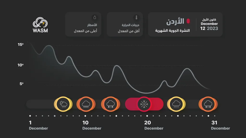
Climate model output from WASM Regional Center regarding high activity periods during December