

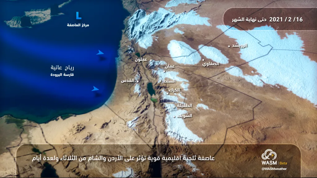
WASM- The snowstorm is expected to begin affecting the region from midnight tonight through Wednesday dawn and continue until Friday. It will be preceded by heavy rainfall across various areas of the Kingdom on Tuesday evening coinciding with strong winds. Snow will fall over altitudes of 800 meters and descend Wednesday dawn and morning to 700 meters, accumulating densely over high mountains, especially the northern mountains and parts of the highlands of the capital Amman. WASM has issued the red alert level, which is the highest severity level for the snowstorm, starting from tonight.

.
Strong winds will intensify with gusts exceeding 110 km/hour during late morning hours on Wednesday. Precipitation of all types will decrease across all regions and be scattered over the north and central parts of the Kingdom, with snow falling intermittently over altitudes of 800-900 meters. However, a stronger cold front pushing from northern Siberia will deepen in the afternoon toward Jordan, leading to a renewal of severe precipitation and dense accumulating snow over 800 meters. The accumulation level will drop to 600 meters during Wednesday/Thursday night with intensification of the snowstorm in terms of wind strength and precipitation density, with heavy rainfall falling below these altitudes.
The snowstorm will continue until Thursday morning and begin gradually receding Thursday afternoon, with the snow level rising to 800 meters then to 900 meters and stabilizing around 1000 meters throughout Thursday evening in the form of scattered showers, with dense snow accumulations over wide areas of the mountains, and the formation of dense fog and clouds touching mountainous regions.
.
Starting from Friday dawn, a new low pressure system will form over the coasts of Palestine, leading to a renewal of heavy precipitation of all types in the form of dense snow over 950 meters in all regions above sea level and occasionally below that, accumulating heavily in the high mountains.
These weather conditions will continue until Friday evening, with the snowstorm beginning to recede Friday evening. The Kingdom will remain under the influence of the remnants of this storm on Saturday in the form of scattered showers mixed with snow showers from time to time.

WASM is monitoring another polar surge expected mid to late next week, which will lead to renewed chances of snow falling again, and will continue to issue all details on an ongoing basis.
To find out temperatures in your cities, please visit the following link.. www.wasmweather.com