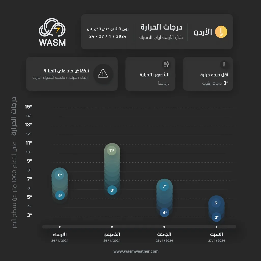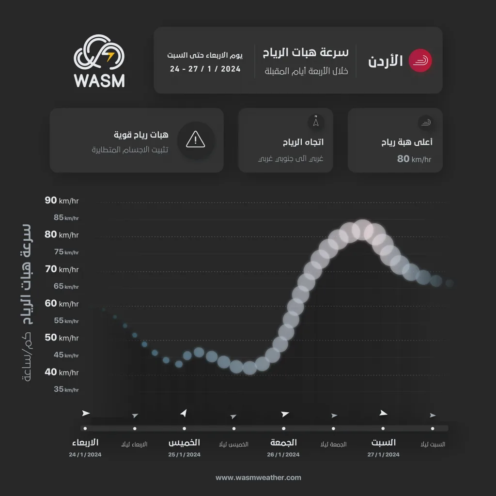
WASM – The Kingdom will be affected by a "strong and prolonged" winter storm accompanied by polar-origin winds sweeping from the east and north of the European continent. It will begin on Friday and continue for several days until at least the end of next week, resulting in very large quantities of rain over wide areas, stormy winds, snowfall in mountainous regions, and temperature drops to zero degrees Celsius and below in highland areas.
The WASM Regional Center issues this weather bulletin using the advanced W.DMM technology developed within the center, which is unique to WASM. This bulletin's data is characterized by "stability and exceptional accuracy, even during medium and long-term periods".
Thursday.. Cold conditions and temporary decrease in rainfall intensity..
As a result of the beginning formation of the winter storm, rainfall intensity will decrease during Thursday daytime, becoming scattered showers in the north and center of the Kingdom. However, during the night of Thursday/Friday, rainfall will gradually intensify and become heavy and continuous in the north and center.
Friday.. Beginning of winter storm impact..
The winter storm will begin on Friday in the form of strong winds and gusts exceeding 70-80 km/h, coinciding with heavy rainfall amounts and the formation of flash floods and possibly flooding in valleys and watercourse channels. Snow showers will also fall on the peaks of high mountains, particularly the southern ones, amid severely cold conditions.
Saturday through Monday.. Continuation of the winter storm..
The winter storm will continue from Saturday through Monday with very large amounts of rainfall, almost continuous, over the western regions of the Kingdom and the northeastern areas. Snow showers will fall on high mountains, particularly the southern ones, amid continued strong winds and low temperatures. Gradually, during Monday evening, polar winds will deepen toward the Kingdom, temperatures will drop continuously, and the "winter storm" will intensify.
The winter storm "intensifies and becomes powerful" starting from the middle of next week
The winter storm will intensify starting from the middle of next week and become "powerful," accompanied by very large amounts of rainfall and heavy hail. Gradually, snowfall is expected in mountainous regions, and this winter storm is expected to continue until the end of next week.
High chance of snow in the middle of next week..
As a result of polar-origin winds surging toward the eastern Mediterranean basin and the Kingdom, a significant increase in the probability of snowfall in mountainous regions is expected. The WASM Regional Center will issue all details successively, especially since the winter storm is expected to intensify between Monday and the end of next week amid very low temperatures, strong and sometimes stormy winds, and very large amounts of precipitation.
Alerts..
Winter storms are important weather conditions that strike many regions of the world during the winter season. Winter storms are characterized by very large amounts of rainfall and opportunities for widespread flooding and flash floods, rising water levels in many low-lying areas, strong winds, and heavy winter precipitation and snowfall in mountainous regions if they intensify.
The WASM Regional Center issues a red alert level starting Friday due to the strong weather conditions expected during the impact of the prolonged and powerful winter storm.