WASM – The WASM Regional Center issues its monthly weather bulletin using the advanced climate model for February 2021, noting that the climate model has been developed with a new update that improves its outputs and increases its accuracy.
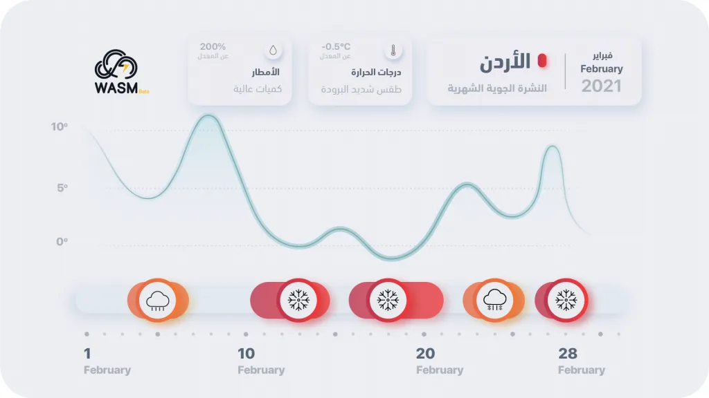
February is expected to be cold with significant temperature fluctuations at the beginning of the month. A succession of atmospheric depressions is expected, particularly after February 10th, and three severe cold polar surges are anticipated, especially after mid-month, which will increase chances of snow again.
Rainfall quantities will be above normal, as occurred in the previous month, and temperatures will be below normal. No significant interruptions in precipitation are expected. The strongest conditions are expected after mid-month, coinciding with polar winds.
The expected weather conditions are as follows..
- Heavy rainy and cold conditions between February 4-6 at orange alert level, followed by a noticeable temperature rise.
- Severe cold conditions accompanied by heavy precipitation and increased chance of snowfall between February 11-14 at red alert level.
- Renewed strong surge of polar winds between February 16-20 with increased chance of snowfall at red alert level.
- Weather conditions with precipitation between February 23-25 followed by a temperature rise at orange alert level.
- A new surge of polar winds on the last day of the month extending into early March at red alert level.
The accuracy of long-range weather forecasts using WASM's climate model reaches rates that sometimes exceed 75-80%. We have upgraded the model to a new version, where the climate model consists of 5 layers that analyze climate data and similar periods. A new sixth layer has been added to increase the accuracy of determining weather conditions and their intensity. Long-range forecasts are extremely important as they monitor distant weather systems and enable early preparation for them. WASM is unique in the accuracy of its long-range forecasts due to its use of advanced technology.