
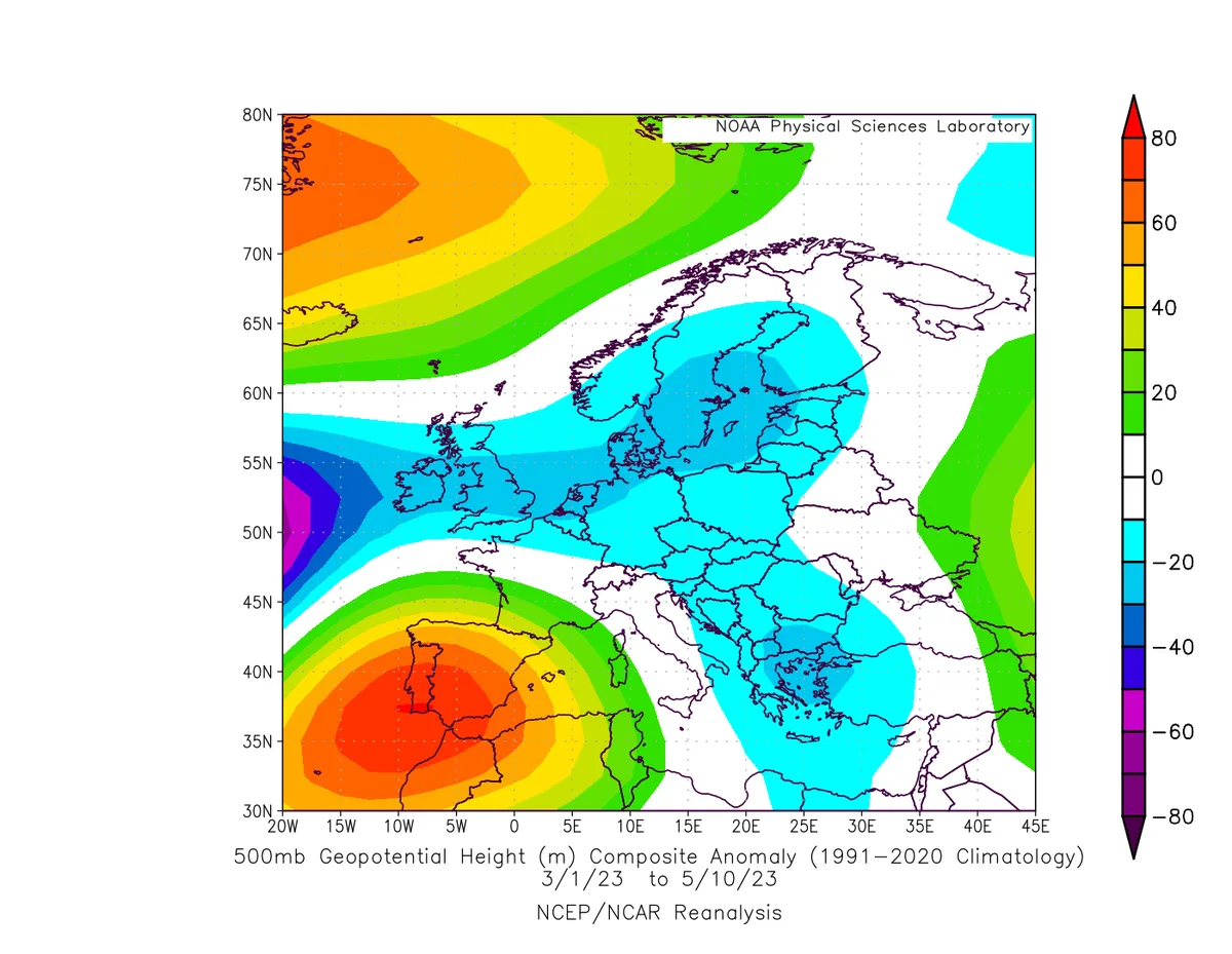
WASM - Khamsin depressions have been almost completely absent from the Kingdom this season, with no fully-characterized Khamsin depression recorded since the beginning of spring. What has been affecting the Kingdom frequently instead are integrated atmospheric depressions or Cypriot lows, which is unusual compared to this time of year. Jordan and countries in the Middle East region experienced a cold, humid, and rainy spring, with rainfall amounts exceeding 3-4 times the normal seasonal precipitation. But what are the scientific reasons? Before we answer this question, let us properly define these depressions from a correct scientific perspective, away from the common and unscientific definitions spread through local media outlets..
- Khamsin Depressions..
These are frontal atmospheric depressions known as "baroclinic," but they are dry and low in moisture. These frontal baroclinic atmospheric depressions form behind the Atlas Mountains in the first phase, then deepen as they move eastward alongside the Mediterranean Sea and over hot African terrain.
These frontal baroclinic atmospheric depressions typically follow the parent Mediterranean low, which is positioned to the northwest and on the southeastern side of its cold front, which initially affects the Atlas Mountains. The change in the speed of movement of cold winds associated with the parent cold front, resulting from their collision with the Atlas Mountains, causes a sharp descent of these winds behind the mountains and warming of the winds "adiabatically" behind the Atlas Mountains, causing a sharp thermal baroclinic difference and the formation of the nucleus of this atmospheric depression in the form of a "lee low" or the atmospheric depression situated behind the mountains.
This atmospheric depression moves gradually eastward along the parent cold front. This front, combined with the cold water temperature, creates a suitable environment for deepening this atmospheric depression over hot African terrain due to the sharp horizontal thermal difference it causes (baroclinic instability).
For this dynamic to occur, polar air masses must advance transversely, crossing contour lines of the air mass at upper atmospheric levels with lines of latitude at approximately a 45-degree angle toward the east. This causes the expansion of polar air along the Mediterranean Sea and alongside the Mediterranean coasts, making the North African environment very suitable for the formation of these dynamic baroclinic depressions, and not as is spread in local media outlets that they are "thermal" depressions, which reflects the scientific poverty that has spread in the weather forecasting sector in recent years.
This distribution is very important for the formation of these atmospheric depressions that benefit from the cold waters of the Mediterranean Sea, the tilted positioning of polar air masses, and the high Atlas Mountains, which act as a spark for these frontal depressions to form and develop.
However, this spring, a strong atmospheric high pressure system stationed over North Africa prevented the formation of these Khamsin depressions almost entirely, causing a severe drought wave in the Maghreb region and North Africa, which reflected on a cold and rainy spring season in the eastern Mediterranean region. Khamsin depressions typically cause large amounts of rainfall in the Maghreb region due to the location of their center.
Media and many sources confuse the identification of these atmospheric depressions, especially since the Kingdom has not been affected by any Khamsin depression for more than 5 weeks due to the absence of this weather system, which is a rare occurrence.
- A Strong Atmospheric High Pressure System over North Africa..
The positioning of a strong atmospheric high pressure system over North Africa prevented the formation of these Khamsin depressions from the start. The source of these depressions is located behind the Atlas Mountains in northern Algeria. The presence of a high atmospheric pressure zone in those areas prevented these Khamsin depressions from forming and deepening, which is unusual and rarely occurs.
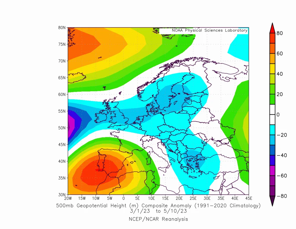
The atmospheric undulation this spring took the form of an Omega Pattern, which rarely occurs. Normally, the atmosphere undulates during this spring period in the form of a Rex Pattern, resulting from the rapid decrease in atmospheric pressure behind the Atlas Mountains and the activity of the Azores high over the British Isles, due to the intensification of the horizontal thermal difference between cooler water surfaces and warmer land areas. However, this arrangement did not exist this spring, which is unusual.
The strength of the deepening of the warm atmospheric high pressure over North Africa and western Europe results from a very sharp undulation of the subtropical jet stream and its weakness at the same time, which prevented these atmospheric depressions from forming and deepening in the first place. This caused cold and polar air masses to move directly toward the eastern Mediterranean basin and the activity of "deep Cypriot" depressions, which formed from northeastern Libya and deepened rapidly over the Cyprus basin in an unprecedented manner for the region's climate at this spring time. This resulted in strong rainy weather conditions with heavy rainfall over the Levant, Jordan, and eastern Mediterranean countries, and an almost complete absence of dust waves and sandstorms.
.
Warming of the Western Mediterranean Region..
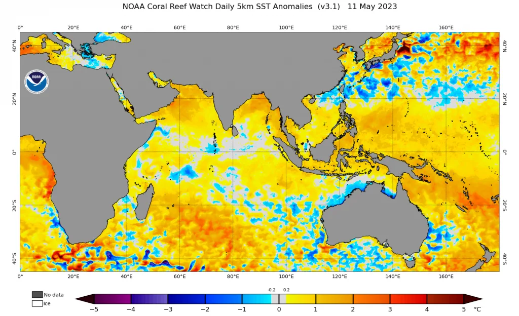
Severe and consecutive drought waves over western Europe and North Africa, which are rare, caused an increase in temperature in those areas and warming of the western Mediterranean Sea, which was an important secondary reason for weakening the baroclinic front from forming initially and caused weakening of these Khamsin depressions.
Weakening of the Jet Stream over Eastern Mediterranean and North Africa..
Baroclinic or frontal atmospheric depressions also require strong dynamic reasons to develop in the first place. A baroclinic unstable front alone is not sufficient; rather, dynamic lifting factors resulting from the activity of a strong jet stream over North Africa must be present, which was completely absent this spring. This also resulted in a strong dominance of subtropical and tropical moist air masses over the Middle East region due to this decline.
- Will These Changes Intensify in the Coming Years?
Despite the change in the characteristics of Khamsin depressions in recent seasons and their near absence in some years due to changes in the North African region with intensified dominance of high atmospheric pressure zones caused by climate change, the WASM Regional Center has a different view regarding the characteristics of Khamsin depressions, which will change over the coming years to become more independent and sometimes stronger dynamic weather systems, which may escalate over the coming years to subtropical Mediterranean storms, especially with increasing temperature rates in the Mediterranean region.
The weakness of the jet stream in the Mediterranean region and the change in atmospheric organization characteristics will only change the characteristics of Khamsin depressions and their near-complete absence from the Maghreb region. WASM will issue a study on these depressions and the change in their characteristics over the coming period.
WASM warns against local media outlets that spread "superficial and weak" information about climate change in Jordan and Middle Eastern countries, claiming that rainfall rates are declining and drought is increasing, under the assumption that climate change is identical in all regions of the world. This indicates scientific poverty and a poor understanding of climate change, as our regions are affected by high rainfall rates and an increase in the number of Mediterranean storms, which are expected to intensify in the coming years and result in unprecedented strong rainy seasons.