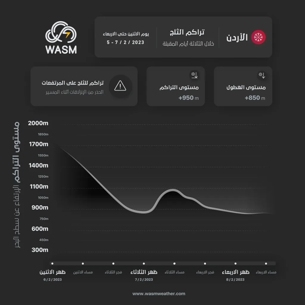
WASM – The winter storm "Jood" is expected to intensify tonight and during Tuesday and Wednesday, reaching its peak strength. Very large quantities of rain and snow are expected to fall on mountainous areas above 900 meters and sometimes below that, accumulating particularly over areas above 950-1000 meters above sea level, specifically during the night of Tuesday/Wednesday.
Very large and "unusual" quantities of rain from Monday night through Thursday..
Very large and unusual quantities of rain are expected, exceeding one-third to half of the entire seasonal rainfall across a wide range of central and northern regions of the kingdom specifically, following the recording of more than one-third of the seasonal rainfall during the previous days alone.
Attention must be paid to mudslides and rockslides, flash floods in wadis, and rising water levels in cities, due to the very large quantities of rain expected, especially since the kingdom was affected by massive rainfall in the previous days
Jordan has been affected for years by sharp climate changes, which have resulted in a significant increase "in rainfall rates" exceeding 150% at least, particularly in the north and central parts of the kingdom.
Snow above 900 meters starting tonight and becoming more accumulated on the night of Tuesday/Wednesday..
Snow is expected to fall above 1000 meters tonight, extending during the hours after midnight and the dawn period of Tuesday to 900 meters. Dense accumulations are expected in the highlands of Ajloun, Jerash, Karak, and Tafilah, while slight accumulations occur in Shobak due to weak precipitation.
As for the capital Amman, slight accumulations are expected in general in the highlands west of the capital Amman, varying on their peaks.
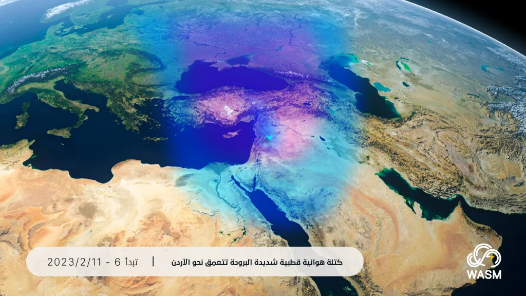
Snowfall will intensify on the night of Tuesday/Wednesday with an increasing deepening of the polar-origin air mass moving toward the kingdom. Snow is expected to fall above 900 meters and sometimes below that, accumulating according to elevation and affecting the mountainous highlands including the highlands west of the capital.
Stormy wind gusts continuing through Wednesday..
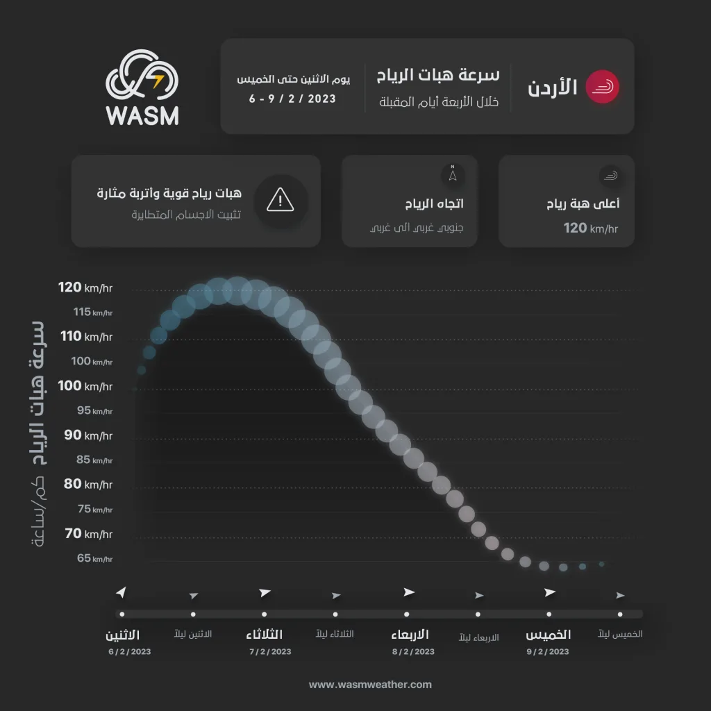
Strong winds and stormy gusts are expected to continue until Wednesday coinciding with the continued impact of the winter storm "Jood," with wind gust speeds reaching more than 120 km/hour in some areas.
Mediterranean storms "Mediterranean Cyclone"
What is affecting the kingdom and the eastern Mediterranean region and Turkey is classified as a winter Mediterranean storm, which becomes highly active during the winter season, especially in February "the peak of its strength and activity." The scientific reasons are due to the ease of deepening polar air masses toward the region, coinciding with the intensification of "the jet stream and its reaching peak strength".
With the intensification of the polar air masses' impact, temperatures rise significantly in northern African regions, which causes the jet stream strength over the Mediterranean, resulting in the development of these strong storms that strike the Mediterranean annually. These storms are expected to increase during the coming years with the intensification of climate change, which means a significant and increasing rise in rainfall rates in Jordan and the eastern Mediterranean region.
Wind gust speeds usually reach 120 km/hour and possibly more than that, as they are accompanied by massive quantities of precipitation and severe snowstorms, very low temperatures, and rough sea waves.