
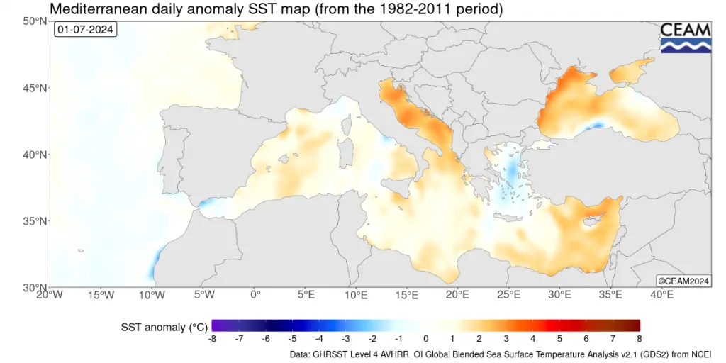
WASM – Mediterranean sea surface temperatures have continued to rise over recent years, and this summer reached record-breaking figures exceeding their seasonal averages by approximately 4-5 degrees Celsius, recording 29 degrees Celsius in its eastern parts, with further increases expected in the coming period despite the moderate weather conditions experienced in recent weeks in the region.
Reasons for rising temperatures in the Mediterranean region..
Heat waves or rising air temperatures cannot be considered the main reason for rising temperatures in the Mediterranean region, as there are many causes that sometimes relate to ordinary water circulation in water bodies. High geological activity may be one of the most important reasons for rising temperatures in water bodies, particularly in the Mediterranean region.
Effects of elevated Mediterranean Sea temperatures..
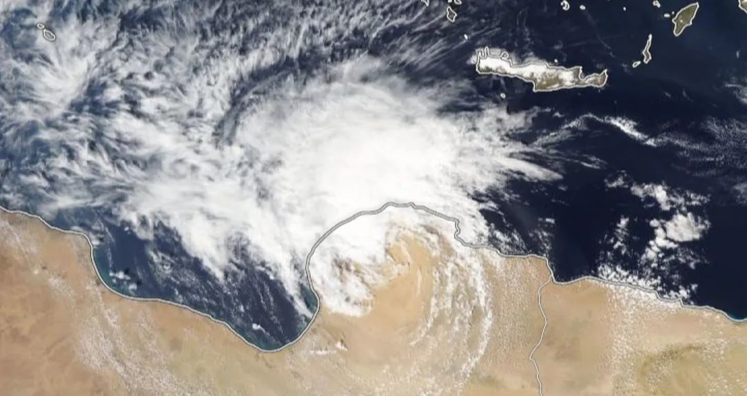
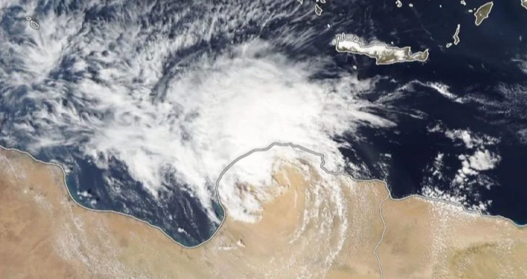
This primarily affects the central Mediterranean region and areas near Libya, Greece, southwestern Turkey, and northwestern Egypt, primarily with the onset of autumn season in the form of a high probability of strong Mediterranean storms occurring and increased flood and dangerous flood indices. This effect later extends toward the eastern Mediterranean basin and during mid-autumn season.
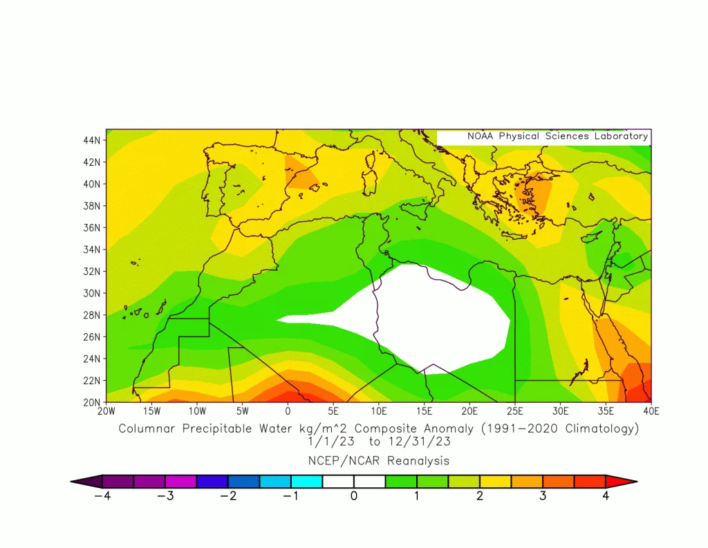
Rising Mediterranean Sea temperatures do not necessarily mean an increase in the number of heat waves or seasonal temperature increases. Despite its high temperatures over recent weeks, temperatures in the Levant, eastern Mediterranean, northern Saudi Arabia, and northern Egypt have decreased noticeably and fallen below their seasonal averages in many periods due to the nature of atmospheric circulation patterns. However, this has clearly coincided with recording high humidity levels, which were evident in the dew point (high condensation level - Dewpoint).
The effect of Mediterranean Sea heat is evident in perceived temperatures, most often at the end of summer in the form of humid waves in the region, especially with increased evaporation rates and declining atmospheric activities in the region due to the nature of atmospheric circulation patterns, which on the other hand reflects increased latent thermal energy in the region.
The effect of elevated Mediterranean Sea temperatures is clearly evident during the end of summer and autumn season, concentrated in the central Mediterranean region primarily and near Italy, Tunisia, Libya, Greece, and even the southwestern portions of Turkey in the form of strong Mediterranean storms resulting from high kinetic energy that resulted from sensible thermal energy released from latent energy in the Mediterranean Sea, which reaches thousands of "joules" per kilogram of air. High temperatures of the Mediterranean Sea surface, especially in its central and eastern parts, mean more latent energy simply, which is easily converted to kinetic energy when cold air masses arrive via the European continent during late summer.
This effect is delayed in appearing over the eastern Mediterranean region due to the behavior of the subtropical jet stream, which intensifies noticeably as we move eastward due to very high temperatures in the Arabian Peninsula and southwestern Asia and continued relatively elevated temperatures in eastern Europe due to continental nature and the expected continuation of heat waves affecting it for extended periods.
The effect of this in the eastern Mediterranean region, northern Saudi Arabia, and Egypt becomes evident during mid-autumn season, and with the ability of cold air masses to reach the eastern Mediterranean region easily after the subtropical jet stream weakens toward the south and with the onset of a decrease in heat wave severity in the Arabian Peninsula. This effect appears in cases of acute baroclinic atmospheric instability in the region, especially with easily decreasing atmospheric pressure near the southern Palestinian coasts. These conditions easily develop into deep-centered and strong-wind low-pressure systems later during late autumn.
Simply put, high Mediterranean Sea temperature is not the only main factor; it is very important for the subtropical jet stream to weaken toward the south to easily drain latent energy. Otherwise, the atmospheric conditions affecting the region remain limited. The surface factor alone is insufficient to cause atmospheric instability of any type, even if it is of the baroclinic type.
Therefore, with accounting for elevated latent energy not released in water vapor from high Mediterranean Sea temperatures, and its conversion to high kinetic energy with the arrival of cold air masses, this easily leads to increased chances of strong storms in the Mediterranean region.
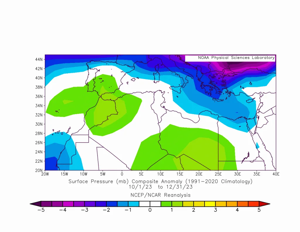
Deep centers of low-pressure systems over eastern and southern Cyprus..
Although high Mediterranean Sea temperatures increase the chance of atmospheric instability resulting from adiabatic thermal change behind Turkish mountains and contribute to the development of very deep low-pressure centers and increased atmospheric activity, especially during winter, this may sometimes reflect negative results in the intensification of dry southwestern winds toward the far south of the Levant region, which push dry air masses to those areas. At the same time, it greatly increases rainfall rates in northern and central Jordan, Palestine, and a wide range of western Syria and Lebanon, and this coincides with the intensification of the subtropical jet stream over northern Saudi Arabia, Iraq, and Kuwait and increased atmospheric activity sometimes due to the presence of warm, humid air mass accompanying the Red Sea low (RSCZ).
With the arrival of deep low-pressure systems toward northern Syria and Iraq, they begin to fill rapidly with the arrival of more cold air around their centers, which suddenly weakens the jet stream over eastern and central Saudi Arabia and its southeastern parts and increases the chances of large rainfall rates in the central and eastern Saudi Arabia, UAE, Oman, Kuwait, eastern Iraq, and Iran regions.
Very deep centers of low-pressure systems over northern Egypt..
These low-pressure systems coincide in formation with weakening of the subtropical jet stream over southern Turkey, especially when atmospheric pressure rises over the central and northern parts of eastern Europe. This weakness in the jet stream facilitates the arrival of cold air to the eastern Mediterranean region and the activity of the warm, humid air mass accompanying the Red Sea low (RSCZ). This causes intensification of baroclinic and barotropic instability of the air, then rapid atmospheric pressure drops north of Egypt. This increases the probability of severe flood waves and extremely large rainfall amounts that may equal an entire rainy season's amount in parts of southern and eastern Jordan and northern Saudi Arabia. These atmospheric conditions generally increase in Jordan, Palestine, northern Saudi Arabia, its northwestern parts, and the Tabuk region and northeastern Egypt, especially when coinciding with the activity of cold fronts of the Kata type, which are dangerous and meet with the presence of the unstable RSCZ area north of Saudi Arabia.
These deep Egyptian low-pressure systems greatly increase the probability of poor flood waves in the central Red Sea region and the Makkah and Jeddah areas. One of these low-pressure systems at the end of November 2022 caused the worst flood wave in Jeddah and Makkah, which was classified as the strongest in recent climate records.
Slower speed of eastern Siberian fronts during winter..
The speed of cold Siberian fronts classified as backdrop fronts slows down, especially with rapid atmospheric pressure drops and increased atmospheric instability of the adiabatic type behind Turkish mountains. This stimulates the activity of low-pressure systems in the nature of these fronts over northern Egypt. As we mentioned in the previous period, this may contribute to the development of very deep low-pressure systems toward northern Egypt and southeastern Mediterranean.
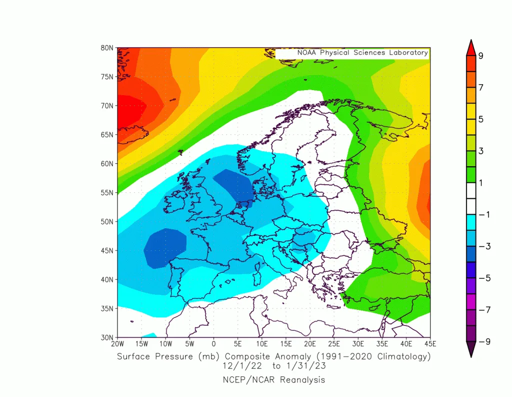
The speed of this type of front often leads to the failure of warm front formation surging from subtropical regions or the Mediterranean region and the occurrence of sharp, dry cold waves. Consequently, the failure of low-pressure system formation resulting from baroclinic instability ultimately occurs. Therefore, in recent years there has been a noticeable decline in the intensity of harsh Siberian cold waves in the Middle East region, eastern Mediterranean, and the Levant due to its coinciding with the rapid formation of warm fronts and the rapid deepening of Egyptian low-pressure systems and the emergence of regionally severe rainy conditions.
Snowstorms..
Despite the weakness of Siberian cold waves or Siberian fronts, the probability of severe snowstorms occurring is possible but the number of these storms decreases correspondingly. To understand this simply, if snowstorms occur, they are extreme but with low frequency. The scientific reason for this is that low-pressure system centers deepen over the Mediterranean region if cold air arrives, and with the nature of atmospheric circulation in some periods, especially when the polar jet stream weakens significantly, this facilitates rapid flow of polar winds toward the eastern Mediterranean and coinciding with very deep low-pressure centers, which may increase the chance of a severe snowstorm occurring. The most important of these storms, which occurred in a similar manner, are the storm of January 27, 2022, and similarly to the storm of February 17, 2021, the storm of December 12, 2013, and the storm of February 19, 2015.
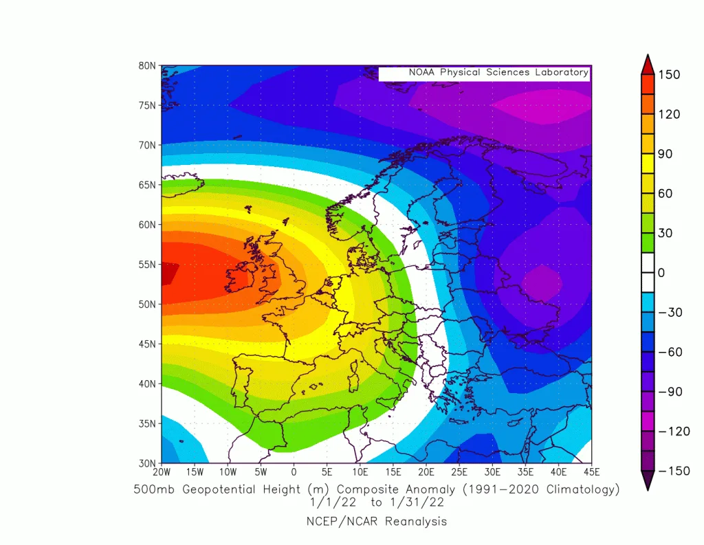
Similarly, excess thermal energy released before its conversion to kinetic energy works to raise temperatures noticeably and tangibly due to rising Mediterranean Sea heat. However, it causes greatly increased precipitation. If required cold conditions are available, the coinciding of high precipitation with cooling causes extremely severe snowstorms.
Extreme snowstorms are characterized by their intensity during a short time period, rapid decline, and increased major damage. Deep low-pressure system centers exhaust their resources rapidly and cause multiplied damage.
Summary of Results..
- High Mediterranean Sea temperatures increase the occurrence of strong storms in the central Mediterranean region.
- They increase the strength of rainy conditions in the Arabian Peninsula, Badiyat al-Sham, and Jordan regions.
- They increase high rainfall rates in the central and eastern Mediterranean region and the Arabian Peninsula.
- They reduce the probability of snowstorms but increase the chance of extreme snowstorms with high damage in the region.
- They increase the chance of Egyptian low-pressure system formation responsible for floods in Jordan, Palestine, Egypt, northern and western Saudi Arabia, and Iraq
They increase the severity of floods in the western sector of Saudi Arabia, Makkah, and Jeddah due to Egyptian low-pressure system activity.
- They noticeably reduce dry Siberian cold waves.
- They reduce the impact of southern Jordan, Palestine, and northern Saudi Arabia from Cypriot Mediterranean storms.
- They increase the chance of humid and hot waves during late summer in the region.
- They extend rainy seasons for longer periods in the eastern Mediterranean, Levant, and Arabian Peninsula regions.
- They caused increased rainfall rates up to 60% in the Middle East region
The results of this study remain subject to change on some points depending on the nature of unusual atmospheric circulation patterns during some periods due to climate changes affecting various countries of the world.