WASM – The Regional WASM Center has issued its monthly weather outlook for November based on data from our advanced climate model, which operates using a calibrated flexible statistical analog approach. The model delivered exceptionally accurate results during the previous month in identifying the location, intensity, and timing of major rainfall events.
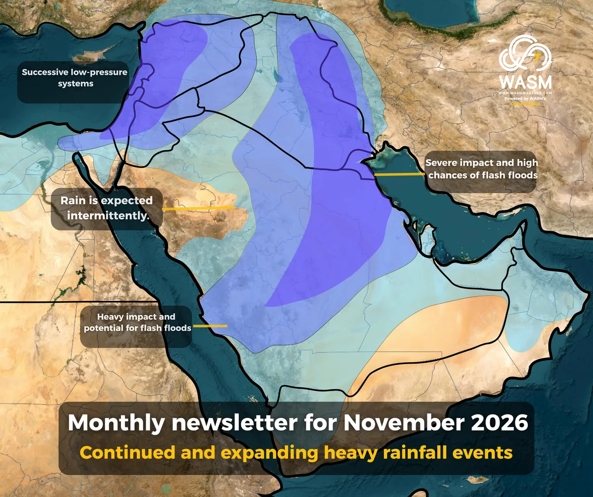
Heavy rainfall is expected to expand across the Arabian Peninsula, extending toward central and eastern Saudi Arabia, the Gulf countries, Qatar, Bahrain, and Kuwait. Later in the month, rainfall activity is forecast to shift further toward southeastern Saudi Arabia, the UAE, and Oman.
Severe and recurring rainfall events are also expected to continue across Iraq and the Levant, with a major regional rainfall episode anticipated around the middle of the month.
Weather conditions are expected to become temporarily more stable after mid-month, accompanied by warmer temperatures across most of the region, while rainfall activity becomes more focused over southern parts of the Arabian Peninsula.
This will likely be followed by a renewed increase in significant rainfall events during the final third of the month, accompanied by temperatures considerably below seasonal averages
The Levant
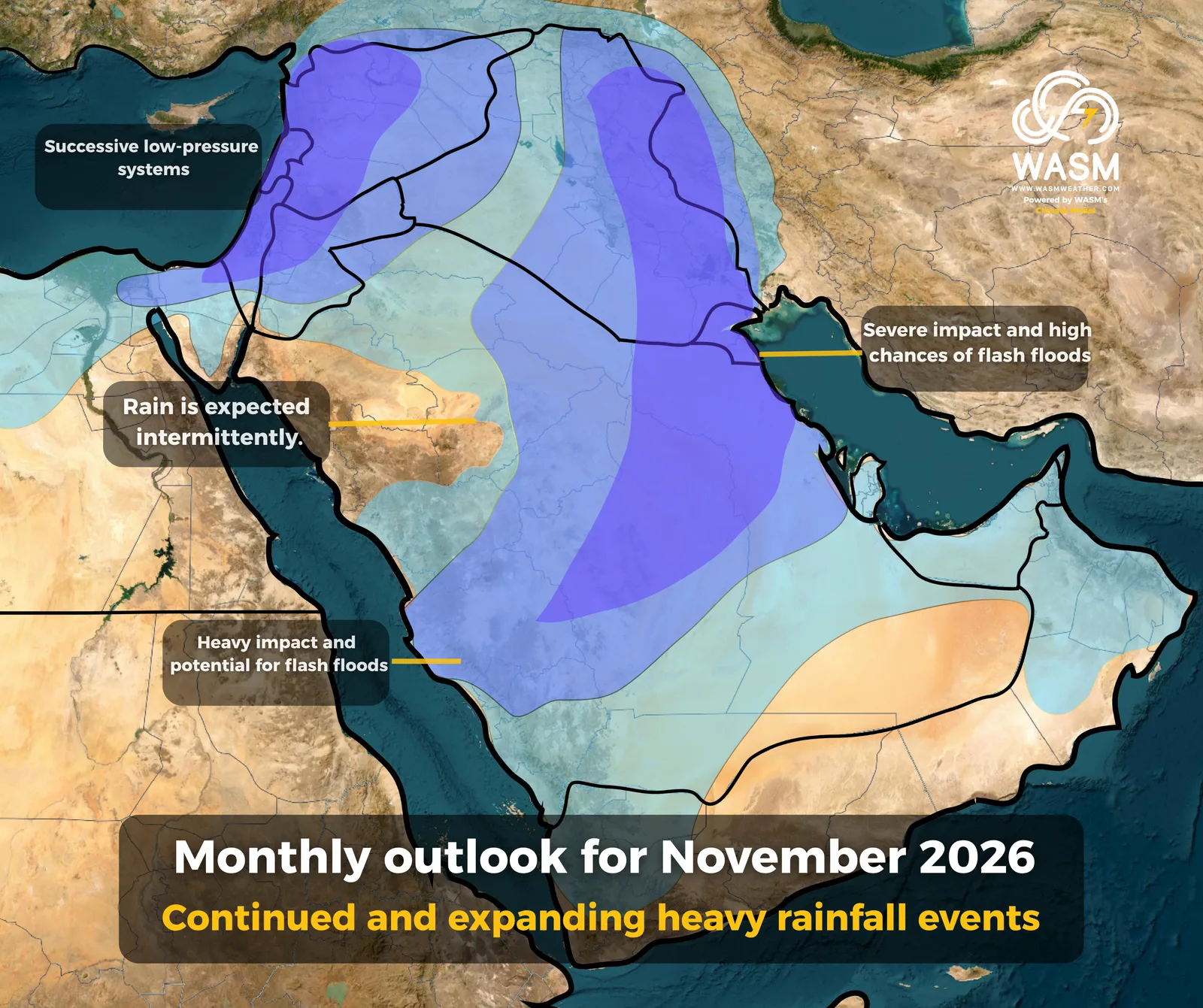
Several heavy rainfall events are expected to affect the Levant in succession, with the main peaks anticipated around mid-month and again during the final week of November. Temperatures are likely to remain noticeably below normal throughout these periods.
The weather pattern is expected to feature mainly fully developed winter-type low-pressure systems, which is relatively unusual for the region’s climate at this stage of the season.
The Arabian Peninsula and Iraq
Heavy rainfall events are expected to continue across the Arabian Peninsula and Iraq, reaching their peak during the second week of the month and around mid-November.
The most affected areas are expected to include central, eastern, northeastern, and northern Saudi Arabia, as well as Kuwait, Qatar, and Bahrain. In addition, parts of central western Saudi Arabia and the coastal areas of Makkah Province are expected to experience significant rainfall activity.
These rainfall events are expected to be particularly intense at times, with periods of heavy precipitation
.
Atmospheric Pattern
High-pressure systems are expected to persist over Europe and North Africa, while the Siberian High is forecast to weaken noticeably and remain centered farther east over central and northeastern Asia.
At times, the Siberian High may extend toward southwestern Asia, helping to push moisture-rich tropical waves toward the Arabian Peninsula and enhancing rainfall potential across the region.
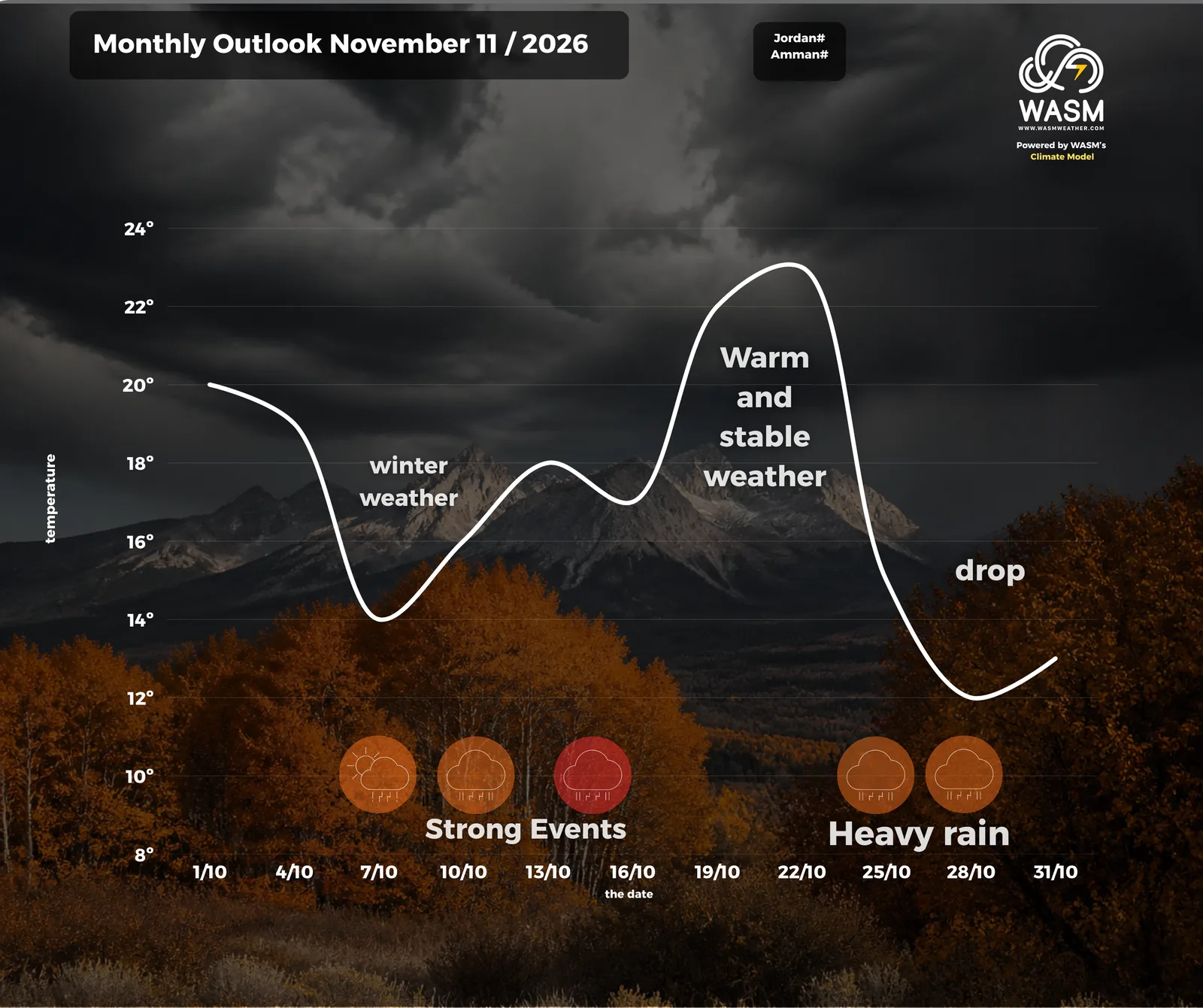
The dominant weather regime is expected to result from a combination of cold Mediterranean low-pressure systems advancing from the central and eastern Mediterranean, together with a highly active extension of the Red Sea Trough
 .
El Niño
The El Niño phenomenon is currently registering exceptionally strong levels. Statistically, such conditions are often associated with above-average rainfall across parts of the Middle East and prolonged drought episodes across the Maghreb region.
El Niño is expected to reach its peak by late December, which could further enhance its influence on large-scale atmospheric circulation patterns.
For more information and smart weather alerts, download the WASM Weather app:
iOS: WASM Weather on the App Store
Google Play: WASM Weather on Google Play