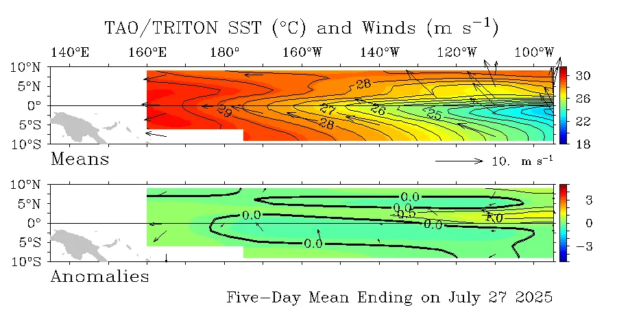
WASM- The Pacific Ocean continues to experience a prolonged phase of unusual inactivity and neutral conditions since mid-summer 2024, following a strong El Niño phenomenon during the 2023-2024 season, which is considered uncommon for tropical activity in the equatorial Pacific Ocean region.
What are El Niño and La Niña phenomena? ENSO
is the measure that assesses the rise or fall of temperatures in the equatorial Pacific Ocean region relative to seasonal averages. For a La Niña phenomenon to be recorded, according to the definition of the Australian Climate Center, the temperature rate must drop below -0.8°C for three consecutive months, and according to the U.S. National Oceanic and Atmospheric Administration, this is determined at –0.5°C for the same period. This measure has not been achieved throughout the previous period. El Niño is identified using the same values but with positive numbers.
Why did the La Niña phenomenon fail to develop during the previous season?
The WASM Regional Center issued several studies in summer 2024, being one of the few centers that predicted the failure of La Niña development for complex scientific reasons particularly related to the polar circulation in the South Pole, which was weaker than usual, which affected the disruption of trade wind movement that supplies the equatorial Pacific regions with cold water. It is a dynamic system related to rapid upwelling of cold water across Peru's coasts due to the effects of Coriolis force resulting from Earth's rotation around itself.
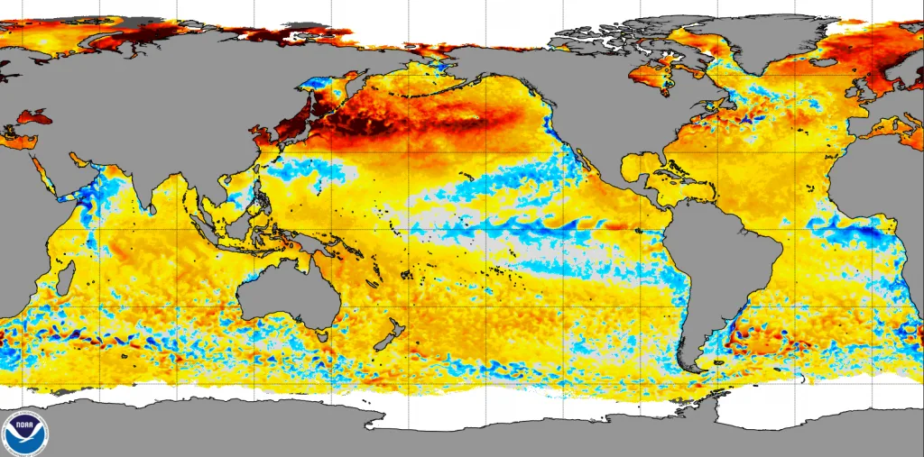
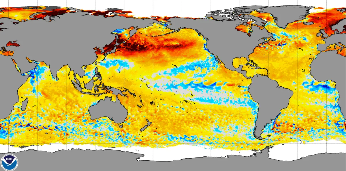
With disrupted trade wind movement and the accumulation of marine heat waves across most water bodies, this caused the La Niña phenomenon to fail before it could form during the previous season, which put the equatorial Pacific Ocean into a phase of inactivity and neutral conditions.
Were the data issued from the American CFS models accurate regarding this phenomenon?
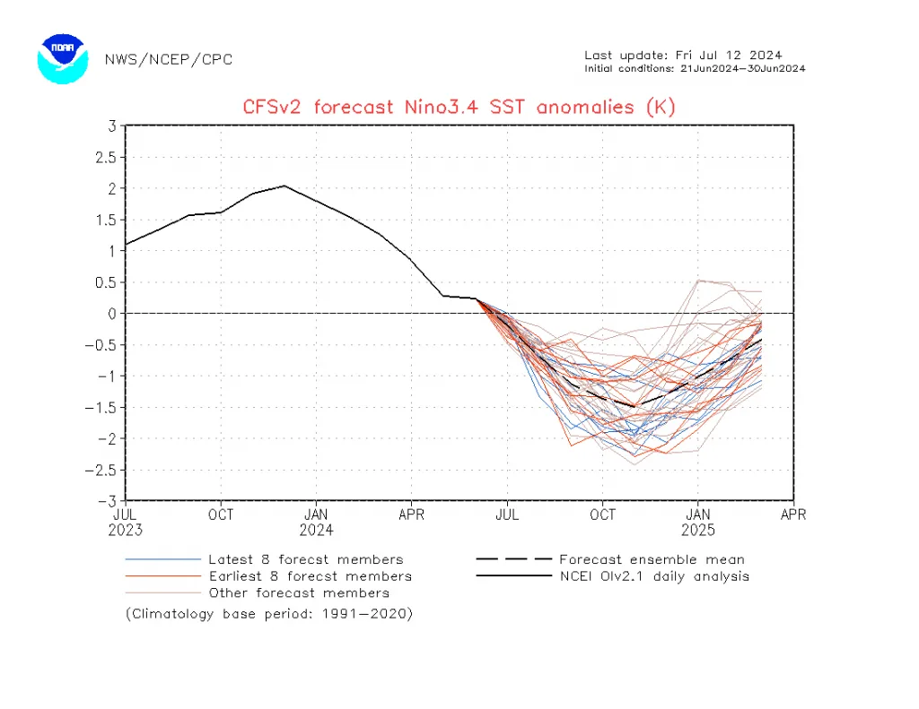
Relying on American data for long-range forecasts regarding ENSO phenomena led to significant errors in long-range forecasts by many centers around the world, which predicted an "extreme" La Niña phenomenon during the previous season. The European model ECMWF data and the Australian BOM center data had the highest accuracy and succeeded in predicting the inactivity of the equatorial Pacific Ocean during the previous season.
Does the decrease in rainfall rates in some regions relate to La Niña?
While clarifying the main point about the absence of a dominant climate phenomenon in the equatorial Pacific Ocean during the previous season, ENSO phenomena have no direct relation to rainfall rates. One of the biggest scientific misconceptions spreading is linking this phenomenon (which did not occur) to decreased rainfall rates in some areas of the Levant and southeastern Arabian Peninsula during the 2024-2025 season.
What is expected during the coming season?
Forecasts indicate the continuation of the inactivity of the equatorial Pacific Ocean for the second consecutive season, but wait.. there are significant changes expected during the second half of the coming season with a good probability of the development of a weak Modoki El Niño phenomenon, or at least warming of a large portion of the equatorial band of the Pacific Ocean, which will reflect intense atmospheric circulation and extreme weather conditions around the world.
Effects on the Atmosphere
The phase of neutral conditions and inactivity for the equatorial Pacific region simply means that these phenomena do not have a major influence on atmospheric circulation. However, there are more important phenomena we issued a major study on its impact, which is the Pacific Decadal Oscillation "PDO," which may lead to disruptions in atmospheric circulation.
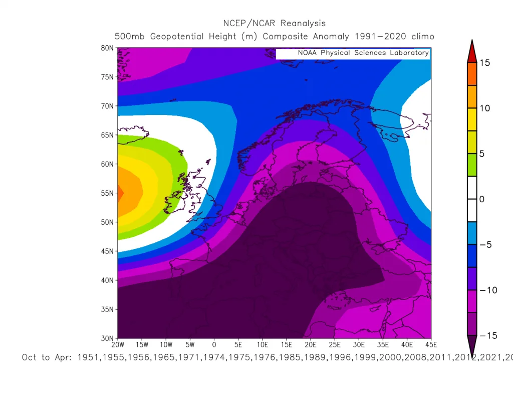
The continuation of the neutral phase simply means more stable circulation in the "Hadley" cell in the Pacific Ocean region. However, due to significant temperature variations occurring in the equatorial Atlantic region, this will clearly lead to important disruptions in the movement of subtropical jet streams, particularly in the eastern Atlantic and western Mediterranean.
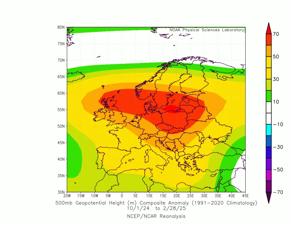
The sharp impact on the polar jet stream will continue in the coming season but in a manner different from previous years. The cooling of the equatorial Atlantic region and the negative regression of the PDO coefficient in the North Pacific region will cause large and sharp undulations in the polar jet stream, leading to global cold waves concentrated toward the south and west of the United States, as well as the northern and central Atlantic region, and finally the eastern and southeastern Europe, Turkey, and the central and eastern Mediterranean basin, the Arabian Peninsula, and sometimes parts of eastern and central Asia.
Therefore, the atmosphere is an extremely complex system, affected by many interrelated climate factors. Linking atmospheric circulation to La Niña and El Niño phenomena or failing to define them correctly usually leads to inaccurate results or difficulty in forecasting general atmospheric circulation.