
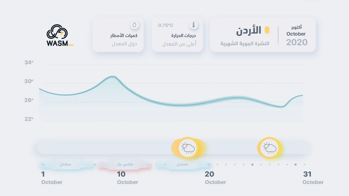
October is expected to be drier and warmer than usual compared to normal conditions, with two rainy periods anticipated: the first in mid-October and the second at the end of the month, with expected moderate intensity.
The atmosphere will generally be autumnal and moderate most of the time, with temperatures dropping during night and morning hours, tending to be cold. A temperature rise is expected between October 8-12, followed by a decline. A weak to moderate rainy condition is expected in some areas in mid-October, followed by generally moderate and humid conditions tending to be cold at night and in the morning. A rainy condition is then expected at the end of October.
A strong high-pressure system is expected to dominate northern Europe and extending to its east, as well as northwestern Africa. This pushes cold winds away from Jordan and the eastern Mediterranean toward the central and eastern Mediterranean at times, resulting in the dominance of a high-pressure system or an extension of the inactive Red Sea low. Cold air masses occasionally approach, causing weather conditions in mid-month and another at the end of the month.
This autumn is expected to be generally drier and have less rainfall than usual, with weather conditions expected to change at the end of autumn and the beginning of winter.
The chart above monitors expected temperatures and weather conditions integrated with weather alert levels, which are green, then yellow, then orange, with the strongest level being red.
WASM Regional Center relies on the climate model developed by WASM Inc., which is characterized by high accuracy in monitoring distant and medium-range weather conditions, with accuracy exceeding 80% in some releases.