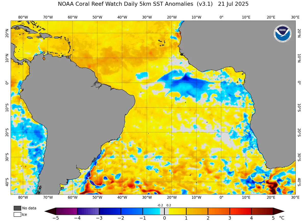
WASM – The WASM Regional Center is monitoring a continuous decline in the temperature of the tropical Atlantic Ocean region over several weeks, with cooling appearing for the first time in summer 2024.
The cooling of the tropical Atlantic Ocean region is a "qualitative and fundamental" climatic phenomenon in the atmospheric circulation in various regions of the world, which may be largely responsible for different weather conditions such as those occurring during this summer, particularly in terms of the concentration of strong heat waves toward the European continent and the northwestern Mediterranean region.
Tropical Atlantic Ocean Region|
This region plays a very significant role in tropical circulation and the intensity and nature of the tropical waves being pushed forward, affecting the subtropical jet stream in the eastern Atlantic and Mediterranean region, which also controls weather systems in various regions of the world on a "long-term" basis, which increases its sensitivity to climate change or climate cycles for long periods.
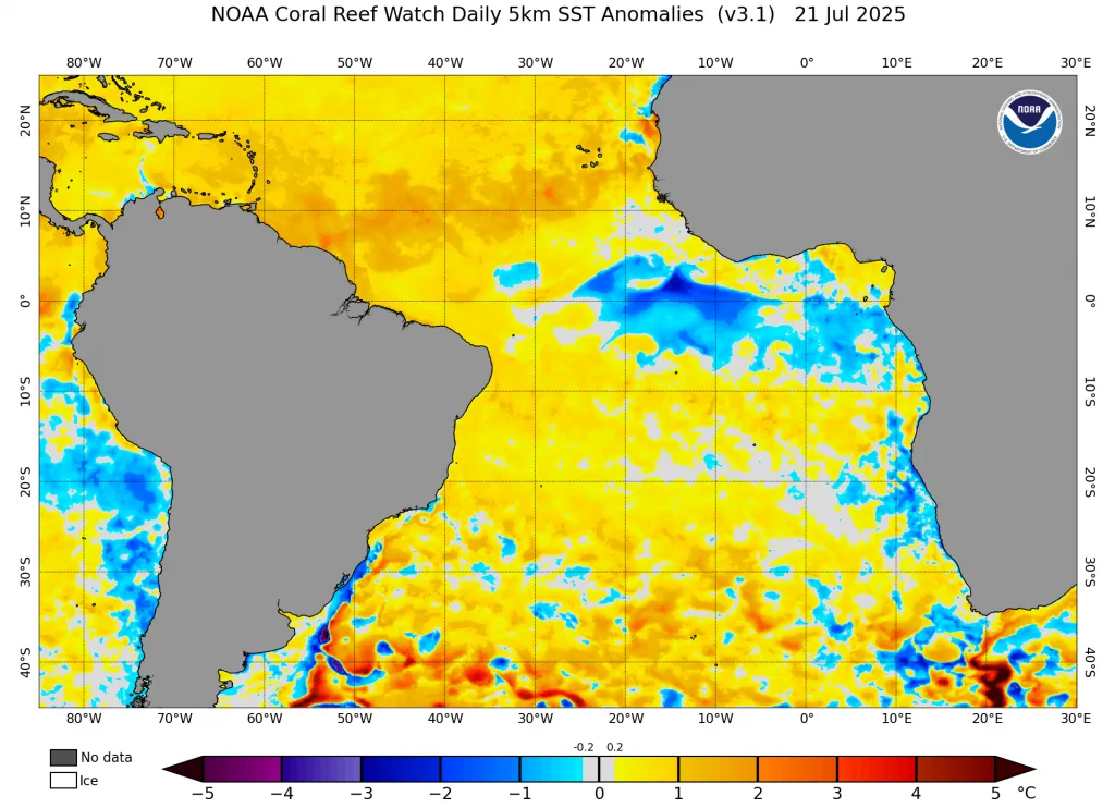
With the recording of significant melting in Arctic ice, especially north of the Atlantic Ocean and polar regions due to rising water temperature for reasons that are still largely unknown and may be accelerated by the greenhouse gas phenomenon, cold areas are clearly beginning to expand in the Atlantic Ocean region.
The first area appeared in the northern part and south of Greenland Island due to increased flow of freshwater resulting from ice melting, as well as the appearance of widespread cold waters in the tropical Atlantic Ocean region and being pushed from the depths due to the effect of Coriolis force on water current movement and as a result of wind patterns parallel to African coasts that enhance this phenomenon.
Cooling Results|
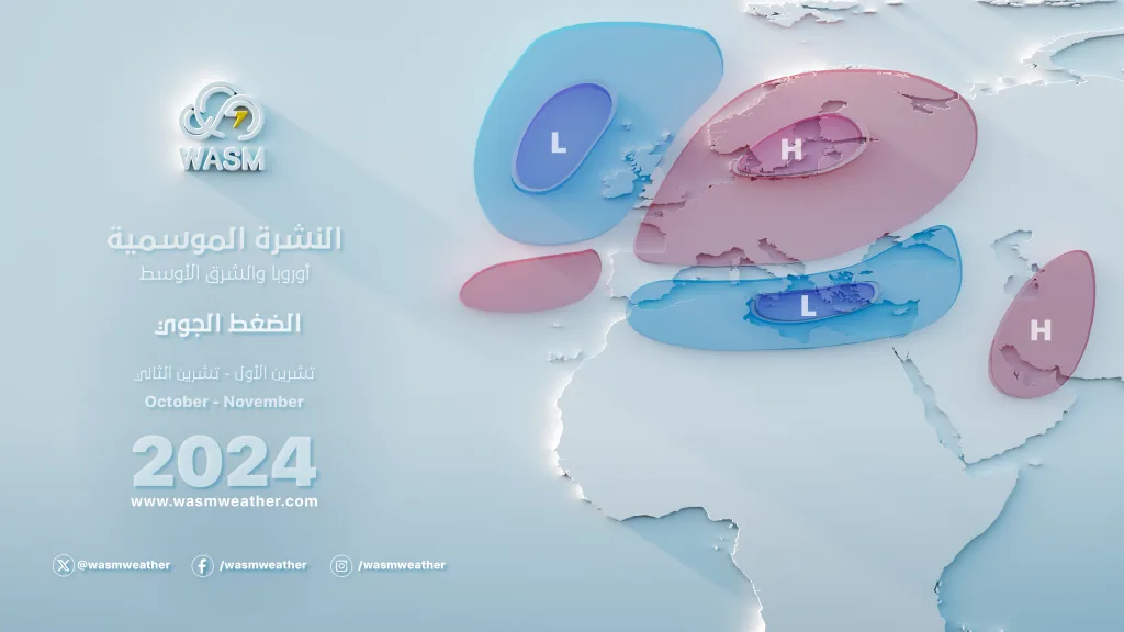
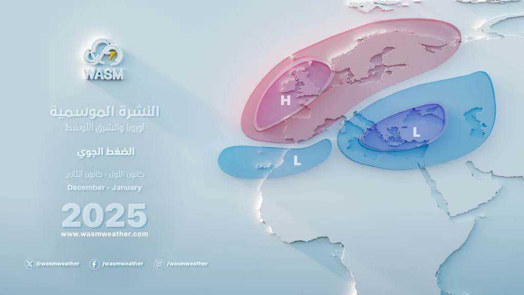
The cooling results in those Atlantic Ocean areas lead primarily to a "significant" weakening of the subtropical jet stream in the Mediterranean and southern Europe region, which increases the ease of heat waves or dry warm masses pushing toward Europe continuously. The weak jet stream leads to sharp undulations of this jet stream and then extreme weather conditions that lead to heat or cold waves in the region.
The other cooling that is increasing in the southern region of Greenland Island contributes to weakening the warm Gulf Stream pushed from the Gulf of Mexico toward western Europe, which leads to moderation and rainfall toward those areas across the Atlantic Ocean. This weakening will cause significant disruption in the nature of the polar jet stream and its severe weakening "for the first time" in many years in those areas, which increases the exposure of the European continent to dry masses being pushed from the Sahara and North Africa continuously, accompanied by colder waves toward southeastern Europe, Balkan countries, Greece, Libya, Egypt, the Levant, and western and northern Saudi Arabia.
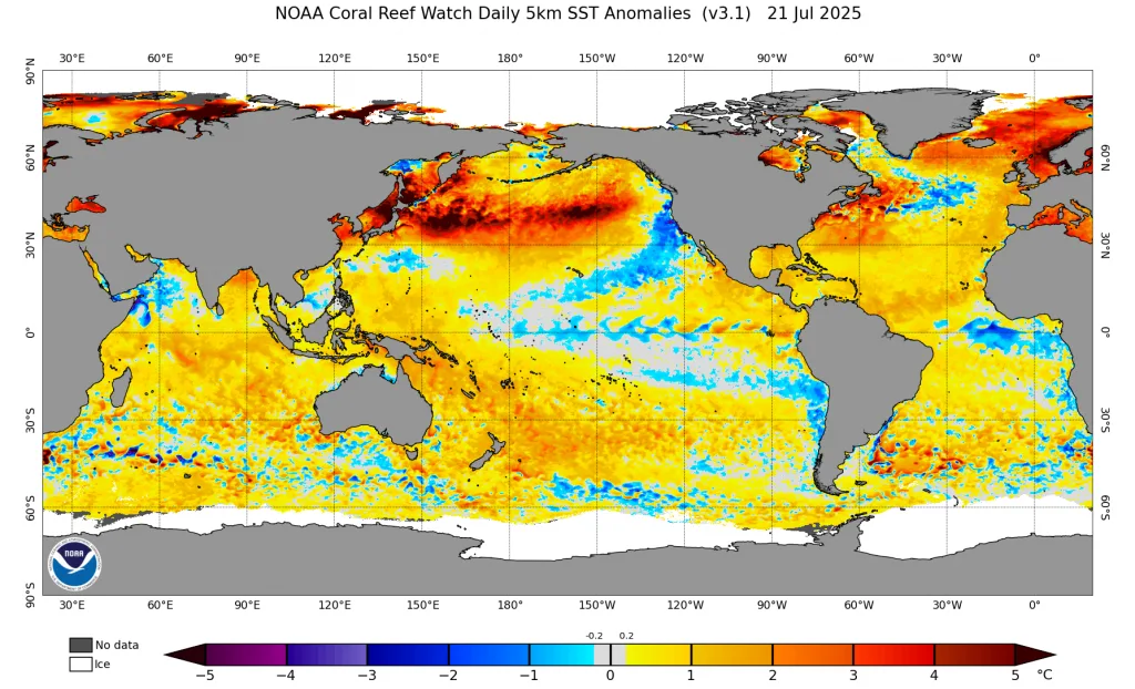
The coincidence of this with record-breaking warming in the North Pacific Ocean will lead to complex results in atmospheric circulation, which may cause severe extremes in eastern Europe and its southeastern region during the upcoming rainy seasons, which may enhance the severity of climate changes that appeared from 2014 in the region and resulted in a significant increase in rainfall rates in Jordan, Palestine, northeastern Egypt, and the Arabian Peninsula.
Weakening of the Polar Jet Stream|
The WASM Regional Center continues to monitor this "dangerous" climatic phenomenon, which will occur starting from the mid-Atlantic Ocean through the European continent to Asia. The weakening of the polar jet stream reflects more dangerous climatic conditions in the region that may lead to acceleration of climate changes that we have witnessed since 2014 for the first time, and we expect the clear beginning of this stream's weakening during the upcoming rainy season, specifically in the second half of it.
The weakening and sharp undulation of the polar jet stream, coinciding with the weakening of the subtropical jet stream, will lead to pushing rainy westerlies or those causing strong atmospheric disturbances toward the south more than usual and exposing the region to more cold waves in number and summer periods more moderate like the current summer being experienced in the Mediterranean region, the Levant, and western and northern Arabia Peninsula.
Due to the possibility of developing the "Modoki Niño" phenomenon during the second half of the rainy season, this will lead to more extreme results on climate conditions around the world, including the Mediterranean region and the Arabian Peninsula.
These multiple climatic data and their coincidence at the same time lead to very different results on atmospheric circulation, but there are clear phenomena that have begun to increase, especially around continuous heat waves on Europe and rising temperatures there and declining rainfall rates in the last 10 years, matched by the opposite in the southeastern Mediterranean region, southern Levant, Jordan, Palestine, the Arabian Peninsula, northeastern Egypt, and western Turkey, which are witnessing a significant increase in rainfall rates and a decrease in the number of heat waves since summer 2021.
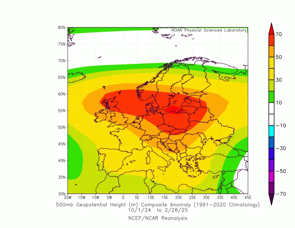
The previous rainy season witnessed a strong polar jet stream that partially bent at the far southeastern and eastern Europe, leading to pushing polar masses toward northern Arabia Peninsula. These results were almost identical to the climate model data of the WASM Regional Center