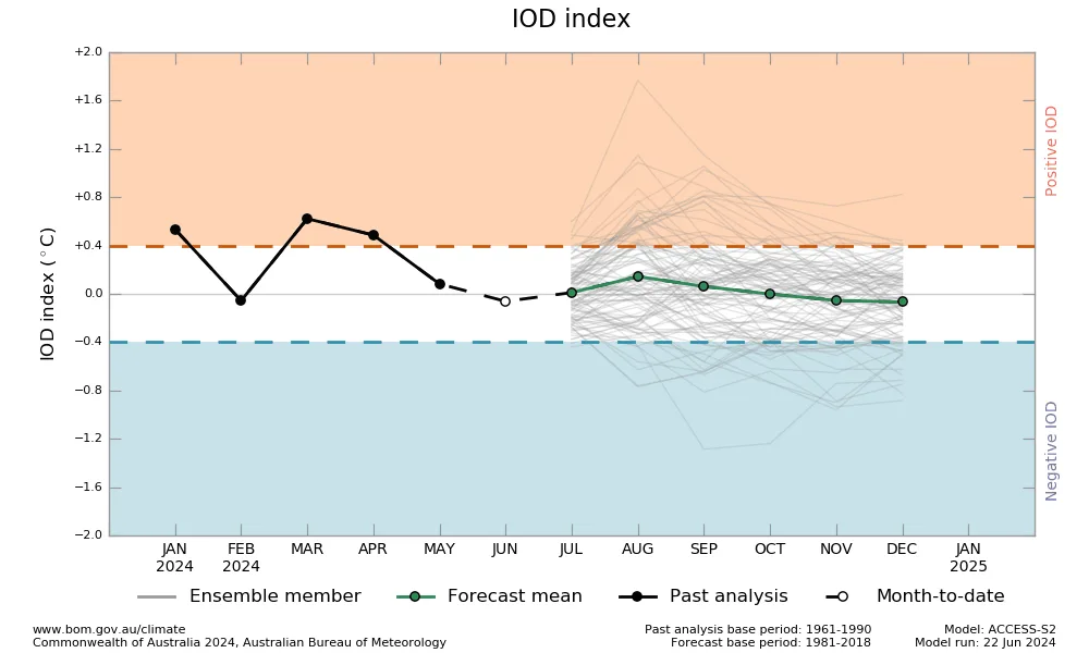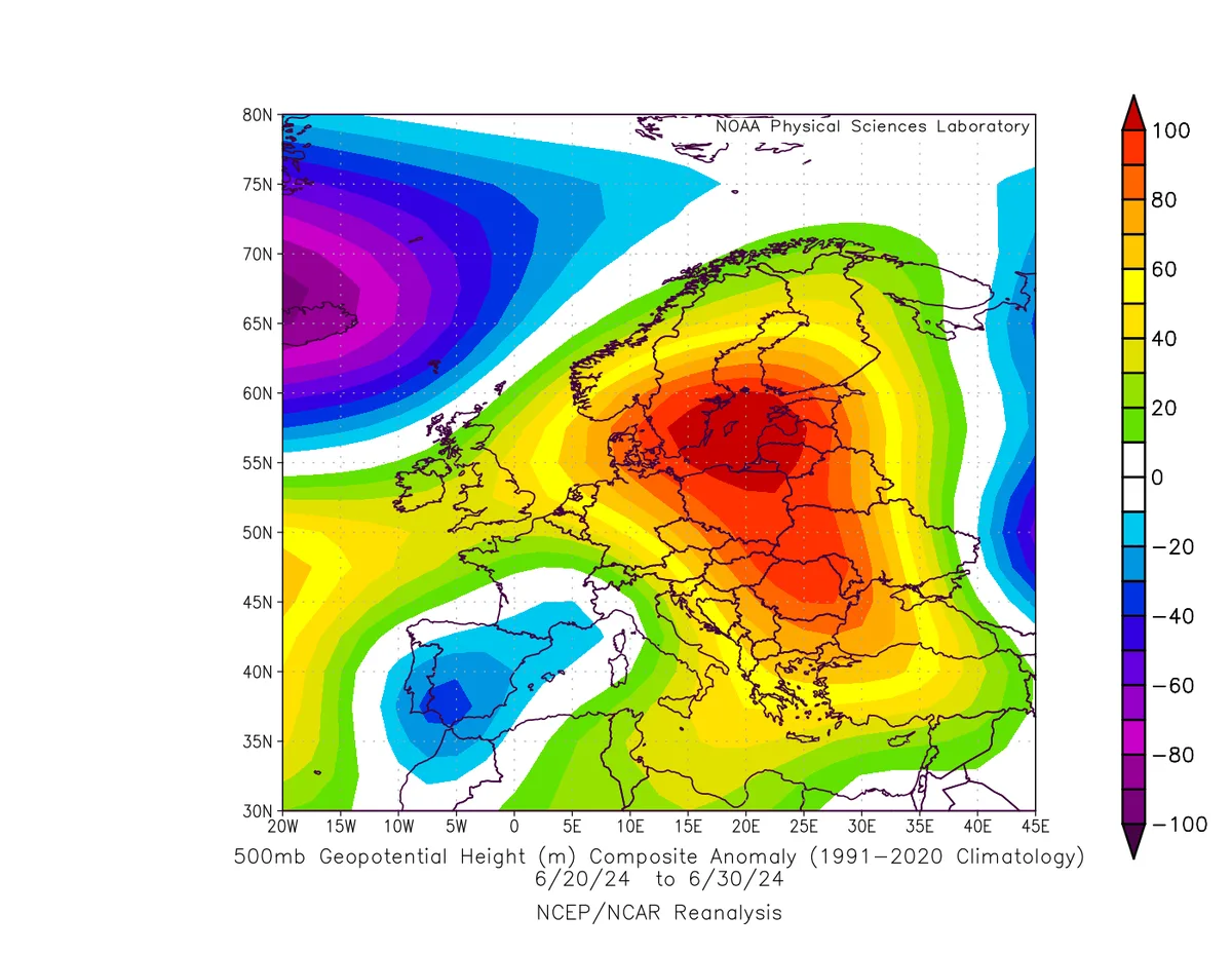
WASM – Temperatures continue to rise significantly across the European continent above their seasonal averages by several degrees and in an unusual manner for an extended period. This temperature increase started from the central and eastern parts of the European continent as a result of the influence of hot and dry African desert air masses of the cT type.
Expected Results..
The continuous temperature rise in the European continent is not new and has occurred during previous years as a result of recent climate changes. The anticipated increase in temperatures across the European continent will lead to the development of strong, persistent heat waves that strike central and eastern Europe continuously and extend towards western and northern Europe in certain periods, particularly during the second half of July.
The strong heat waves are expected to continue for at least the first half of August and then decline noticeably afterward with a temporary change in atmospheric behavior.
These heat waves will coincide with strong weather conditions during certain periods, particularly in western and southern Europe. These strong weather conditions consist of heavy rainfall situations resulting from the activity of cold North Atlantic fronts of the dangerous Kata type at this time of year.
Scientific Reasons..
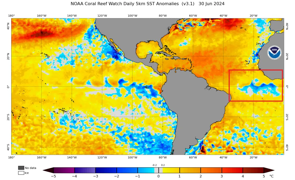
After running the climate model of the WASM Regional Center, unusual changes were detected in Atlantic Ocean water temperatures between extremely high warming in its northern and western parts and noticeable cooling in the tropical and subtropical parts near African coasts.
This causes strange behavior of the subtropical jet stream primarily, making it highly modulated near eastern Atlantic regions, resulting in the formation of several strong and deep low-pressure systems south of Greenland and west of the British Isles, coinciding with sharp cold fronts penetrating toward the southeast and causing severe weather conditions sometimes over parts of western and southern Europe.
This creates a very hot and dry air tunnel surging from the great African deserts through Algeria and Tunisia toward Italy, then west of the Greek islands and reaching central and eastern Europe. This hot air tunnel will intensify significantly before mid-July and continue for several weeks during the upcoming period.
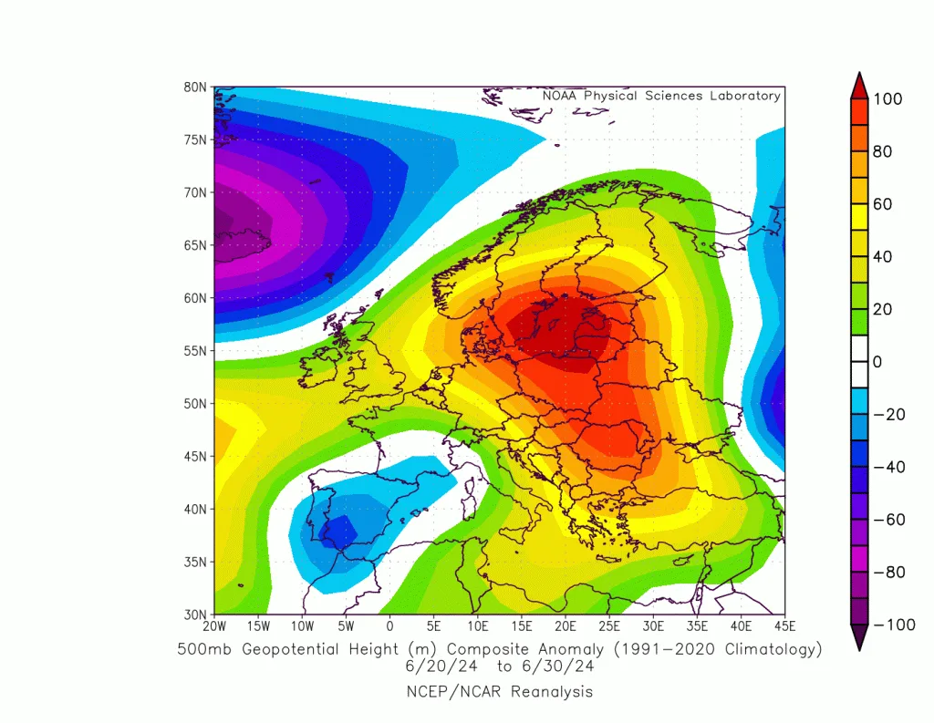
These weather conditions cause a strong and massive high-pressure system over most European regions, with its center positioned over eastern Europe and the Scandinavian islands. It causes cooler air masses from northern Siberia to be pushed toward the Black Sea and the eastern Mediterranean region and the Levant. This results in temperate conditions and temperature decreases to normal or below seasonal averages. The extremely high water temperatures of the eastern Mediterranean cause changes in the characteristics of the moderate air masses surging from northern Siberia, raising their temperatures and increasing the chance of weather instability particularly over the coasts of Syria, the mountains of Lebanon and southern Turkey during certain periods.
This atmospheric pattern sometimes triggers the development of highly active tropical waves toward tropical West Africa and pushes these tropical waves eastward, causing unusual and strong hurricane activity at the same time heading toward Central and North America, coinciding with heightened Bermuda (Azores) high-pressure activity over the far western Atlantic Ocean.
Expected Results in the Arab Region..
This results in more moderate periods during July and the first half of August in the eastern Mediterranean region, northern Arabian Peninsula, the Levant and Jordan, coinciding with very high temperatures in eastern Arabian Peninsula, Kuwait, eastern Iraq and Iran, with temperatures remaining above their seasonal averages in general. This coincides with heavy seasonal rainfall in western and southern Saudi Arabia and Yemen. This rainfall becomes extremely heavy by late summer.
These weather conditions change during the second half of August, where chances of strong heat waves increase toward the eastern Mediterranean and northern Arabian Peninsula, Egypt, coinciding with very high rainfall rates in western Arabian Peninsula, Sudan, Yemen and southern Egypt.
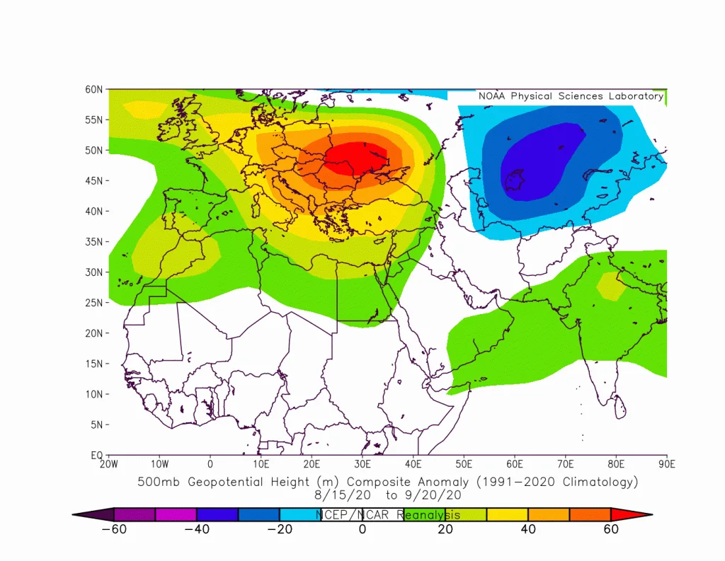
Linking these results to tropical cell activity near the Arabian Sea region leads to different results from the initial conclusion, especially if we examine the results of the WASM Regional Center's climate model or results from global climate models. The active tropical cell, which is expected to surge toward southern Arabian Peninsula after mid-July, works to increase tropical activity, which is accompanied by accelerated descent of air currents from upper atmospheric layers and rapid dynamic heating over Iraq and northern Arabian Peninsula, matched by an extremely hot summer pattern over Europe, particularly central and eastern Europe. This leads to expected significant temperature increases over the northeastern Arabian Peninsula, Kuwait, eastern Iraq, Iran and extension of heavy thunderstorm rainfall along the length of western Saudi Arabia and possibly even to its coasts and wide areas of Sudan reaching the Jordanian desert in certain periods, especially during heat wave periods.
This also leads to a significant increase in wind speeds in the eastern Mediterranean region, the Levant and Jordan, a typical to sometimes moderate summer pattern with some short hot periods that may coincide with unusual seasonal weather disturbances particularly in desert regions or the coasts of Syria and the mountains of Lebanon.
However, as mentioned in the report, the hot summer pattern in Europe is expected to decline noticeably in the second half of August due to the clear breaking of sun rays over the North Pole dome and rapid cooling expected to occur, leading to an abrupt expansion of polar air masses and emergency temporary cooling of the European continent due to the position of the polar and subtropical jet streams, which in turn increases the dominance of tropical activity over southern and western Arabian Peninsula and Sudan and even parts of southern Egypt with increased jet stream activity. This leads to intensification of the hot air mass extending from northeastern Saudi Arabia and Iraq to the Levant region and significantly increased probability of a record strong heat wave toward the Levant, Jordan and eastern Mediterranean during the second half of August.
The thermal energy released and compressed over northeastern Arabian Peninsula is considered enormous, resulting from strong tropical cell activity in the Arabian Sea region, where it surges and expands as an intense hot air mass toward a large part of southeastern Europe, the Levant, Egypt and northwestern Saudi Arabia during late summer.