
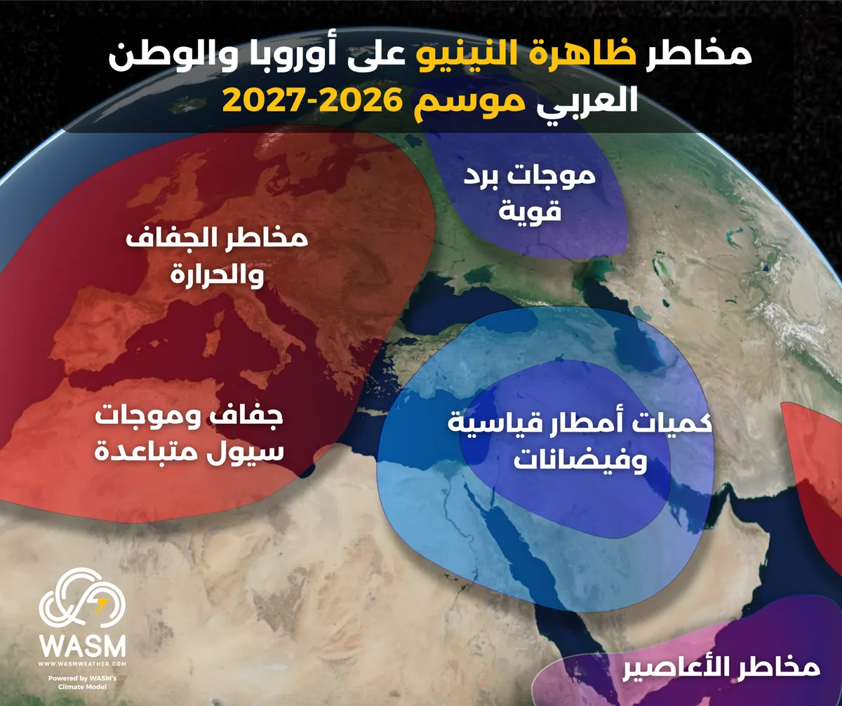
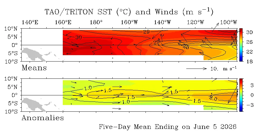
TAG- The El Niño phenomenon is developing continuously and at an accelerating pace, which causes rising temperatures in the tropical region of the tropical Pacific Ocean with forecasts reaching record numbers during the 2026-2027 season.
This phenomenon coincides with important climatic factors and cycles represented by a continuous decrease in temperatures in the northern Atlantic Ocean region, causing a significant amplification of this phenomenon's impact on the atmosphere, similar to what happened in 1998 but with different phenomena and details.
The WASM Regional Center conducted an approximate simulation of atmospheric circulation during the 2026-2027 season with the beginning and intensification of this phenomenon, and it is expected to reach its peak during the end of 2026 and beginning of 2027.
The center issued several detailed scientific reports on the phenomenon and its impacts on the atmosphere and expected results for the Arab region.
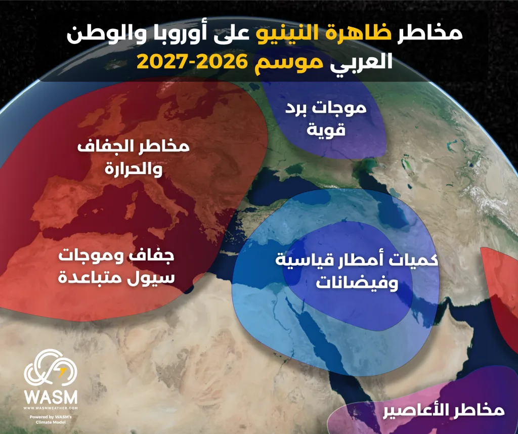
- Record rainfall amounts|
Preliminary results show expectations of record and large amounts of rainfall over the Arabian Peninsula region as a result of continuous cold air masses being pushed forward and coinciding with large amounts of tropical humidity, which will lead to severe and exceptional rainfall conditions occurring successively.
Preliminary results according to climate model data indicate several active periods, particularly during the beginning and mid-autumn, which will be more concentrated towards Iraq, the Arabian Peninsula region, and parts of the Maghreb, and another period during late autumn and winter which will be more concentrated towards the eastern Mediterranean basin, the Levant, central and western Saudi Arabia, and central Red Sea extending towards the eastern and southeastern parts.
According to preliminary data, rainfall conditions will be general and comprehensive with heavy rainfall covering most of the Middle East region during autumn and winter.
Based on simulation of "jet stream" maps that blow in the upper layers of the atmosphere, the chance of strong cold waves during winter will also be high in the Arabian Peninsula region and the Levant, and this differs from some El Niño years due to factors affecting the nature and general behavior of the polar jet stream.
Continuous heat waves|
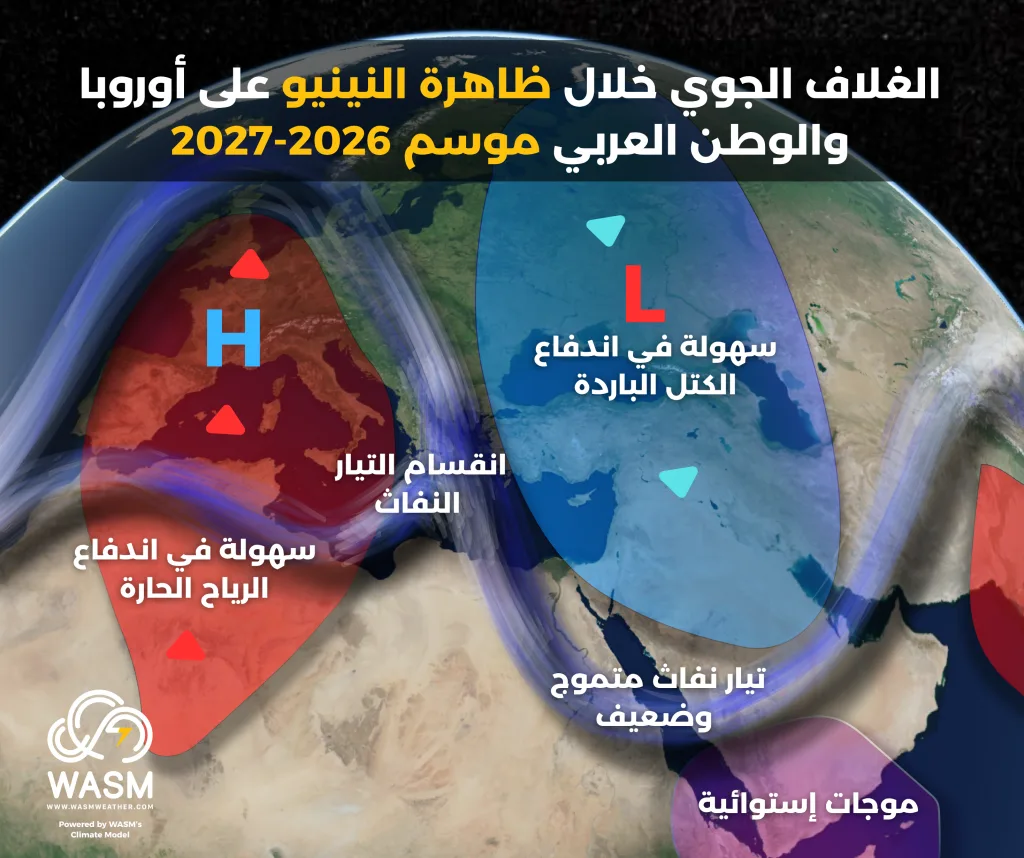
Results indicate abnormal behavior of the jet stream over North Africa and southern Europe, which has been observed for years, but this phenomenon has begun to intensify during this summer which is represented by the splitting of the jet stream over the Mediterranean region, making it easier for hot winds from the great deserts to push towards Europe.
Weakening of Atlantic westerlies and difficulty reaching Europe compared to the usual pattern, and if they do reach it will be weak, leading to weakness in the jet stream over the Mediterranean supported by changes in Atlantic Ocean and western Mediterranean temperatures and the slowing of the warm Gulf Stream, these factors combined coincided with the beginning of the strong El Niño phenomenon which caused its intensification.
This results in the continuation of strong heat waves easily towards Europe this summer, and the push of cooler than usual winds towards the eastern Mediterranean and the Levant, but it leads to more extreme weather conditions during autumn and winter through causing strong and successive rainfall conditions over the Arabian Peninsula, the Middle East, and the Levant.
Weak and highly undulating jet stream over the Arabian Peninsula|
Weather and climatic conditions affecting the northern Atlantic Ocean and its coincidence with strong El Niño and a complete reversal of tropical activity in the Indian Ocean will result in a "near collapse" of the subtropical jet stream as simulated through our climate model over the Arabian Peninsula region.
This results in strong and widespread atmospheric disturbances and baroclinic atmospheric instability conditions and continuous frontal systems during the coming rainy season, as humidity and coldness will coincide at the same time and with high intensity.
Summary|
The results we obtained from our climate model are somewhat extreme during the coming rainy season in the region, and our model is characterized by high accuracy in detecting long-range weather conditions in the region, but they remain preliminary results that could change in some details but not in the general form.
Therefore, we advise responsible authorities and agricultural and energy sectors to prepare and adapt the infrastructure for the extreme weather conditions expected as a result of the strong El Niño phenomenon.