
Update Date | 31-10-2026
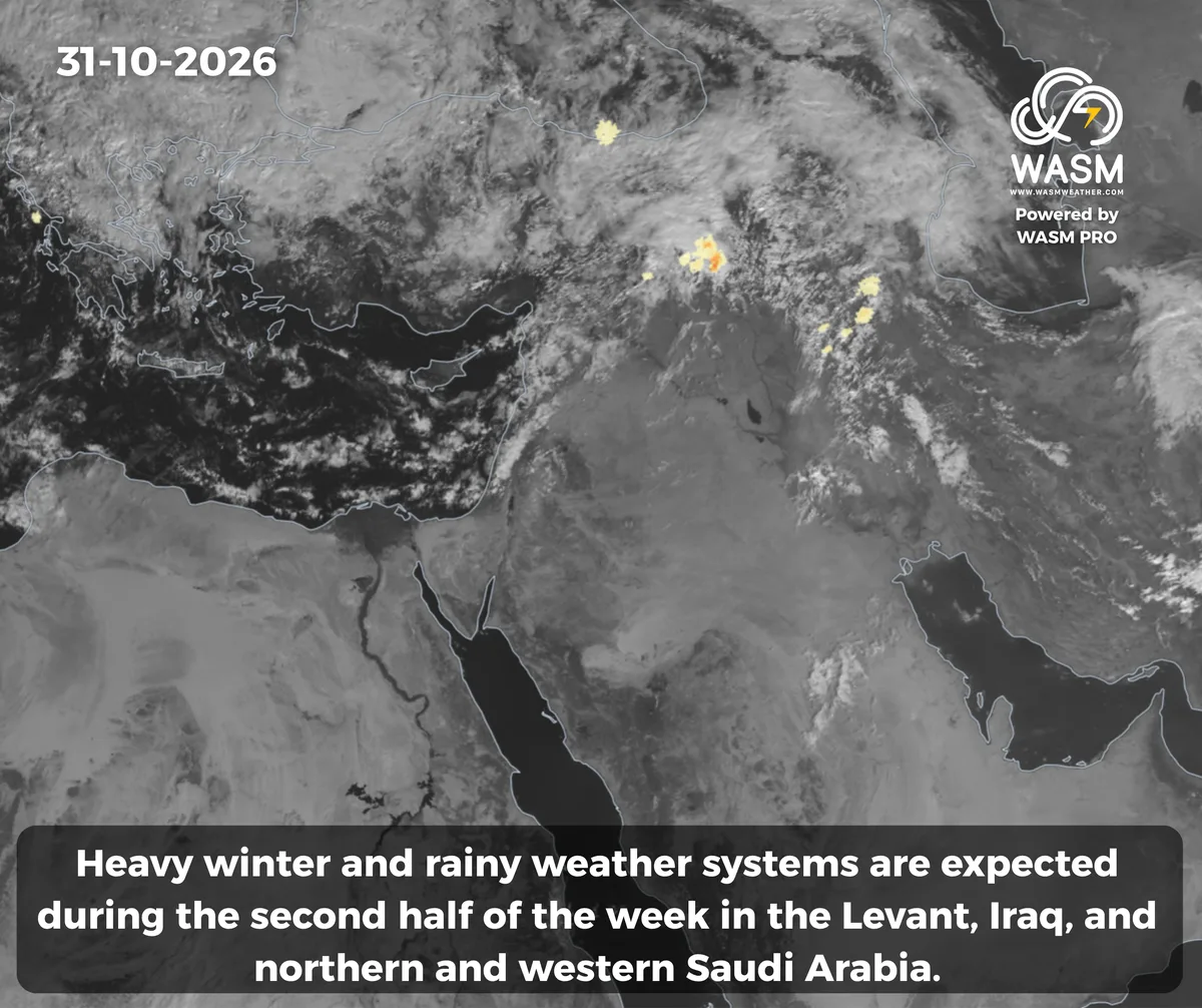
WASM | Cold and wintry low-pressure systems during the second half of the week, with widespread rainy conditions gradually returning before mid-month across large parts of the Middle East once again.
- Cold and wintry low-pressure systems bringing heavy and widespread rainfall are expected to affect the Levant, Iraq, northern Saudi Arabia, and Kuwait during the second half of the week as polar air approaches the eastern Mediterranean, a relatively rare occurrence for this time of year.
- Another tropical wave, deeper and richer in moisture, is being monitored during the second week of November. It is expected to coincide with the cold low-pressure systems, leading to additional heavy rainfall across the region, particularly over the Arabian Peninsula, Gulf countries, the Levant, Iraq, and Kuwait.
- The current widespread rainy event has already caused damage and fatalities in several areas of the Levant and Iraq. The regional WASM Center was the only regional source to indicate this weather event early through its W.DMM model and its proprietary climate model.
The detailed weather bulletin for the Arab region for the 2026-2027 season has been issued.
Detailed Weather Forecasts by Region and Country
Details of the Cold Low-Pressure Systems During the Second Half of the Week
The current rainy situation will continue, mainly affecting northern Saudi Arabia, parts of Kuwait, Iraq, Syria, and areas of eastern and northern Jordan at the beginning of the week. A new peak in activity is then expected from the second half of the week, impacting northern and western Saudi Arabia, Iraq, Kuwait, and all Levant countries, including Jordan, Palestine, Syria, and Lebanon.
Several cold low-pressure systems are expected to develop, bringing heavy rainfall while coinciding with the approach of polar air masses, which is unusual for this time of the year. These systems will later interact with a highly humid tropical wave advancing from the Arabian Sea, resulting in another significant rainy event before mid-month.
Saudi Arabia, the Gulf Region, and the Arabian Peninsula
Thunderstorms will continue but with lower intensity across parts of northern, western, and northeastern Saudi Arabia, Iraq, and Kuwait. Rainfall is expected to intensify again by midweek and toward the end of the week as cold low-pressure systems approach the eastern Mediterranean.
Thunderstorms may occasionally extend to northern Riyadh Region and parts of the northern Eastern Province in a scattered manner.
Temperatures are expected to drop significantly across northern and northwestern Saudi Arabia, with winter-like conditions arriving earlier than usual.
Heavy rainfall is also expected to affect large areas of Saudi Arabia and the Gulf countries during the second week of November.
The Levant
Heavy rainfall is expected to renew, particularly across Syria and parts of Lebanon and Jordan, on Saturday and Sunday, with a high risk of flash floods in central Syria.
Several early-season cold low-pressure systems are expected to affect the Levant during the second half of the week, bringing renewed heavy rainfall along with cold and wintry conditions.
Jordan
The regional rainy event is expected to temporarily weaken, although chances for scattered showers will remain across parts of central, northern, and eastern Jordan on Saturday and Sunday, followed by a temporary rise in temperatures on Monday.
Jordan is expected to be affected by cold low-pressure systems bringing heavy rainfall beginning in the second half of the week amid cold and wintry weather. Rain showers are expected on Tuesday and Wednesday across parts of northern and central Jordan, before intensifying on Thursday and during the weekend, becoming heavy at times.
Heavy rainfall is expected to continue intermittently through the first half of November, with cold and wintry conditions. No major dry or stable weather periods are anticipated during the month.
Syria
The prolonged heavy rainfall event is expected to continue through the first half of November, accompanied by cold and wintry conditions.
Heavy rainfall is expected to redevelop across large parts of Syria on Saturday and Sunday, with a high risk of flash flooding in central regions.
Several areas of Syria are expected to record exceptionally high rainfall totals in the coming period due to successive and unusually persistent weather systems.
Polar air masses are expected to approach the region during the second half of the week, beginning Wednesday, bringing heavy rainfall and cold wintry weather that will intensify toward the weekend, with a very high risk of flash flooding.
Palestine
Temperatures are expected to rise temporarily on Sunday and Monday, followed by renewed heavy rainfall during the second half of the week as polar air approaches the region.
Scattered rainfall is expected on Tuesday and Wednesday, becoming heavier and more widespread by the weekend as the low-pressure systems deepen.
Lebanon
The severe rainy conditions are expected to continue for an extended period, with increasing chances of snowfall over high mountains later in early November due to the arrival of cold and rainy low-pressure systems during the second half of the week.
Iraq
Thunderstorms are expected to renew over the coming days in the form of heavy rain showers affecting different areas intermittently. More widespread and heavier rainfall is expected during the second half of the week, accompanied by an elevated risk of flash floods.
Another rainy event is being monitored during the second week of the month, which is expected to be even more intense and widespread.
For more information and smart weather alerts, download our app, available on both Apple Store and Google Play:
iOS: WASM Weather on App Store
Google Play: WASM Weather on Google Play