
WASM | A Highly Active Regional Low-Pressure System Affecting the Middle East, Bringing Significant Rainfall Totals and Elevated Flash Flood Risk
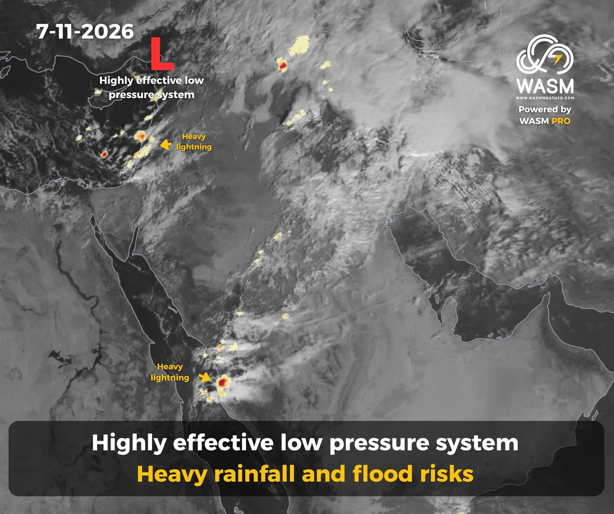
- A highly active low-pressure system is bringing substantial rainfall accumulations across the Levant, including Jordan, Palestine, Syria, and Lebanon, as well as Iraq and Kuwait. Its influence is then expected to expand into large areas of Saudi Arabia next week, with the potential for very significant rainfall totals.
- Another tropical wave, deeper and richer in moisture, is expected during the coming days. It will coincide with the early-season cold low-pressure system and result in additional heavy rainfall across extensive areas of Saudi Arabia, the Gulf countries, Iraq, and Kuwait. The rainfall is expected to include the Riyadh Region, Al-Qassim, and the Eastern Province for the first time this season, with substantial rainfall accumulations anticipated.
- Another widespread and heavy regional rainfall event associated with a strong tropical wave is also being monitored. This event is expected to develop later in the month after mid-November, focusing initially on the Levant and western Saudi Arabia before gradually expanding into wider areas. Further details will be announced soon.
The November 2026 Monthly Outlook has been issued.
Details of the Low-Pressure System
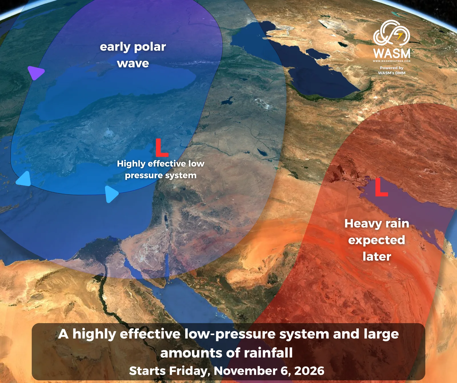
A region-wide low-pressure system bringing heavy rainfall is affecting the area, coinciding with the approach of unusually early polar air masses for this time of year.
At the same time, a highly humid tropical wave originating from the Arabian Sea is expected to deepen, leading to another regional rainfall event that will begin in the Levant before expanding during the middle of next week into the Arabian Peninsula, particularly central, eastern, and northern Saudi Arabia, as well as Kuwait, Iraq, and the Levant.
Saudi Arabia, the Gulf Region, and the Arabian Peninsula
Rainfall is expected to intensify further across the Northern Borders Region, Kuwait, and Hafar Al-Batin as part of the advance phase of the severe rainfall event associated with cold low-pressure systems moving in from the eastern Mediterranean.
Thunderstorms may occasionally extend into northern parts of the Riyadh Region and parts of the northern Eastern Province on a scattered basis.
Temperatures are forecast to decrease significantly across northern and northwestern Saudi Arabia, with unusually early winter-like conditions developing.
A widespread regional rainfall event is expected to affect large parts of Saudi Arabia and the Gulf region during the middle of next week, focusing mainly on central and eastern Saudi Arabia, Iraq, Kuwait, and northeastern regions, particularly Al-Qassim, Riyadh, Hafar Al-Batin, and the northern parts of the Eastern Province.
Successive severe rainfall events are expected to continue across the region over the coming weeks. Another powerful rainfall event is being monitored for later in the month, with a primary focus on western Saudi Arabia. Additional details will be issued soon.
The Levant
The Levant is being affected by a cold and heavy rain-producing low-pressure system covering Jordan, Palestine, Syria, and Lebanon through Sunday.
The system is expected to bring significant rainfall totals across most areas, accompanied by cold and wintry weather conditions.
Jordan
Heavy rainfall is expected to continue through Sunday across western regions of the Kingdom due to the low-pressure system.
Parts of northern and central Jordan may record substantial rainfall totals amid unusually early cold and wintry conditions for this time of year.
Weather conditions are expected to stabilize gradually on Monday. However, further atmospheric disturbances are expected during the middle of next week, bringing additional rain showers to some areas.
Successive low-pressure systems and rainfall events are expected over the coming weeks, interrupted only by short and temporary warm periods. A major rainfall event is also being monitored for the period after mid-November, with more details to follow soon.
Syria
A highly active low-pressure system will continue affecting Syria through Sunday, bringing significant rainfall accumulations, particularly across northern regions and coastal areas.
Thunderstorms are expected across most parts of the country, including Damascus, Daraa, and southern Syria.
Weather conditions are expected to improve gradually on Monday before new atmospheric disturbances return during the middle of next week.
Rainfall activity is expected to remain active during the coming weeks, while the risk of flash flooding will remain elevated, especially after mid-November.
Palestine
The low-pressure system continues to bring widespread and substantial rainfall across most areas of Palestine through Sunday, accompanied by cold and wintry weather conditions.
Flash flood risks remain elevated, particularly in coastal regions.
Heavy rainfall events are expected to return later in the month, especially after mid-November, with additional details to be released soon.
Lebanon
A highly active low-pressure system will continue affecting Lebanon through Sunday, bringing heavy rainfall, substantial rainfall accumulations, snowfall over the higher mountains, and cold winter-like conditions.
Iraq
Heavy and widespread thunderstorms are expected to continue through Sunday as the highly active low-pressure system affects the region.
The heaviest rainfall is expected to include Baghdad, accompanied by an elevated risk of flash flooding.
Heavy rainfall events are expected to continue across Iraq, with several strong and highly active peaks anticipated, particularly after mid-November.
For more information and smart weather alerts, download the WASM Weather app:
iOS: WASM Weather on the App Store
Google Play: WASM Weather on Google Play