
Update Date | 8‑10‑2026
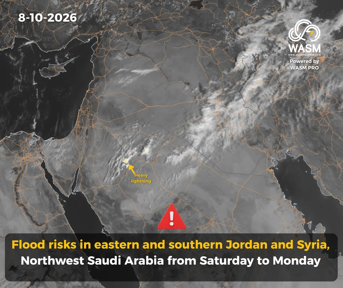
WASM Weather Center – A noticeable rise in temperatures and unstable weather at the end of this week and the beginning of next week across the Levant and northwestern Saudi Arabia (detailed country-by-country forecast in the report), with flash‑flood risks in some areas, and a quasi‑winter low‑pressure system approaching the region late next week.
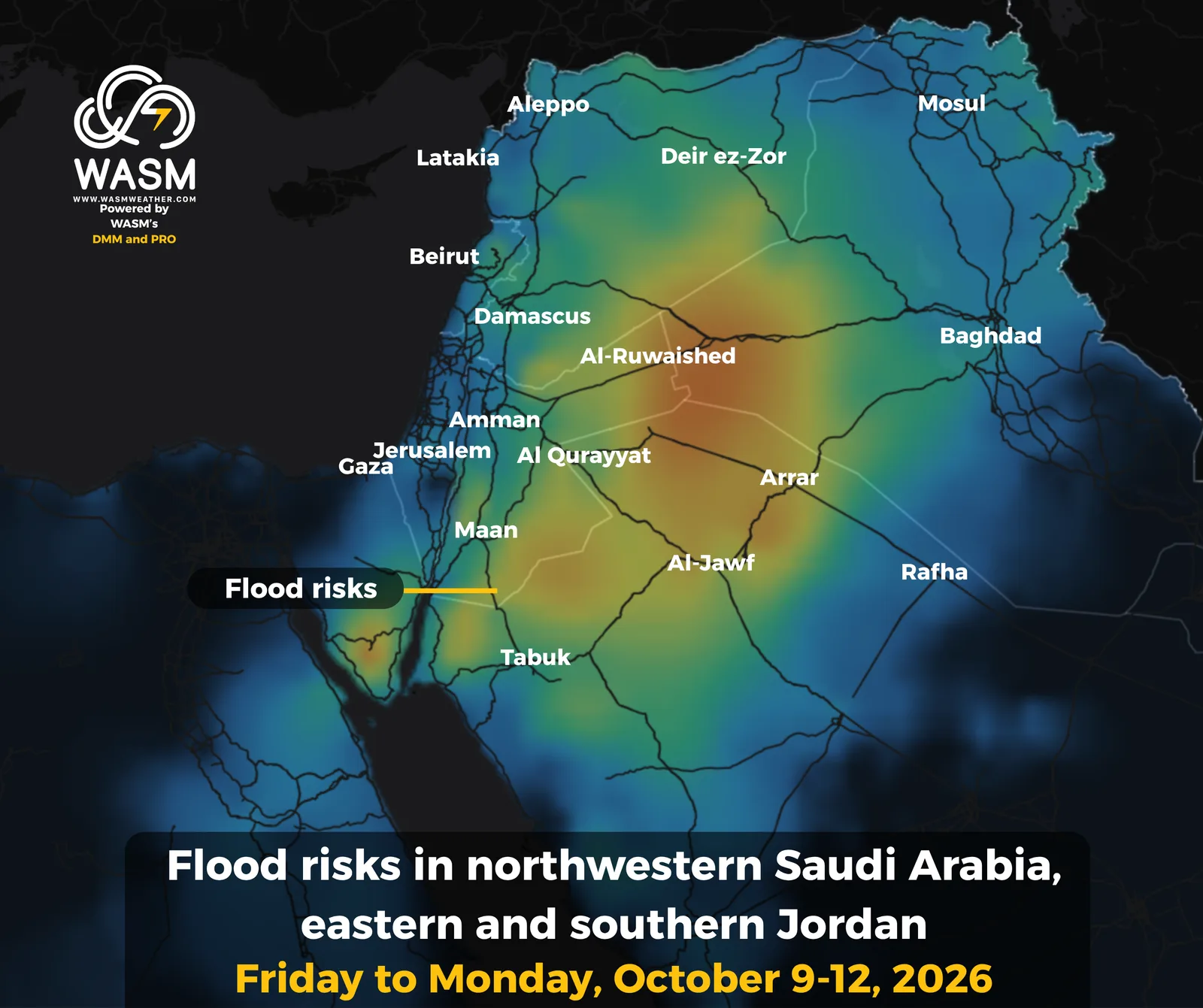
Temperatures will rise in the coming days alongside increasing atmospheric instability over the Levant and northwestern Saudi Arabia. Thunderclouds will begin forming over southern and eastern Jordan, southeastern Syria, and northwestern Saudi Arabia on Thursday and Friday, then extend into various parts of the Levant from Saturday through Monday. Flash‑flood risks will significantly increase in southern and eastern Jordan and northwestern Saudi Arabia, especially on Saturday and Sunday.
A quasi‑winter low‑pressure system is expected to approach the region late next week, with details to be issued progressively.
Wasm Regional Center is monitoring a heavy, widespread rainfall event expected to begin during the last third of this month. Details will be released gradually.
The detailed seasonal weather bulletin for the Arab region for 2026–2027 has been issued.
Weather Details by Region
Saudi Arabia, the Arabian Gulf, and the Arabian Peninsula
Weather instability will intensify in northwestern Saudi Arabia, especially in Al‑Jawf, Tabuk, Qurayyat, northern Hail, and parts of the Northern Borders region, becoming stronger toward the end of the week. This will lead to thunderstorms and occasional strong winds, with continued and intensifying thundercloud activity over parts of the Asir highlands, Mecca, Taif, Al‑Baha, and western Medina.
Rainfall may become heavy at times in parts of Al‑Jawf, eastern Tabuk, western Northern Borders, and Qurayyat, with flash‑flood risks especially on Saturday and Sunday. More details will follow.
Rain events will become more widespread, stronger, and heavier next week over northwestern Saudi Arabia, then expand further after mid‑month to reach parts of Kuwait, northern Al‑Qassim, and northeastern Saudi Arabia.
Temperatures continue to drop across the region, tending toward coolness late at night in northern areas. Humidity remains high along coastal regions of Saudi Arabia, the UAE, Qatar, and Bahrain, with cloud cover and dust‑raising winds in exposed areas of Riyadh and the Eastern Province.
The Levant
Temperatures will rise noticeably toward the end of the week as the Red Sea trough extends into the region, causing clear weather instability, followed by heavy rainfall events next week in various areas—most concentrated over eastern and southern Jordan and eastern Syria—bringing heavy showers, flash‑flood risks, and strong winds.
A significant drop in temperatures is expected later next week with widespread rainfall as a quasi‑winter low approaches. A heavy regional rainfall event is being monitored for the last third of the month.
Jordan
Temperatures will rise clearly toward the end of the week, approaching near‑summer levels. The weather will be warm during the day and remain slightly cool at night and in the early morning.
Thunderstorms will affect southern and eastern Jordan, extending on Sunday into various parts of the country. Initial indicators suggest these showers may be heavy in southern and eastern Jordan from Saturday through Monday, with flash‑flood risks. Details will be issued progressively.
A heavy regional rainfall event is being monitored for the last third of the month.
Syria
Temperatures will rise toward the end of the week with unstable weather, especially in eastern Syria and parts of northwestern Syria, bringing heavy thunderstorms at times. These showers will intensify from Saturday through Monday.
A noticeable drop in temperatures is expected late next week as a quasi‑winter low approaches, bringing rainfall to various regions. Details will follow.
Palestine
Temperatures will rise toward the end of the week, bringing mild autumn weather during the day, moderate conditions at night and early morning, and cooler temperatures in the mountains. Weather instability returns Saturday and Sunday with scattered showers. A significant drop in temperatures is expected late next week with rainfall as a quasi‑winter low approaches.
Lebanon
Temperatures will rise toward the end of the week with scattered showers expected in various areas. Weather instability intensifies late next week with heavy rainfall due to the approach of a quasi‑winter low.
Iraq
Temperatures continue to break downward with ongoing weather instability. Thunderstorms will occur in some areas alongside mild nighttime conditions. Instability and thunderstorm activity will increase next week across various northern and western regions. Rain events are expected to intensify around mid‑month and afterward, becoming very heavy.
Mobile App
For more information and smart alerts, download our app on Apple Store and Google Play.
iOS: https://apps.apple.com/us/app/wasm-weather/id6810005560
Google Play: https://play.google.com/store/apps/details?id=com.wasmweather.app