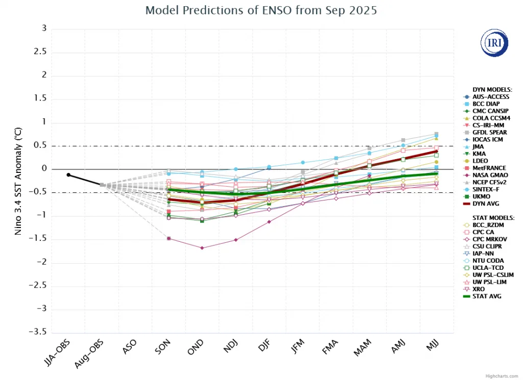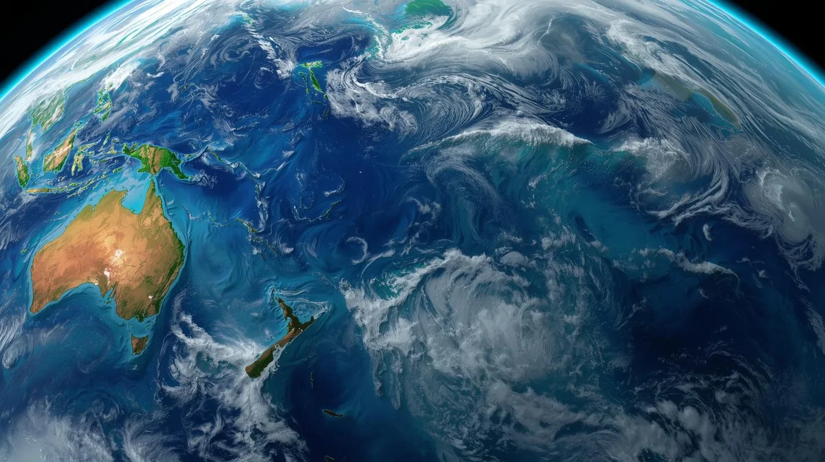
WASM- The WASM Regional Center continues to closely monitor the tropical Pacific Ocean, where the La Niña climate phenomenon continues to fail to develop, which significantly affects atmospheric circulation and global climate conditions.
La Niña is a phenomenon characterized by a decrease in temperature rates in the tropical zone of the Pacific Ocean, and it continues to record values that do not meet the criteria for this phenomenon's development, as a result of hot water hotspots that dominate the tropical part of the Pacific Ocean.
Tropical Pacific Ocean phenomena clearly affect the general atmospheric circulation, but in connection with other climate factors, they lead to unique atmospheric circulation.
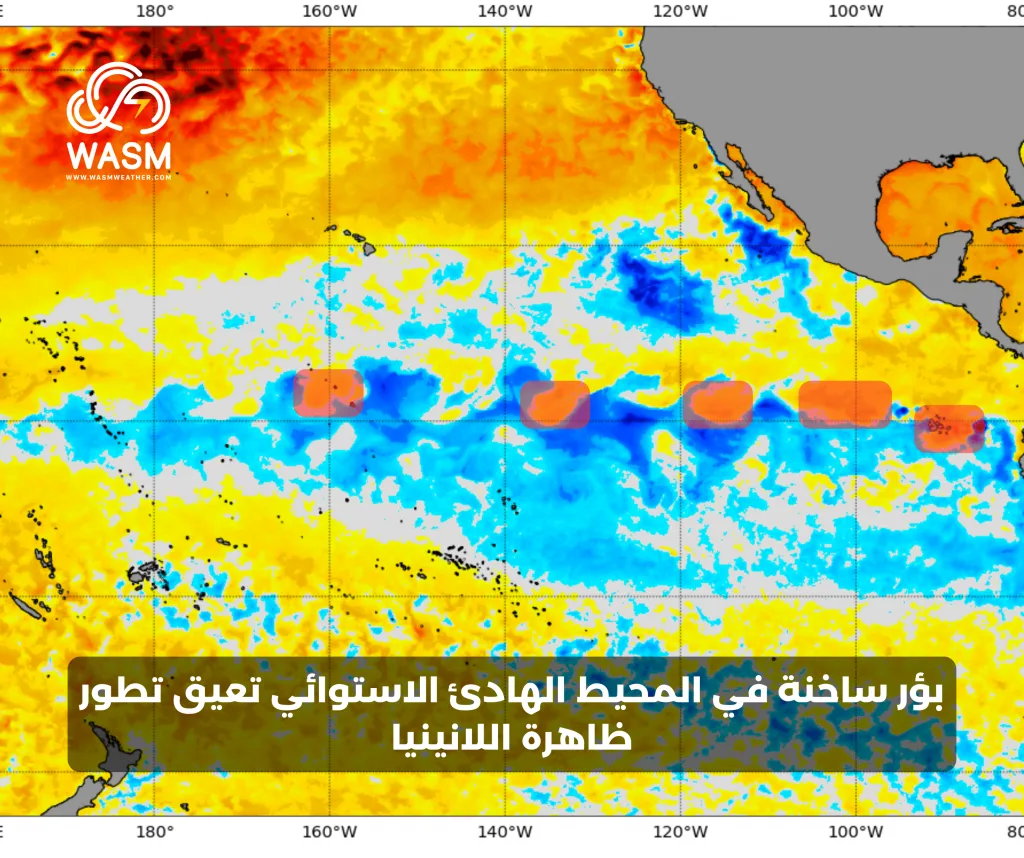
Hot water hotspots appear in the tropical region of the Pacific Ocean|
Hot spots continue to surge from the area north of Peru, and unusually dominated the Panama Bay (located northwest of Brazil), and recorded for the first time climatically unusual heat throughout the summer season, which usually records noticeable cooling.
The presence of warm water in the eastern and central parts of the tropical Pacific Ocean is primarily due to massive marine heat waves that affect the entire Pacific Ocean, which causes disruption of the important trade wind movement that greatly promotes the La Niña climate phenomenon.
Major disruption in trade wind movement|
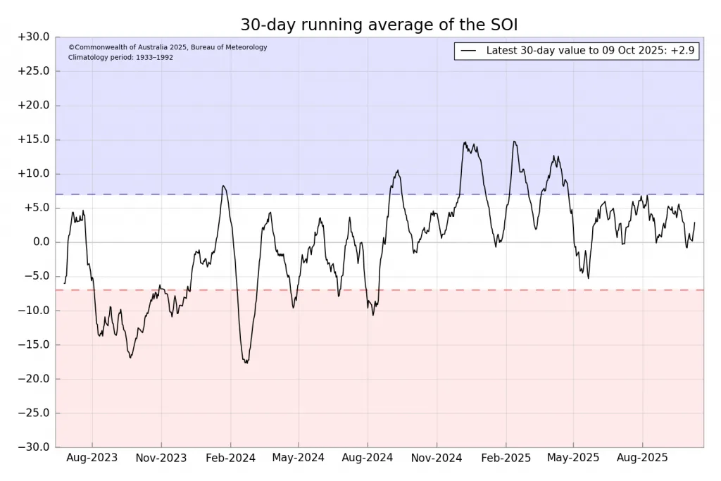
The disruption of trade wind movement prevents the development of the La Niña climate phenomenon, which is one of the essential bases for its rapid development. These winds remain extremely weak and disturbed, hindering the development of this phenomenon, and the reasons go back to marine heat waves spreading across the Pacific Ocean.
Southern Annular Mode (SAM) remains weak|
The increase in southern polar oscillation values is essential for promoting trade wind movement and spreading cold water along the equator of the Pacific Ocean. This factor remains weak, although it recorded improvement in recent days.
Summary|
The summary of the scientific report indicates that La Niña continues to suffer from its inability to develop and continues to fail to form for the second consecutive year in a manner that is rare compared to climate records, which reflects the strength of marine heat waves in the Pacific Ocean.
Forecasts indicate the continuation of the same current conditions until the end of autumn, when the reverse phase begins in the tropical Pacific Ocean, which is expected to last long this time, characterized by a significant rise in temperature, starting from its western regions with the beginning of winter.
The WASM Regional Center expects the "Modoki Niño" phenomenon to begin developing slowly from the beginning of winter until mid-2026 to then affect the atmosphere for several months with extremely extreme climate conditions. This phenomenon is considered one of the most dangerous climate phenomena, and this is consistent with our analyses since summer, which have begun to clearly appear in reality
The reason for predicting this phenomenon goes back to marine heat waves adjacent to the west of the Pacific Ocean, warm water in deep waters in those areas, and a rapid and sharp shift in the Indian Ocean oscillation from the negative phase to slightly positive in record time, which makes the accumulation of warm water in region 4.0 rapid, leading to a dangerous oscillation in atmospheric circulation.