
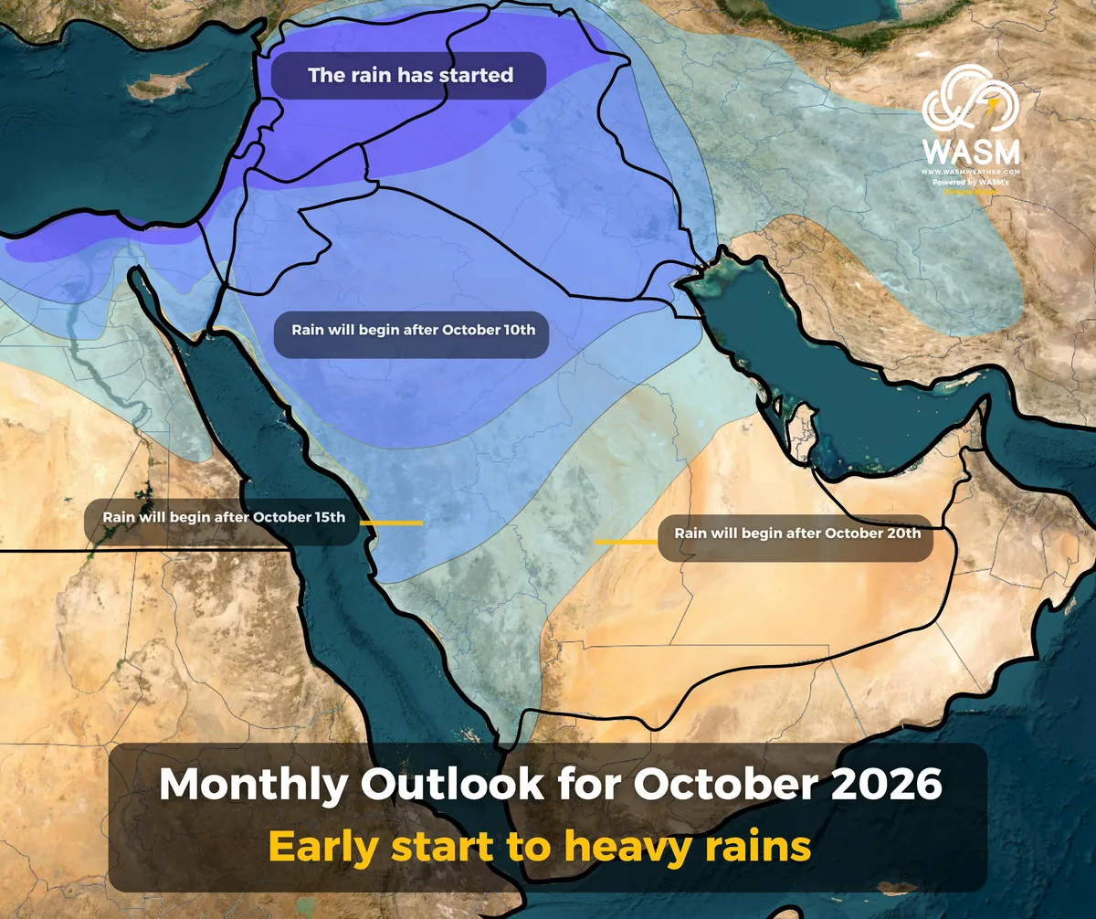
WASM — The WASM Regional Center issues its monthly bulletin based on the Center’s climate‑model data, which records high accuracy for the region’s climate and operates using flexible statistical similarity periods. The model run dated 1‑10‑2026 (main run) covers the Arabian Peninsula and the Levant.
Current results indicate a gradual increase in weather systems at the beginning of the month, affecting parts of northern and western Saudi Arabia, the Levant, and parts of Iraq. However, these systems remain within the weak to locally moderate category in some areas, especially northern parts of the Levant and western Saudi Arabia.
Starting from the second week of the month
Weather systems intensify noticeably, with their classification rising to the yellow level in many regions. Despite this, their spatial coverage remains relatively limited, though rainfall intensity improves. These systems focus on wide areas of the Levant—including Jordan and Palestine—and various parts of northern and western Saudi Arabia.
Second Half of the Month
Weather systems strengthen significantly, marking the true beginning of the rainy season in the region, God willing. These systems will be characterized by sequence and continuity.
According to the model data, weather systems reach their peak intensity during the last third of the month, especially mid‑period. They intensify again during the final days of the month and the beginning of November.
Weather systems during the second half will be more widespread and more intense, with the possibility of very heavy rainfall in many regions, accompanied by high flash‑flood risk, requiring maximum caution and full preparedness.
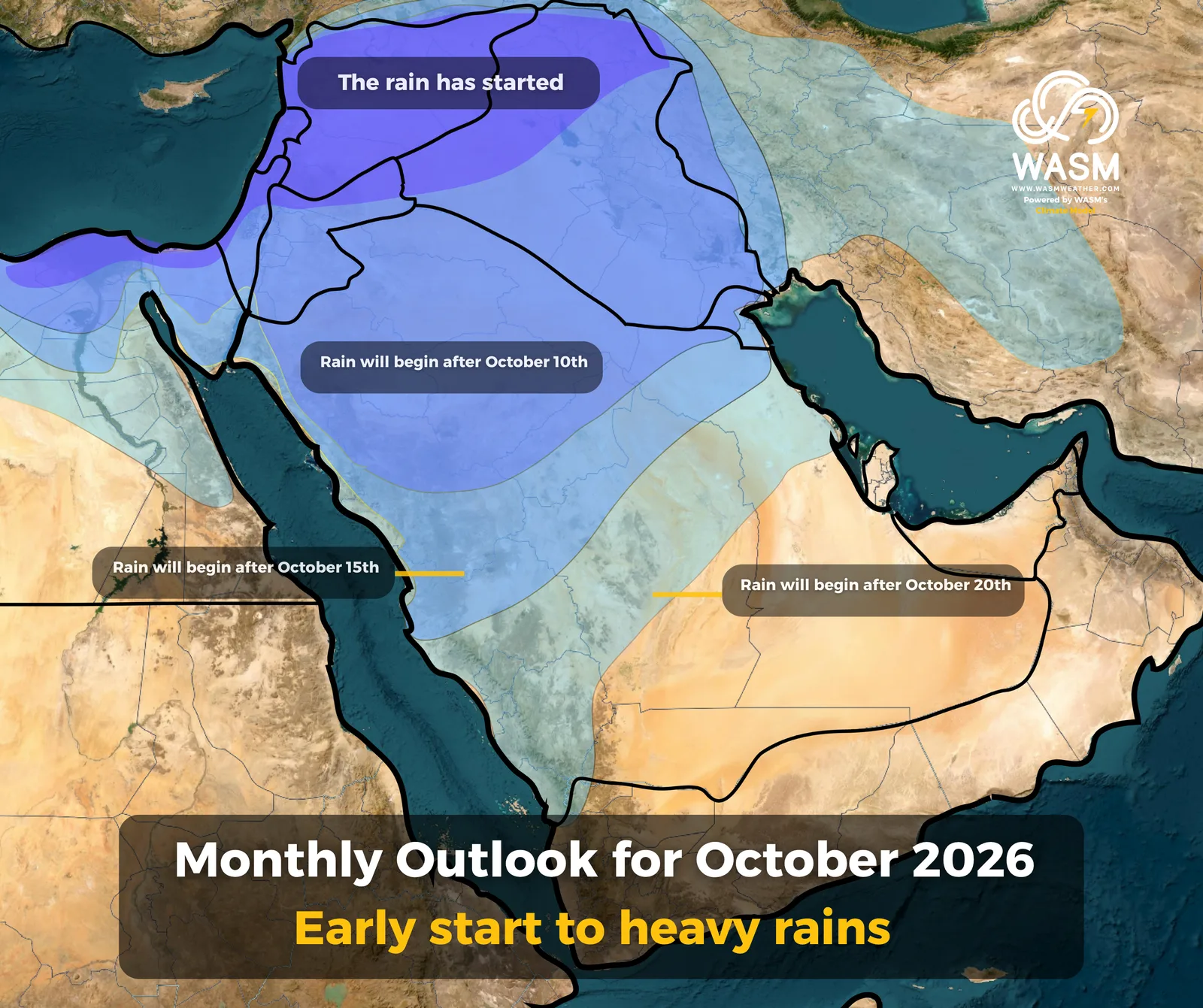
The map indicates the expected start of heavy rainfall events in the region, and these systems are forecast to expand and intensify progressively and strongly after mid‑October.
Scientific Reasons
The data obtained by the WASM Regional Center from its advanced climate model indicate a clear and unusual weakening of the westerlies coming from the Atlantic Ocean. This weakening is driven by globally extreme climatic conditions, most notably the rapid and significant cooling of the North Atlantic. This cooling is causing a sharp change in the nature of the jet stream and its waviness, making it easier for a strong and persistent high‑pressure system to develop over Europe.
This high‑pressure system will push cold air masses toward the Mediterranean Basin (the entire Mediterranean region), including North Africa. At the same time, strong moisture transport from the Arabian Sea and increased activity of the Red Sea Trough will combine to produce intense weather systems across the Arab region—especially the Middle East, the Arabian Peninsula, and the Levant.
At the beginning of the month, moisture transport toward the region remains weak, though it begins gradually. The jet stream also remains active over northwest Arabia. However, by mid‑month—and progressively—the jet stream weakens significantly over northern Arabia, allowing substantial transport of subtropical and tropical moisture from the Arabian Sea.
The WASM Regional Center has issued the seasonal forecast for 2026–2027, indicating a high‑intensity rainy season, God willing, with elevated flash‑flood risks across the region.
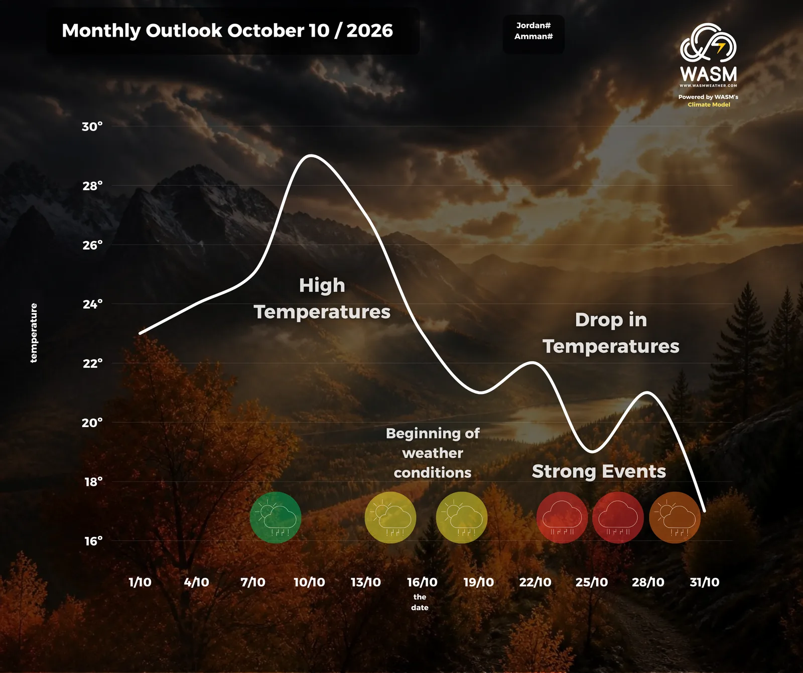
The temperature curve for Amman, Jordan, and the expected weather systems—God willing—shows a clear increase in the strength of weather events by mid‑October, becoming strong during the second half of the month, especially in the last third. This pattern applies to most regions of the Levant.