
WASM - The WASM Regional Center possesses the only climate model of its kind in the Arab region, which operates using flexible statistical calibration methods. With some improvements introduced during the summer season, it achieved exceptionally accurate results in the region and Europe and was able to detect high-precision weather details that even exceeded the adopted global climate models.
With the model being operated experimentally on 9-9-2024, unusual weather conditions expected in the Mediterranean region were forecasted during the upcoming rainy season, as well as areas of western and northern Saudi Arabia and later Iraq, Kuwait, and the northern Arab Gulf region. WASM will issue detailed information with the seasonal bulletin for the 2024-2025 season.
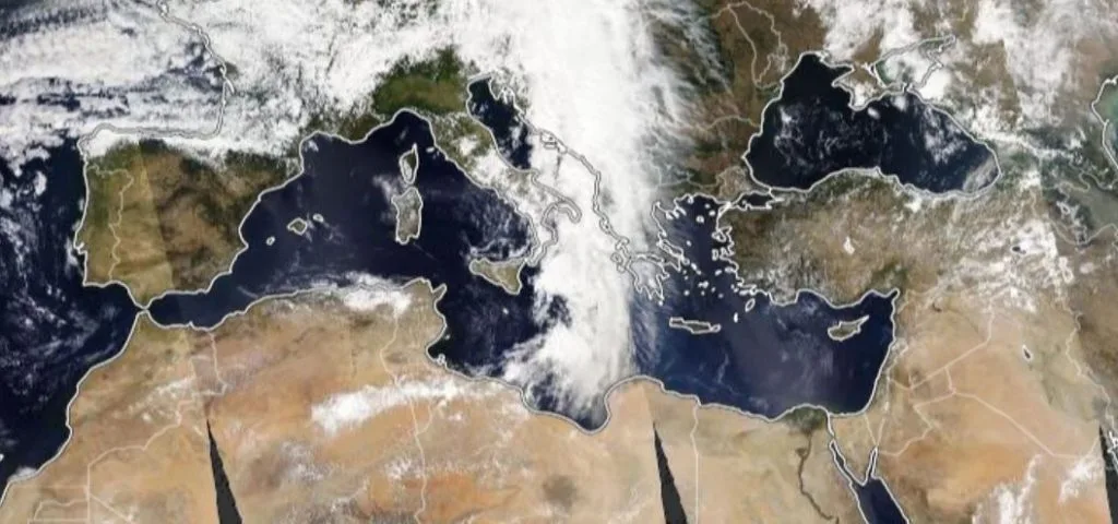
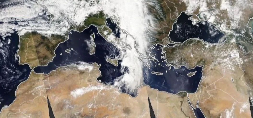
The Mediterranean region will be highly turbulent..
With initial data indicating that unusual strong storms will begin in the central Mediterranean in mid-September, this indeed occurred on the ground. The WASM Regional Center expects these storms to continue in succession, especially in the central Mediterranean region and parts of its eastern areas during the beginning of the rainy season, particularly with the onset of autumn and until before mid-autumn. With the shift of the European high-pressure axis slightly with the end of autumn and its concentration more toward central and western Europe, strong weather conditions are expected to concentrate more in the eastern Mediterranean region later, while continuing across the entire Mediterranean region.
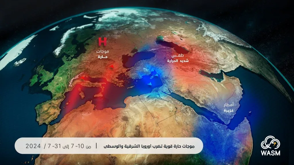
The Mediterranean records unprecedented high temperatures..
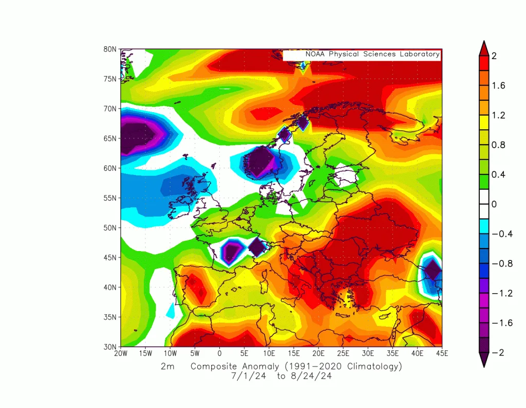
Unusual weather conditions will coincide with high temperatures in the Mediterranean region, with a rare tropical weather system detected south of Italy on September 8, which caused enormous amounts of rain in the central Mediterranean region and significant damage to those areas, as a result of the high temperature of the Mediterranean Sea, which increases the energy of forming storms and increases their impact.
The high temperature of the Mediterranean Sea does not only affect the region, but its effects extend significantly to areas west of the Arabian Peninsula. Through an important study issued by the WASM Regional Center, it was found that the increase in Mediterranean Sea temperature causes intensification of rainy conditions in western Saudi Arabia and the Red Sea coasts and the Makkah region during rainy seasons due to increased probability of strong frontal activity.
Unusual circulation of the atmosphere..
As a result of several highly fluctuating and unusual climate factors, along with high temperatures in water bodies, this has caused unusual behavior of the jet streams in the atmosphere, which will expose the European continent to long and unusual dry periods, sometimes separated by brief active and cold periods. This will result in the surge of cold air masses and sometimes even polar masses toward the Mediterranean Sea, especially central and eastern Mediterranean regions.
The weakness of the subtropical jet stream over the Mediterranean caused the continuation of the flow of more temperate air masses toward the region over recent weeks, coinciding with rare activity of eastern tropical waves. This resulted in high rainfall rates in western Arabia and the Sahara region. Due to the intensification of polar air masses with the climatological onset of autumn, this facilitates the easy arrival of cold air toward the Mediterranean and the formation of strong storms in the Mediterranean.
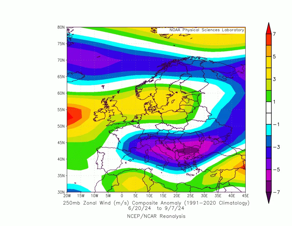
The unusual atmospheric circulation affects most regions of the world, with the formation of strong storms this time in lower mid-latitudes, and drought and heat waves in some higher mid-latitude regions. This is due to the weakening of the polar jet stream and its severe undulation, which increases heat exchange in the atmosphere and increases the likelihood of strong storm formation.
Detection of intensification of the polar jet stream over western and central Europe will expose many Mediterranean areas to strong storms during the upcoming rainy season. With the expected shift of this jet stream's axis eastward from the Atlantic, it will increase the ease of arrival of extremely cold polar air during winter toward the entire Mediterranean region, especially its eastern part.
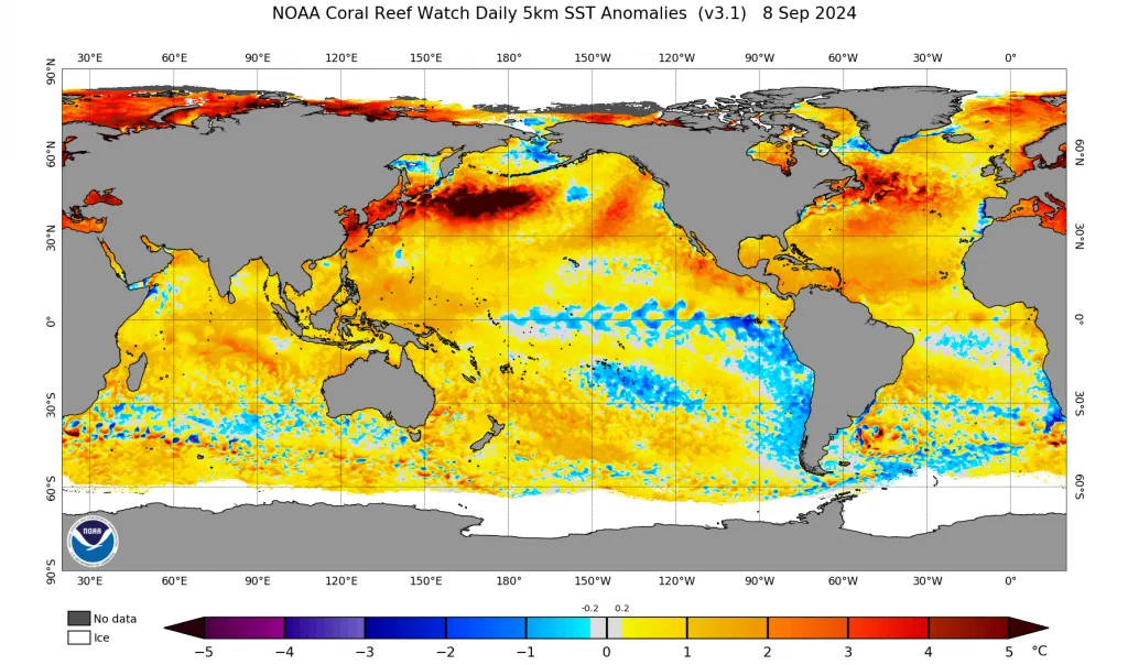
The La Niña phenomenon continues to fail to develop..
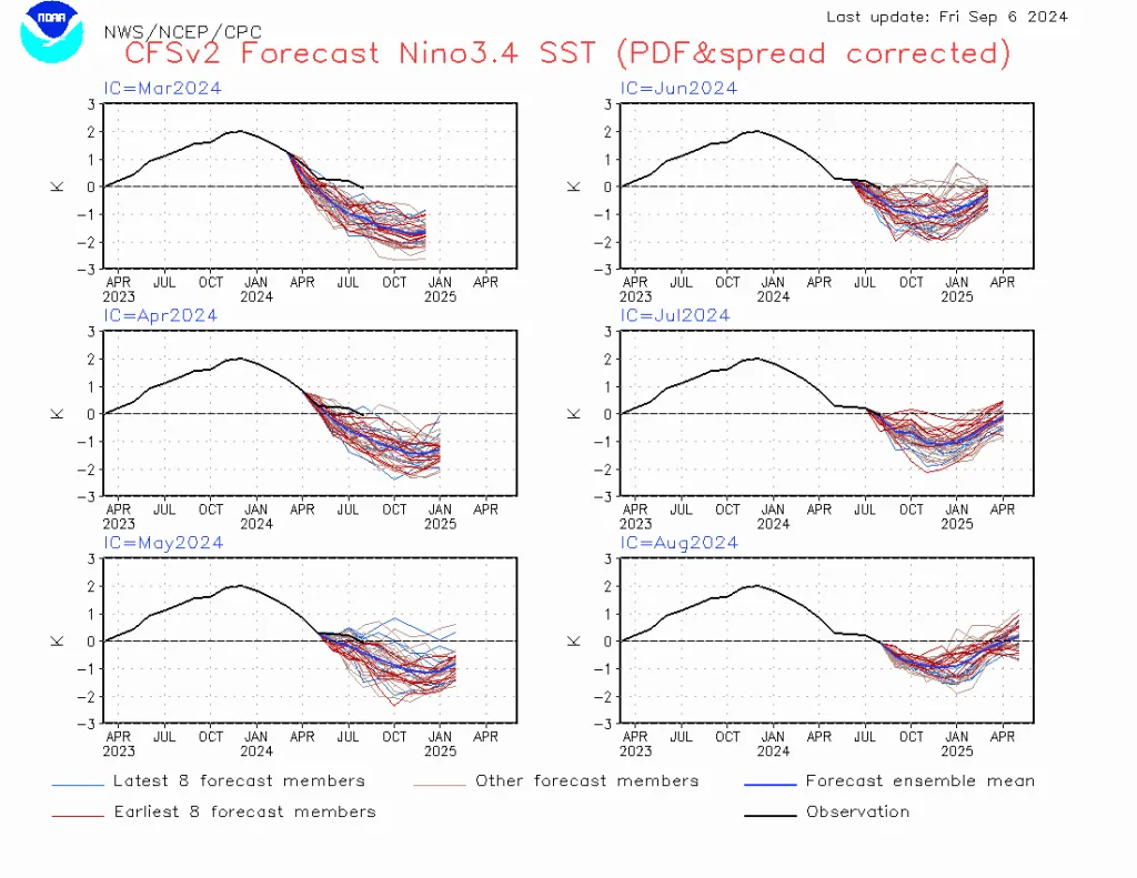
The failure of La Niña to develop, contrary to initial expectations from the beginning of summer, which aligned with studies issued by the WASM Regional Center during the summer, complicates seasonal forecasting. However, the WASM climate model data, which operates in a completely different way, continues to align with this failure in development, which is due to many reasons explained in this report. The oscillation of this factor causes significant changes in the subtropical jet stream and strange atmospheric circulation during the upcoming period. It may lead to intensification of heat exchange and atmospheric circulation intensity during the upcoming period through the development of sharp undulations called "Rossby waves." Due to the very high temperatures in mid-latitudes and subtropical regions, which accumulated due to severe polar atmospheric circulation during the previous season, this will lead to intensification of the circulation process and the intensity of mid-latitude storms, including the Mediterranean region.
Cooling of the Atlantic tropical region relative to its northern part..
The WASM Regional Center was the first entity to alert to this point and issued a detailed study about it during the summer, and its impact will cause significant changes in the subtropical jet stream over the eastern Atlantic and Mediterranean regions. This phenomenon is expected to continue until spring 2025, leading to a high probability of repeated Mediterranean storms during the upcoming rainy season, and prolonged dry periods over the European continent.
The weakness of the subtropical jet stream increases the ease of flow of cold air masses toward the Mediterranean during the upcoming season, coinciding sometimes with undulation of the polar jet stream, especially over eastern Europe during the upcoming rainy season. With the addition of the high heating factor of the Mediterranean region, this greatly facilitates the development of several strong storms in the Mediterranean region.
High moisture corridor west of Saudi Arabia..
With the expected rise of atmospheric pressure over southwest Asia and its extension from Siberian regions due to the bending axis of the polar jet stream, and the intensification of Mediterranean storms, this will result in a high and intense moisture corridor west of Saudi Arabia and its central and western areas, extending to the north and even to Jordan, the Levant, and Egypt during mid and late autumn, exposing these areas to large amounts of rain that may be unprecedented in modern climate records.
The activity of Mediterranean or Egyptian depressions in the eastern Mediterranean increases the chance of western Saudi Arabia, Makkah, and Jeddah experiencing severe weather conditions during November and December, especially with the expected shift of the Red Sea low-pressure center more toward central and northern Red Sea and extending to the southeast Mediterranean.
The long drought wave will break in some Maghreb regions..
The intensity of Mediterranean storms will break the long drought waves affecting the Maghreb for many years, particularly Tunisia, eastern Algeria, and western Libya, specifically during the beginning and middle of the autumn season.
The WASM Regional Center will soon issue the seasonal bulletin through detailed maps illustrating atmospheric pressure systems, rainfall rates, and temperatures across various regions of the Arab world, Europe, and the North Atlantic, along with a simplified seasonal bulletin for North America, using WASM climate model data.