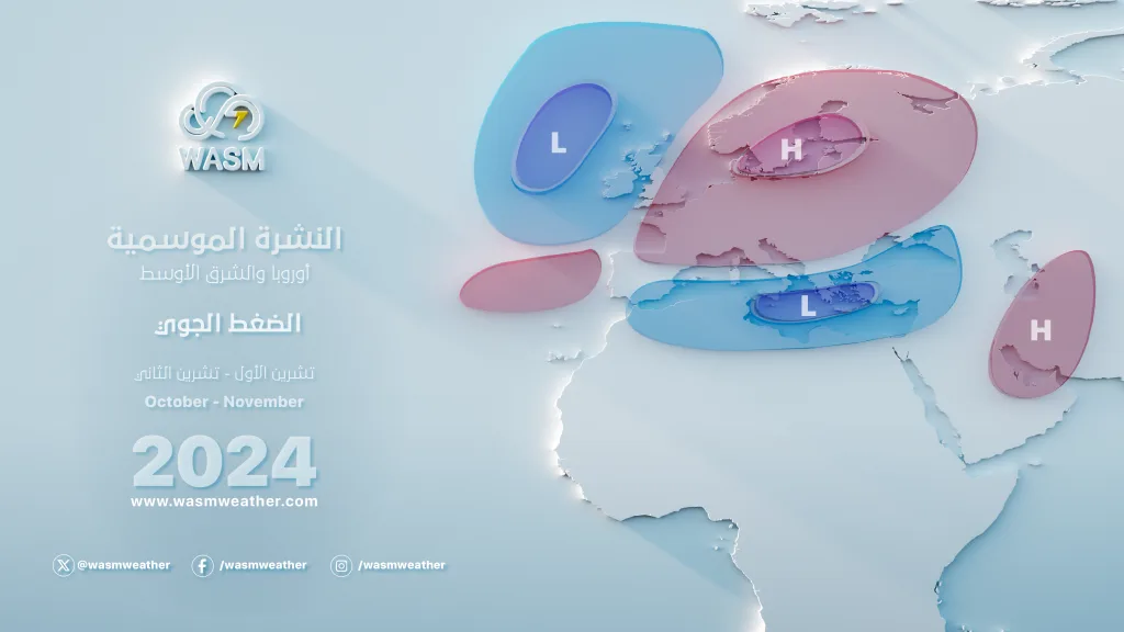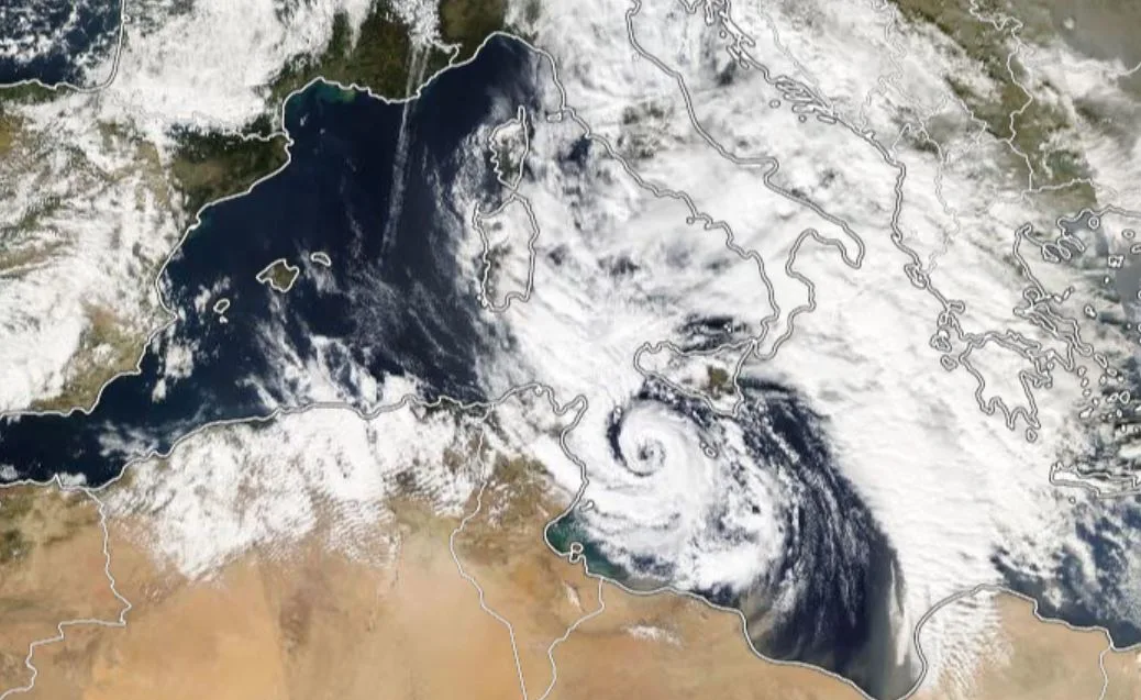
WASM – The WASM Regional Center is monitoring an unusual and rare atmospheric circulation pattern beginning in the last days of the current month through November and December, with its peak expected during January. This takes the form of "intense" activity of polar waves toward the Mediterranean region and the Arabian Peninsula, concentrated mainly over eastern Mediterranean, Turkey, the Arabian Peninsula, and the Levant.
These expected polar waves result from unusual and atypical activity of the polar jet stream, which recurred similarly during the 2014-2015 and 2021-2022 seasons, but is expected to recur with greater strength, clarity, and comprehensiveness during the upcoming rainy season.
What does early polar activity mean?
This does not mean early snowfall, as the Mediterranean remains warm, except for high mountainous areas such as Lebanon's towering mountains or northern Algeria's mountains, but it does mean expectations of large quantities of rainfall in this region during November or a renewal of Mediterranean storm activity, particularly in the eastern and central Mediterranean region.
It also means the occurrence of early winter cold waves. The results of WASM's climate model indicate significant polar activity during the first 10 days of November in the eastern Mediterranean region, the Levant, and northern Arabian Peninsula, with a renewal of this polar activity in the form of dry conditions after mid-November and continuation of these early polar waves throughout November alternating between wet and dry.
Rainfall interruptions are not expected in the region, while stable periods lasting a week or 10 days are considered typical in atmospheric circulation behavior.
Early polar activity will become more pronounced during late November and the first half of December in the eastern Mediterranean region mainly and northern Arabian Peninsula.
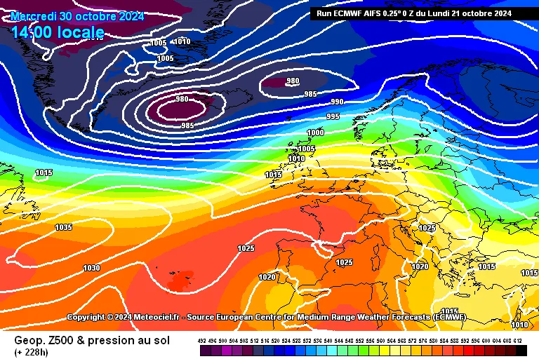
The continuous activity of polar waves toward the region greatly increases the chances of heavy rainfall in the Arabian Peninsula and Arab Gulf countries during autumn, as the atmospheric response to polar jet stream undulation during autumn in subtropical latitudes differs greatly from winter. The humid and warm air masses that remain "dominant" over those areas increase in activity and dynamism and cause significant and comprehensive rainfall in the desert regions, Arabian Peninsula, and Arab Gulf countries, especially areas of northern Arabian Gulf and the Red Sea in general.
As for the impact of early autumn polar waves on the Levant, it greatly increases the chances of heavy rainfall or large quantities of precipitation, due to the large thermal difference between Mediterranean sea temperature and upper atmospheric layers, which increases the activity of air instability, as well as increases cold front activity.
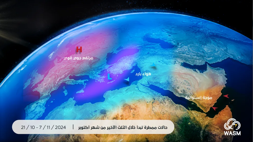
Polar jet stream records sharp weakness and major undulation|
The early and rare coldness in the Mediterranean region, especially its east, northern Arabian Peninsula, Turkey, and southern Europe is due to the undulation of this jet stream that blows at an altitude of 9 km above sea level. This jet stream undulation causes high activity of what is called Rossby waves. These waves are primarily responsible for the major heat exchange that occurs between hot tropical and subtropical regions and cold polar regions.
The more intense these waves become, the more this reflects an active and dynamic atmosphere, greatly reducing the effect of global warming but causing high extremes in rainfall weather cases and strong storms as a result of high temperatures recorded especially in mid-latitudes during 2023 for completely unknown reasons.
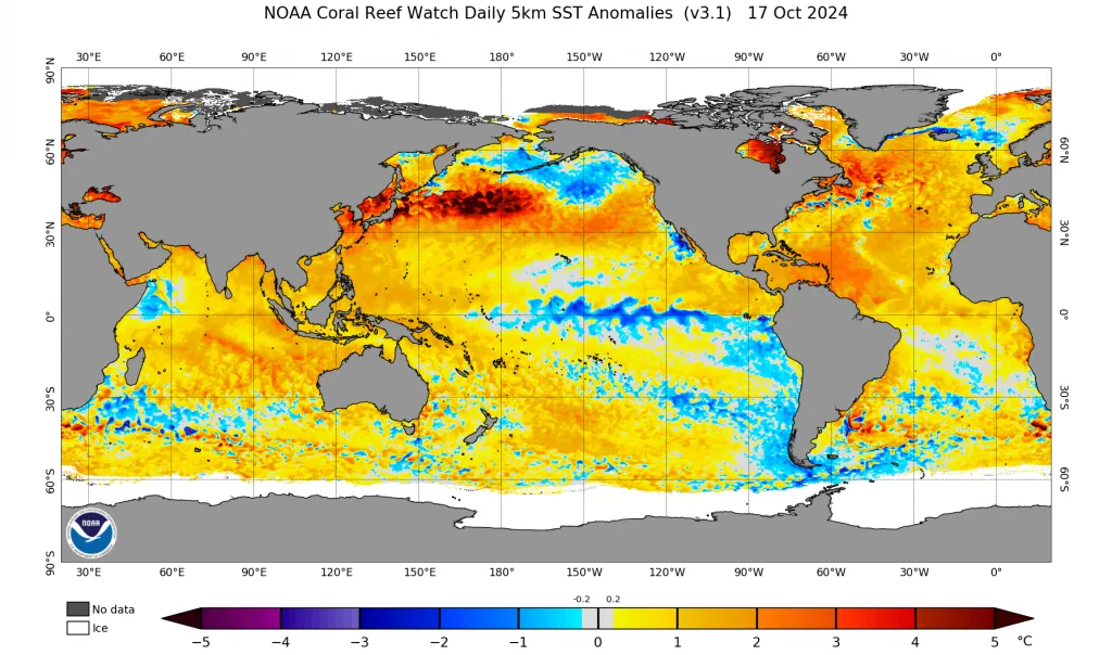
Polar jet stream undulation is due to complex scientific reasons, but the most important are temperature differences in several regions, most importantly: Atlantic tropical regions as well as tropical areas in the Pacific Ocean, and the northern Pacific Ocean, which records accelerating coldness contrary to expectations and perhaps this is due to rapid polar wind flow activity toward mid-latitudes.
Failure of La Niña climate phenomenon development|
Tropical Pacific Ocean phenomena are considered the most important in affecting atmospheric circulation. The failure of this phenomenon to develop greatly affected climate data and the nature of polar jet stream influence. The change in subtropical cell activity in the tropical Pacific caused much impact on the nature of the subtropical jet stream (blows at higher altitudes between 11-13 km). This jet stream records major and unusual weakness in many parts of the world, especially the Mediterranean region, southern Europe, and northern Arabian Peninsula, which greatly contributed to the beginning of cold periods early this season.
A strong atmospheric pressure high zone will cover most of Europe's regions|
It appears that this "Azores" atmospheric high recorded very early activity this season and caused a cold and dry air mass to push toward the region, registering the first cold wave controlling the Arabian Peninsula and the Levant, rarely occurring, even though Siberian high activity remains weak and shy, this will not last long.
The strong European (Azores) atmospheric high is due to strong polar jet stream activity over eastern Atlantic Ocean region and its sharp undulation, which results from strong undulations in jet streams over North America, especially the American West and eastern American coasts and western Atlantic, leading to different Atlantic storm centers this season shifting westward more than usual compared to the previous rainy season, especially as we monitored unusual warm waters near those areas that stimulate this storm activity.
The Siberian high, which remains weak (which is normal at this time), will take a different axis this season and toward the southwest of Asia and north Arabian Sea (meaning it will take a center to the east more than usual compared to these years), which will lead to a high humidity tunnel toward the Arabian Peninsula and continuous throughout most of the upcoming rainy season stimulated by a deep low center of the Red Sea depression due to Mediterranean storm activity. This humidity tunnel, which may be semi-permanent, may result in an unusual rainy season in Saudi Arabia, the Arabian Peninsula, and even the Levant, Egypt, Iraq, and Arab Gulf countries.
The extension of the Siberian high westward will be temporary and rapid between waves of strong Azores atmospheric high activity. To simplify, the extension of the Siberian high this season toward the region will be followed by high activity of Mediterranean lows later, due to atmospheric organization, and this actually greatly increases the chances of snowy conditions in the Levant and northern Saudi Arabia. To simplify this matter, cold dry air masses will coincide with the presence of cold humid air masses from northern Europe, which increases the chances of snowy conditions.
WASM Regional Center's climate model records unprecedented highly accurate results|
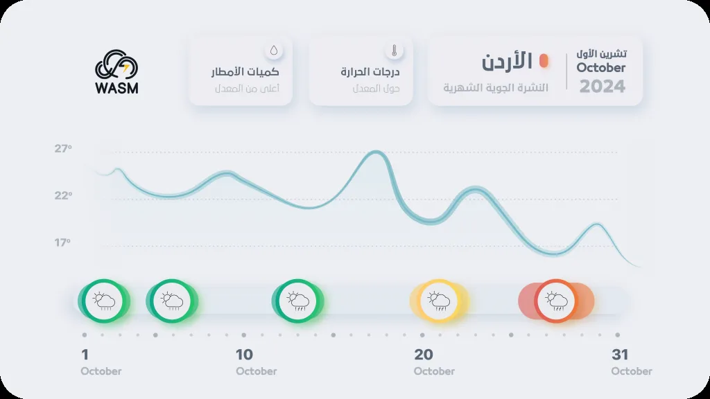
It appears that atmospheric organization perfectly matches what WASM's climate model monitored, and with our overcoming the noise in climate data related to the La Niña phenomenon that failed to develop, our model predicted that the beginning of the current rainy season would be slightly delayed until late October, and it appears that physical computational models sense this clearly by late October in the region.
WASM's climate model will be run during the coming week via an important main data cycle, and we do not expect any changes to the seasonal forecasts issued during September, as real-world simulation results closely match the expected results from WASM's climate model.