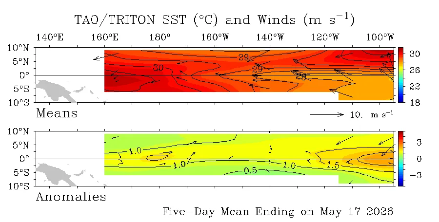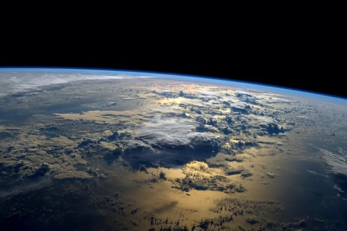
WASM- The WASM Regional Center is monitoring the powerful climate phenomenon "Super Niño," which is a very significant rise in surface temperatures in the tropical Pacific Ocean region. This rise is expected to record unprecedented and historic figures in modern climate records over the coming months.
The Niño phenomenon, in brief, directly affects tropical circulation in the atmosphere, which we call at the WASM Regional Center the "heart of the atmosphere." The direct impact on tropical activity reflects very strong consequences on atmospheric circulation and significant changes to weather and climate patterns globally, ranging from severe dry waves in some regions to flood waves, torrents, and extremely strong storms in other areas.
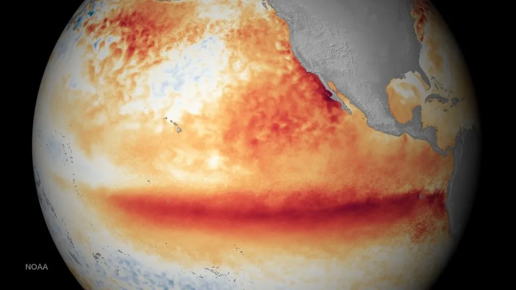
- The "Super Niño" Phenomenon for 2026|
The expected phenomenon will be completely unconventional in terms of the extreme temperatures that will accompany it, resulting from warm and semi-deep Kelvin water waves in the tropical Pacific Ocean. The causes of these waves are completely unknown, but they were clearly evident during 2025, when our center was able to detect these waves and predict the Niño phenomenon independently months in advance.
The expected Niño will coincide with "qualitative" climate factors, becoming an unconventional Super Niño phenomenon. It will coincide with the neutrality of the Indian Ocean Dipole (IOD) values, so this circulation will rotate over a larger area and less sharply in the Indian Ocean region to affect very directly the primary tropical wave oscillation (MJO) and concentrate it more in the Pacific Ocean regions, causing a strong collapse of the subtropical jet stream in the eastern Pacific and western United States region, as well as in the Atlantic Ocean region, and also in the eastern Europe and eastern Mediterranean region, northern Arabian Peninsula, and southwestern Asia, with an increase in the number of cyclones in the Pacific Ocean region.
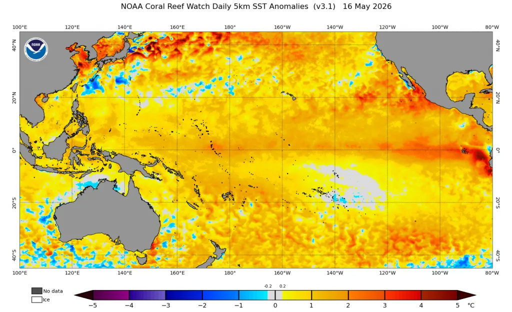
This qualitative organization of climate factors and through its simulation in our climate model led to "extremely extreme" results in terms of very large rainfall rates in the Middle East region, especially the northern half of the Arabian Peninsula, Egypt, the Levant, and Iraq, as well as extreme results in terms of low temperature rates. This will be released soon through scientific reports and accurate seasonal bulletins using our climate model.
It is worth noting that the WASM Regional Center has also been unique in the accuracy of its long-range forecasts in recent months, surpassing all sources by a very large margin due to our development of a specialized climate model for long-range forecasts, as we predicted a strong rainy season and this is exactly what happened on the ground.
- The Beginning of "Super Niño" Explosion |
Based on monitoring semi-deep Kelvin waves in the tropical Pacific Ocean region, these waves will reach the Pacific Ocean surface by the end of the current summer, leading to a very significant rise in temperature in the tropical Pacific Ocean region, which is reflected in specialized global climate models for ENSO phenomena.
The arrival of very hot water in the tropical Pacific Ocean region will cause significant and rapid fluctuations in the usual trade winds that blow from east to west. The very large temperature rise in the eastern and central Pacific Ocean will lead to "westerly reversals," which will increase the water temperature in the tropical Pacific Ocean regions. The fluctuation of trade wind movement, its severe disruption, and even its collapse will cause significant changes to the primary tropical circulation in the atmosphere (the heart of the atmosphere), thus changing the circulation of the "Walker tropical cell" and the "Hadley tropical cell," causing complete disruption in the atmosphere and changes to normal weather characteristics.

Its Impact on the Arab Region|
Niño phenomena have an important history in the climate of the Arab region. They typically cause severe drought in the Maghreb regions, and bring record-breaking and large quantities of rainfall to large parts of the Arabian Peninsula, Iraq, Egypt, and the Levant, especially if it is a Super Niño phenomenon.
It is expected that the impact of the anticipated "Super Niño" phenomenon will be cold in terms of temperatures and not warm. Niño does not mean warm or cold weather when its effects begin, but rather weather conditions divergence around the world first.
The Niño phenomenon subsequently, months after its development, causes additional warming of the atmosphere in general as a result of thermal energy released from the major tropical activity in the Pacific Ocean region. This is what will be observed later.
Major tropical activity leads to the conversion of latent energy drained from strong thunderstorms into sensible thermal energy, and the major activity of the "Hadley cell" leads to the transfer of this heat to both sides of the equator in the Pacific Ocean region, then its transfer to different parts of the atmosphere and an increase in the chances of heat waves resulting from subtropical weather systems.
This requires many weeks and possibly months for heat to accumulate in the atmosphere. However, these results cannot be determined so easily unless we study the activity of the polar jet stream, which is the most important factor responsible for thermal balance. This could lead to very strong storm activity along with significant thermal extremes.
The characteristics of Niño and how it will play an important role in the atmosphere will usually be simulated through specialized global climate models for long-range forecasts, while taking into account the nature of the region's climate locally to obtain the best results, and this is what is being simulated in our climate model.
The Niño Phenomenon Now|
The Niño phenomenon is currently recording very rapid growth, with the 3.4 region reaching +1.0, registering high temperatures in all tropical Pacific Ocean regions, as well as the western coasts of the United States, which also directly affects the nature of the polar jet stream, which will be more undulating during the upcoming season.
The results of the Niño phenomenon will appear much more clearly during the winter and spring of 2027 on the global climate, as it reaches the peak of its strength and then begins its gradual decline or transforms into another form of Niño, which increases extremes on atmospheric circulation.