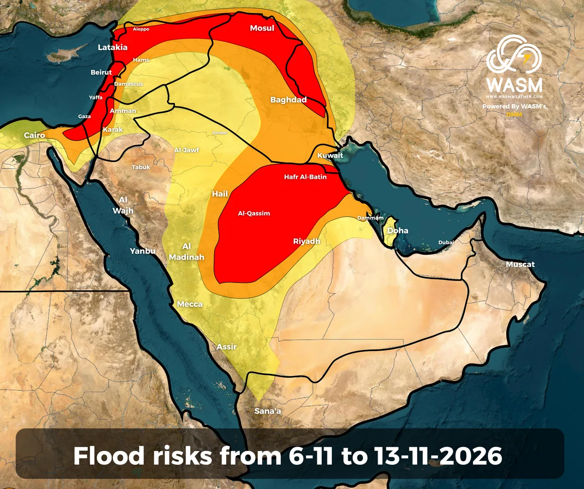
WASM – Successive severe rainfall events are expected to continue affecting the region during the coming period. This time, the rainfall is forecast to extend into central and eastern Saudi Arabia, northeastern Saudi Arabia, and the Gulf region for the first time, signaling a further expansion and intensification of these weather systems.
In detail, a highly active low-pressure system is expected to affect the Levant and Iraq from Friday through Sunday, coinciding with the approach of an unusually early polar air mass for this time of year. The system is expected to bring significant rainfall accumulations across Jordan, Palestine, Syria, and Lebanon, accompanied by strong winds and early-season cold, wintry conditions.
The influence of this low-pressure system is then expected to gradually extend next week across large parts of Saudi Arabia, including Al-Qassim, Riyadh, Hafar Al-Batin, the Northern Borders Region, Kuwait, the Eastern Province, central western Saudi Arabia, Qatar, and Bahrain.
The scientific explanation for this widespread regional event is the interaction between the highly active low-pressure system and a deep, moisture-rich tropical wave advancing toward the Arabian Peninsula, coinciding with the intrusion of colder air associated with the developing depression.
Severe rainfall events are expected to continue affecting the region over the coming weeks, coinciding with the strengthening El Niño phenomenon, which is associated with unusual weather patterns on a global scale.
For more information and smart weather alerts, download the WASM Weather app:
iOS: WASM Weather on the App Store
Google Play: WASM Weather on Google Play