
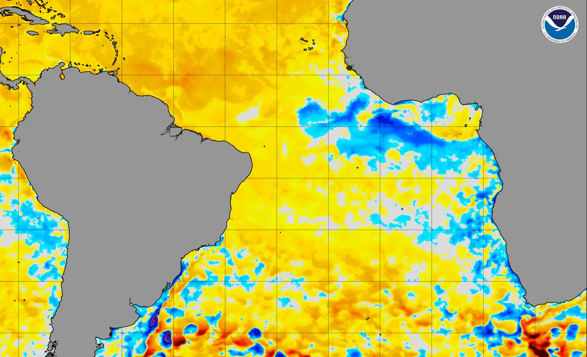
WASM – A significant climate phenomenon is expected to affect atmospheric circulation for the first time since 1994, characterized by a major drop in temperatures in the tropical Atlantic Ocean region. This climate phenomenon has not occurred for 32 years and has a significant impact on atmospheric circulation.
This climate phenomenon occurs amid a major rise in ocean temperatures worldwide and the growth of marine heat waves, which according to WASM Regional Center data is expected to have severe effects compared to normal conditions.
This phenomenon causes a direct impact on atmospheric circulation in the Atlantic Ocean region due to its acute effects on tropical activity and the main tropical-subtropical circulation in the Atlantic Ocean region – Hadley Cell. As observed, it increases subtropical activity in northwest Africa, reflecting a dangerous development for hurricane activity in the subtropical Atlantic Ocean region, especially with the continuation of marine heat waves in the Atlantic Ocean.
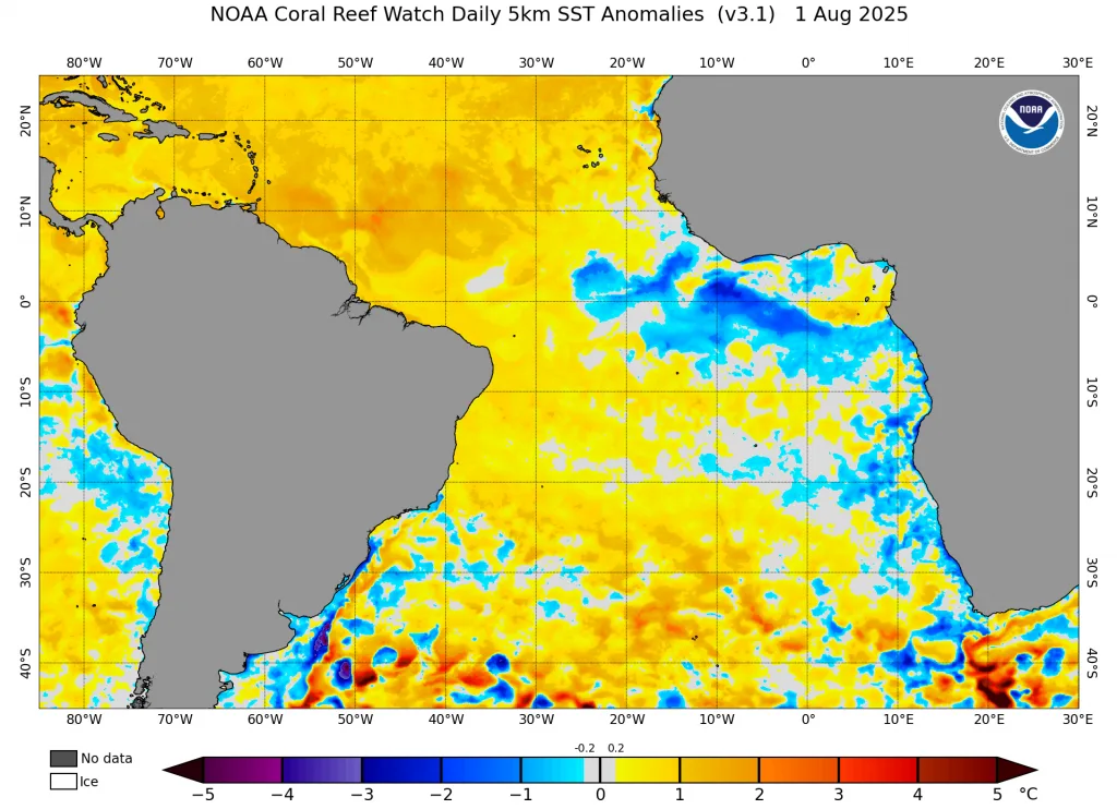
Tropical Atlantic Ocean|
Unlike tropical Pacific phenomena "La Niña and El Niño" which alternate very rapidly from year to year, the opposite occurs in tropical Atlantic phenomena, which may require more than 25 years for a climate phenomenon to develop in a much more complex manner. It is noted that our regions are more closely linked to the warmth of the northern subtropical part of the Atlantic Ocean (TNA and NTA zone).
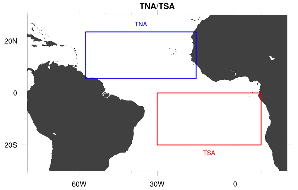
The temperature of the tropical Atlantic Ocean region rose to an all-time high in early 2024, significantly affecting atmospheric circulation. It is believed that the expected cooling during the coming period will have severe effects due to the extreme thermal contrast that will occur, which will lead to significant hurricane activity in the Atlantic Ocean region during the coming years and intensification of hot and dry waves toward Europe.
The main causes of temperature change in that region remain unknown, but melting ice in the northern part of the Atlantic Ocean through natural water circulation may be a major factor in cooling that tropical region, which will reflect severe effects over at least the next 20 years for this phenomenon, and could extend for a period exceeding 50 years, threatening the general water circulation in the Atlantic Ocean amid the continuation of marine heat waves.
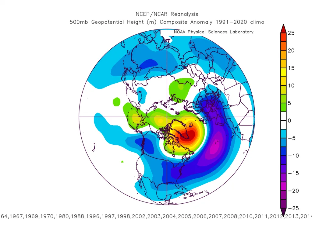
Expected Impact|
The impact of this phenomenon is directly linked to the weakening of the subtropical jet stream in the Mediterranean Sea region, especially the western part and east of the Atlantic region as well as the eastern Mediterranean, specifically in the area between northeast Libya to the coasts of Palestine.
This direct impact leads to a change in the characteristics of Atlantic storms to become less intense or coincide with a more undulating jet stream, which reflects the ease of hot winds surging toward Western Europe and the control of strong high-pressure areas over Western and Central Europe during the coming years, as well as a decrease in atmospheric pressure over the far north of the Atlantic, which strengthens a high-pressure zone over Europe, leading to a reduction in the number of polar waves toward Western Europe.
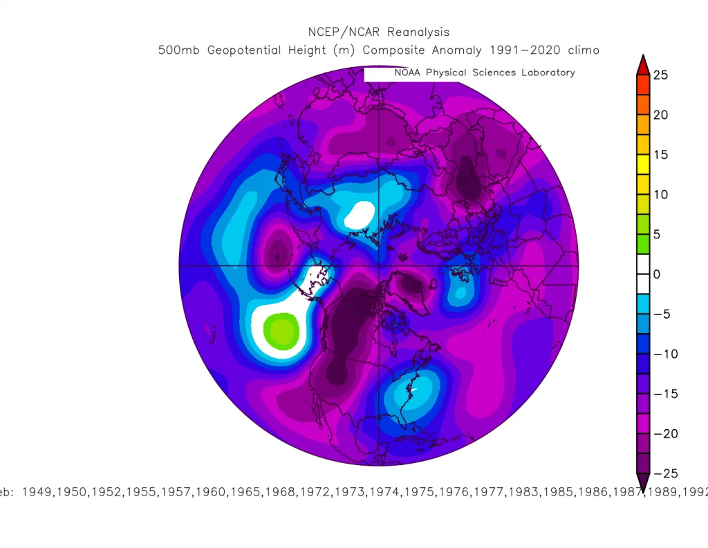
This will lead to heavier rainy seasons toward the Eastern Mediterranean region, northern Egypt, northwest Saudi Arabia, and Jordan and Palestine in particular, as well as western Turkey regions, and even Iraq, Kuwait, and the Arabian Gulf region.
Drought and heat seasons are expected to intensify during the coming period toward the Maghreb region and Western and Central Europe more frequently. However, the effect of this factor alone is linked to other very important climate factors in the tropical and subpolar Pacific Ocean region. It is easy to infer the effect of the positive cycle from this factor, which coincides with stronger and more frequent storms toward Western Europe and the North Atlantic extending from south Greenland.
Atlantic Ocean|
The connection between the cooling of the tropical Atlantic Ocean region coinciding with high temperatures in the high Atlantic region may lead to extremely extreme results and possibly significant undulation of the subtropical jet stream and also the polar jet stream in the Atlantic region during winter, leading to extreme weather and climate conditions on the European continent, particularly with increased numbers of record-breaking heat waves and their repetition during summer, and increased severity of drought waves in those regions.
This also leads to increased rainfall rates in parts of the Sahara between Morocco and Algeria, and increased severity of polar storms toward Eastern Europe and the Eastern Mediterranean region and the Arabian Peninsula, linked significantly to high rainfall rates in the central Red Sea region, western and northern Saudi Arabia, Jordan, Palestine, Iraq, and Turkey during the coming years.
Summary|
- Increased number of hurricanes in the Atlantic Ocean region during hurricane season with the beginning of this factor's change from positive values to negative values, then a decline in their numbers later.
- Intensification and increased frequency of heat waves toward Europe, especially with the beginning of this factor's shift toward negative values, which reflects cooler periods and rainfall in the Mediterranean and the Arabian Peninsula region and the Levant.
- Repetition of heavy rainy cases toward the Sahara region and between the deserts of Algeria and Morocco during the impact of this climate phenomenon.
- Long dry waves expected in Western and Central Europe during winter, offset by cold and wet waves toward the central and eastern Mediterranean and northern Arabian Peninsula and southern and eastern parts of the European continent.
- Connection of this to high rainfall rates in the central Red Sea region and the Mecca region due to the weakening of the jet stream over the Eastern Mediterranean.