

WASM – The WASM Regional Center is monitoring a complete transformation in the atmospheric system starting from mid-October, which aligns with the data from the WASM Regional Center's climate model run on September 11, 2024 and September 25, 2024. This will lead to different weather conditions compared to this period, which will reflect a decrease in temperature, increased cloud cover, and the beginning of major rainy conditions in the Middle East region, intensifying in the Mediterranean area.
- A strong high-pressure system in Europe after mid-October
An important change has been observed in the nature and behavior of the polar jet stream (a current that blows in the upper layers of the atmosphere) over the eastern Atlantic and western Europe. As a result of the activity of hurricanes and tropical waves in the Atlantic Ocean region, these weather systems caused polar winds to flow and surge toward the northern Atlantic Ocean. Consequently, a strong high-pressure system over the central and eastern United States, which also stimulates tropical wave activity and hurricanes in the Gulf of Mexico, has influenced this development.
The shift in the path and intensification of the polar jet stream over western Europe will result in rapid increases in atmospheric pressure over central and eastern Europe, causing notably cold air masses to surge significantly and be noticeably colder than usual toward the Mediterranean, particularly its eastern region.
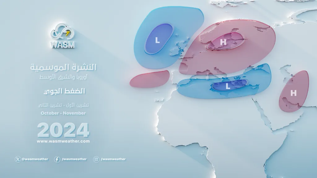
With the continuation of rainy conditions and storms in the central and western Mediterranean region, this Mediterranean front is expected to move eastward during the final third of October, particularly toward the eastern Mediterranean, northern Egypt, and northern Arabian Peninsula.
Expected Results
- Unseasonable cold in northern Arabian Peninsula, northern Egypt, the Levant, Jordan, northern Saudi Arabia, and Iraq during the last week of October.
- The beginning of major rainy conditions in the region, particularly in western Arabian Peninsula, its southwestern areas, its northern and northwestern regions, the Levant region, and Egypt.
Tropical Wave Activity in the Arabian Sea
High activity of tropical waves has been detected in the Arabian Sea region, expected to continue during the second half of October. However, development of these waves into complete tropical weather systems or hurricanes is unlikely due to wind shear activity, which rapidly pushes these weather systems toward the Gulf of Aden and Yemen region.
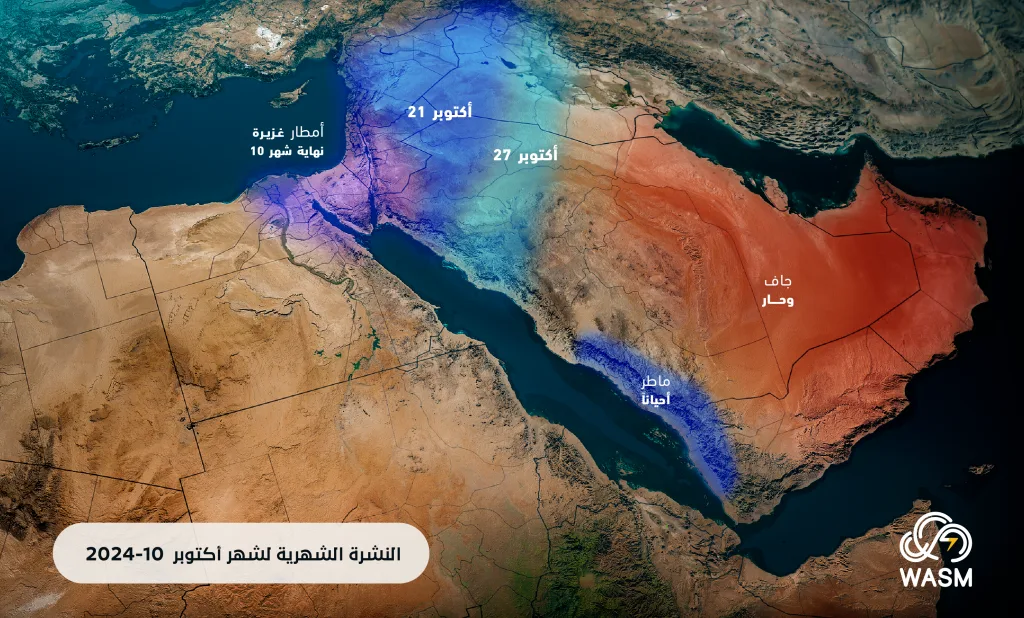
These tropical waves, known as "tropical Rossby waves," advancing from India and moving from east to west, are expected to generate several secondary tropical waves moving northward during the final third of the month, particularly during the last week, causing high activity in rainy conditions, especially with the expected presence of cold air masses over the eastern Mediterranean, which act as a condenser for these wet tropical waves.
At the same time, other major tropical waves originating from African tropical regions (MJO waves) are being detected and will also arrive during the last days of October, causing distinctive tropical activity in the region and a major driver for atmospheric instability in the Arabian Peninsula, particularly its western, southwestern, and northern parts, and later toward northwestern and central Saudi Arabia, the Levant region, Egypt, and Iraq.
Expected Results
- Intensification of rainy conditions in the region due to an increasing flow of wet waves from subtropical and tropical regions.
- Weakening of the subtropical jet stream over the Arabian Peninsula and northern Egypt and its intensification over Iran and southwestern Asia.
Long-term Results
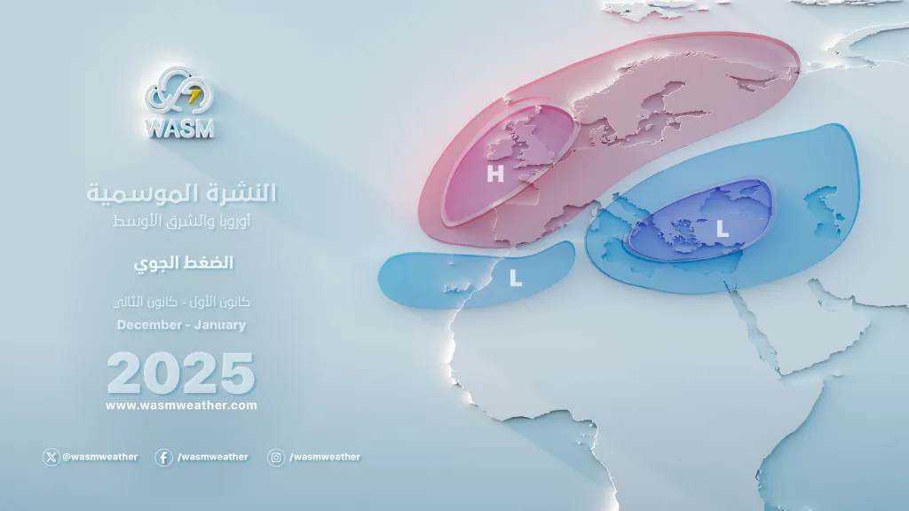
It is expected that most regions of western and central Europe will be increasingly affected by a strong high-pressure system later during the second half of November, facilitating the early arrival of winter conditions toward the region and the expansion of rainy conditions regionally in the Arabian Peninsula and eastern Mediterranean, as well as the central Mediterranean region and Turkey.
Eastern European regions are expected to be exposed to clear and sharp cold waves during November and gradually, which will increase the activity of the Siberian front toward the northeast of the Arabian Sea region and increase the flow of wet waves toward the Arabian Peninsula and eastern Mediterranean region.
Early Cold This Season
It is noted that temperatures have dropped early in the Levant, eastern Mediterranean, and northwestern Saudi Arabia this autumn. This decline is expected to increase sharply and early during the last week of October, bringing near-winter cold due to an unusual path and undulation of jet streams and unusual behavior of atmospheric circulation.
The WASM Regional Center issued seasonal weather bulletins in September for the region and used data from its own climate model, which is the only one of its kind in the Arab region and works using calibrated and flexible statistical analogue period methods. These reports can be read through the following links:
- Seasonal bulletin for the Arab region
Seasonal bulletin for Saudi Arabia and Arab Gulf countries
Seasonal bulletin for Jordan and Palestine
Seasonal bulletin for Iraq and the Levant
Monthly bulletin for October for Jordan