
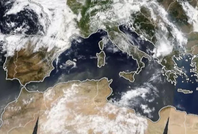
WASM- WASM Regional Center is monitoring a "powerful storm" in the central Mediterranean region acquiring tropical characteristics, which will bring very large amounts of rain and gale-force winds that may exceed gusts of 150 km/hour in central Mediterranean areas and massive amounts of rainfall exceeding 300-400 mm in some regions of the area, noting that the climate model of WASM Regional Center was the only model to detect this storm for a long time due to its method of operation within equations of "statistical period similarity calibration".
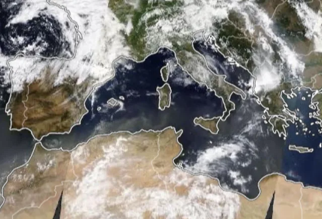
- Storm Characteristics..
The powerful storm will form on Sunday evening and will acquire tropical characteristics, especially in the southern part of the storm near the coasts of Algeria, Tunisia, and Italy. As a result of a high-humidity tropical wave pushing from the tropical African region, followed by polar air surging toward its center at the end of the week, a "significant" intensification of this storm will result.
- Details..
A tropical wave is pushing from the tropical west African region across the great deserts toward a frontal low-pressure center that will form over the central Mediterranean, merging with this weather system, causing it to acquire tropical characteristics and bringing very large amounts of rainfall that may exceed 300 mm in some areas of Italy and central Mediterranean. As the storm continues to be positioned over the central Mediterranean, polar cold winds are expected to surge toward its center, causing renewal of this storm and changes in its characteristics, intensification, and gradual movement toward the east.
- Gale-force wind gusts that may exceed 150 km/hour in the central Mediterranean region..
This powerful storm will continue to affect central Mediterranean countries beginning Sunday evening through the end of the week in intervals, and it is expected to reach peak intensity by the end of the week, bringing very large amounts of rain and gale-force winds. The arrival of polar air toward the storm's center from the north Atlantic directly will cause its sharp deepening, and possibly surface atmospheric pressure in its center falling below 985 millibars and even lower.
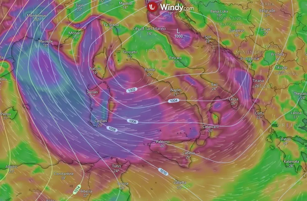
- Tropical and subtropical characteristics the storm will acquire..
As the powerful storm pushes toward the eastern Mediterranean due to jet stream intensification in western Europe, and continues to move over the warm Mediterranean region, it is expected to strike Greece and western Turkey areas and the eastern Mediterranean region, and may cause atmospheric disturbances in the Levant region after mid-month.
Practical Details..
The tropical wave pushing toward the Mediterranean region due to the weakening of the subtropical jet stream and its path change toward the north and northeast contrary to the normal situation is the main reason for this storm's intensification. The warmth of Mediterranean waters and high humidity coinciding with the tropical wave results in very large thermal energy that converts directly to kinetic energy with the condensation process occurring (general thermodynamic laws), this great kinetic energy being converted results in the formation of this powerful storm.
With the slow movement of the storm and its continued positioning over the central Mediterranean, and rising atmospheric pressure in the eastern Atlantic, this causes a large flow of very cold polar winds toward the west and central Mediterranean and toward the storm's center directly, resulting in intensification of its effects. With the availability of the necessary energy to sustain its strong impact, and significant intensification in wind speed around its center reaching gusts exceeding 150 km/hour and continued heavy rainfall.
This powerful storm will gradually push toward the eastern Mediterranean, and with its continued presence over the warm Mediterranean waters recording the highest seasonal temperatures, it is likely to acquire tropical characteristics. With its continued movement toward the east, which will directly affect Greece and the eastern Mediterranean basin and western Turkey, and cause atmospheric disturbances in the Levant region after mid-month.
Strong storms have recurred in Mediterranean regions in recent years, especially in the central and eastern Mediterranean as a result of rising temperatures in the Mediterranean region and unusual atmospheric circulation, noting that rainfall rates recorded a significant increase in eastern Mediterranean countries, Jordan, and the Arabian Peninsula reaching 60% above seasonal averages in recent years, contrary to common perception and due to lack of studies on climate change in the region, and due to increasing activity of Mediterranean low-pressure systems and Mediterranean storms and tropical wave activity.